


<< Text Pages >> Elgea 1 Trikuharria - Burial Chamber or Dolmen in Spain in Pais Vasco
Submitted by holger_rix on Sunday, 29 November 2015 Page Views: 681
Neolithic and Bronze AgeSite Name: Elgea 1 Trikuharria Alternative Name: Dolmen Elgea ICountry: Spain
NOTE: This site is 5.071 km away from the location you searched for.
Region: Pais Vasco Type: Burial Chamber or Dolmen
Latitude: 42.950453N Longitude: 2.542609W
Condition:
| 5 | Perfect |
| 4 | Almost Perfect |
| 3 | Reasonable but with some damage |
| 2 | Ruined but still recognisable as an ancient site |
| 1 | Pretty much destroyed, possibly visible as crop marks |
| 0 | No data. |
| -1 | Completely destroyed |
| 5 | Superb |
| 4 | Good |
| 3 | Ordinary |
| 2 | Not Good |
| 1 | Awful |
| 0 | No data. |
| 5 | Can be driven to, probably with disabled access |
| 4 | Short walk on a footpath |
| 3 | Requiring a bit more of a walk |
| 2 | A long walk |
| 1 | In the middle of nowhere, a nightmare to find |
| 0 | No data. |
| 5 | co-ordinates taken by GPS or official recorded co-ordinates |
| 4 | co-ordinates scaled from a detailed map |
| 3 | co-ordinates scaled from a bad map |
| 2 | co-ordinates of the nearest village |
| 1 | co-ordinates of the nearest town |
| 0 | no data |
Be the first person to rate this site - see the 'Contribute!' box in the right hand menu.
Internal Links:
External Links:
Burial Chamber (Dolmen) in Pais Vasco
You may be viewing yesterday's version of this page. To see the most up to date information please register for a free account.
Do not use the above information on other web sites or publications without permission of the contributor.
Nearby Images from Flickr
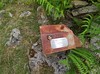
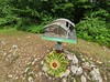
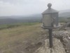
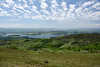
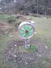
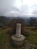
The above images may not be of the site on this page, but were taken nearby. They are loaded from Flickr so please click on them for image credits.
Click here to see more info for this site
Nearby sites
Click here to view sites on an interactive map of the areaKey: Red: member's photo, Blue: 3rd party photo, Yellow: other image, Green: no photo - please go there and take one, Grey: site destroyed
Download sites to:
KML (Google Earth)
GPX (GPS waypoints)
CSV (Garmin/Navman)
CSV (Excel)
To unlock full downloads you need to sign up as a Contributory Member. Otherwise downloads are limited to 50 sites.
Turn off the page maps and other distractions
Nearby sites listing. In the following links * = Image available
476m NE 52° Elgeamendi Trikuharria Burial Chamber or Dolmen
1.2km NNE 13° Elgea 2 Tumulua Round Barrow(s)
1.5km NNE 15° Itsikoaitza Round Barrow(s)
1.8km NW 311° Isikoaitza Tumulua Round Barrow(s)
2.9km NW 315° Galbarrain Tumulua Round Barrow(s)
3.0km ENE 59° Mugarriluze Zutarria* Standing Stone (Menhir)
3.3km NE 51° Alabitarte Tumulua* Round Barrow(s)
4.1km NE 42° Deguria 1 Tumulua Round Barrow(s)
4.2km NE 42° Deguria 2 Tumulua Round Barrow(s)
5.6km NW 310° Maroto Tumulua Round Barrow(s)
5.9km NNE 26° Asuntzeta Mendebal Tumulua Round Barrow(s)
5.9km NNE 26° Asuntzeta Ekialde Tumulua Round Barrow(s)
6.1km NNE 12° Axtroki Castro or Chafurdão
7.0km NNE 24° Puntiaga Tumulua Round Barrow(s)
8.6km NE 47° Linatza Tumulua Round Barrow(s)
8.7km E 84° Mugarriaundi Zutarria* Standing Stone (Menhir)
9.0km NE 46° Urtao Tumulua Round Barrow(s)
9.2km NE 47° Urtapotolueta 1 Trikuharria Burial Chamber or Dolmen
9.2km NE 46° Urtapotolueta 2 Tumulua Round Barrow(s)
9.6km NE 49° Aitzgain Trikuharria Burial Chamber or Dolmen
9.8km NE 49° Aitzgain Tumulua Round Barrow(s)
10.9km E 80° Gallerdi Tumulua Round Barrow(s)
10.9km E 85° Gainlabur Trikuharria* Burial Chamber or Dolmen
10.9km E 82° Artaso Trikuharria Burial Chamber or Dolmen
11.1km SW 225° Eskalmendi Trikuharria Burial Chamber or Dolmen
View more nearby sites and additional images


 We would like to know more about this location. Please feel free to add a brief description and any relevant information in your own language.
 Wir möchten mehr über diese Stätte erfahren. Bitte zögern Sie nicht, eine kurze Beschreibung und relevante Informationen in Deutsch hinzuzufügen.
 Nous aimerions en savoir encore un peu sur les lieux. S'il vous plaît n'hesitez pas à ajouter une courte description et tous les renseignements pertinents dans votre propre langue.
 Quisieramos informarnos un poco más de las lugares. No dude en añadir una breve descripción y otros datos relevantes en su propio idioma.