


<< Our Photo Pages >> Los Llanos Trikuharria - Burial Chamber or Dolmen in Spain in Pais Vasco
Submitted by irundarra on Sunday, 26 February 2006 Page Views: 3524
Neolithic and Bronze AgeSite Name: Los Llanos TrikuharriaCountry: Spain
NOTE: This site is 1.463 km away from the location you searched for.
Region: Pais Vasco Type: Burial Chamber or Dolmen
Nearest Town: Laguardia Nearest Village: Cripán
Latitude: 42.593683N Longitude: 2.532344W
Condition:
| 5 | Perfect |
| 4 | Almost Perfect |
| 3 | Reasonable but with some damage |
| 2 | Ruined but still recognisable as an ancient site |
| 1 | Pretty much destroyed, possibly visible as crop marks |
| 0 | No data. |
| -1 | Completely destroyed |
| 5 | Superb |
| 4 | Good |
| 3 | Ordinary |
| 2 | Not Good |
| 1 | Awful |
| 0 | No data. |
| 5 | Can be driven to, probably with disabled access |
| 4 | Short walk on a footpath |
| 3 | Requiring a bit more of a walk |
| 2 | A long walk |
| 1 | In the middle of nowhere, a nightmare to find |
| 0 | No data. |
| 5 | co-ordinates taken by GPS or official recorded co-ordinates |
| 4 | co-ordinates scaled from a detailed map |
| 3 | co-ordinates scaled from a bad map |
| 2 | co-ordinates of the nearest village |
| 1 | co-ordinates of the nearest town |
| 0 | no data |
Internal Links:
External Links:
I have visited· I would like to visit
DrewParsons would like to visit
rrmoser has visited here
")
For more details visit Megalitos.es.
You may be viewing yesterday's version of this page. To see the most up to date information please register for a free account.
")
")
Do not use the above information on other web sites or publications without permission of the contributor.
Nearby Images from Flickr
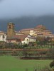
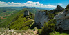
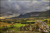
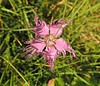
The above images may not be of the site on this page, but were taken nearby. They are loaded from Flickr so please click on them for image credits.
Click here to see more info for this site
Nearby sites
Click here to view sites on an interactive map of the areaKey: Red: member's photo, Blue: 3rd party photo, Yellow: other image, Green: no photo - please go there and take one, Grey: site destroyed
Download sites to:
KML (Google Earth)
GPX (GPS waypoints)
CSV (Garmin/Navman)
CSV (Excel)
To unlock full downloads you need to sign up as a Contributory Member. Otherwise downloads are limited to 50 sites.
Turn off the page maps and other distractions
Nearby sites listing. In the following links * = Image available
2.4km S 181° El Encinal Trikuharria* Burial Chamber or Dolmen
3.4km SSW 211° Chabola De La Hechicera* Burial Chamber or Dolmen
3.8km SW 226° Alto De La Huesera Trikuharria* Burial Chamber or Dolmen
5.5km SW 234° La Hoya* Ancient Village or Settlement
6.2km SW 235° San Martín Trikuharria* Burial Chamber or Dolmen
7.7km WSW 253° El Sotillo Trikuharria* Burial Chamber or Dolmen
10.0km W 261° Layaza Trikuharria* Burial Chamber or Dolmen
11.5km E 99° Longar Arazuri Hipogeo* Chambered Tomb
11.7km NW 321° Gobas de Laño Cave or Rock Shelter
11.7km WSW 248° El Montecillo Trikuharria* Burial Chamber or Dolmen
12.7km ESE 107° Viana Menhir* Standing Stone (Menhir)
15.7km N 354° Corral De Felix Eremu Tumularra Barrow Cemetery
15.9km W 266° La Cascaja Dolmen* Burial Chamber or Dolmen
16.8km W 270° La Peña Lacha Zutarria* Standing Stone (Menhir)
17.5km W 263° Hornillos Necrópolis Barrow Cemetery
18.0km SE 145° Ruinas de Varea Ancient Village or Settlement
18.5km NNE 27° Portillo De Guesal Tumulua Round Barrow(s)
18.9km NNE 26° Arboro Eremu Tumularra Barrow Cemetery
18.9km W 281° Riparasa Zutarria* Standing Stone (Menhir)
19.0km NNE 25° Obi Eremu Tumularra Barrow Cemetery
19.8km W 272° Remelluri Necrópolis* Barrow Cemetery
20.5km N 350° Okina 2 Tumulua Round Barrow(s)
20.7km N 357° Okina 5 Tumulua Round Barrow(s)
20.7km N 349° Okina 1 Tumulua Round Barrow(s)
20.9km N 352° Askain Eremu Tumularra Barrow Cemetery
View more nearby sites and additional images


 We would like to know more about this location. Please feel free to add a brief description and any relevant information in your own language.
 Wir möchten mehr über diese Stätte erfahren. Bitte zögern Sie nicht, eine kurze Beschreibung und relevante Informationen in Deutsch hinzuzufügen.
 Nous aimerions en savoir encore un peu sur les lieux. S'il vous plaît n'hesitez pas à ajouter une courte description et tous les renseignements pertinents dans votre propre langue.
 Quisieramos informarnos un poco más de las lugares. No dude en añadir una breve descripción y otros datos relevantes en su propio idioma.