


<< Text Pages >> Stratton on the Fosse - Artificial Mound in England in Somerset
Submitted by Andy B on Wednesday, 24 June 2020 Page Views: 809
Multi-periodSite Name: Stratton on the FosseCountry: England
NOTE: This site is 1.494 km away from the location you searched for.
County: Somerset Type: Artificial Mound
Map Ref: ST66314938
Latitude: 51.242594N Longitude: 2.484014W
Condition:
| 5 | Perfect |
| 4 | Almost Perfect |
| 3 | Reasonable but with some damage |
| 2 | Ruined but still recognisable as an ancient site |
| 1 | Pretty much destroyed, possibly visible as crop marks |
| 0 | No data. |
| -1 | Completely destroyed |
| 5 | Superb |
| 4 | Good |
| 3 | Ordinary |
| 2 | Not Good |
| 1 | Awful |
| 0 | No data. |
| 5 | Can be driven to, probably with disabled access |
| 4 | Short walk on a footpath |
| 3 | Requiring a bit more of a walk |
| 2 | A long walk |
| 1 | In the middle of nowhere, a nightmare to find |
| 0 | No data. |
| 5 | co-ordinates taken by GPS or official recorded co-ordinates |
| 4 | co-ordinates scaled from a detailed map |
| 3 | co-ordinates scaled from a bad map |
| 2 | co-ordinates of the nearest village |
| 1 | co-ordinates of the nearest town |
| 0 | no data |
Be the first person to rate this site - see the 'Contribute!' box in the right hand menu.
Internal Links:
External Links:
Artificial Mound in Somerset
Possible round barrow at Barlake Farm.
Ref Grinsell 1971
You may be viewing yesterday's version of this page. To see the most up to date information please register for a free account.
Do not use the above information on other web sites or publications without permission of the contributor.
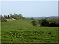
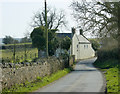
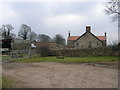
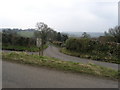
Nearby Images from Geograph Britain and Ireland:
©2009(licence)
©2009(licence)
©2006(licence)
©2006(licence)
©2009(licence)
The above images may not be of the site on this page, they are loaded from Geograph.
Please Submit an Image of this site or go out and take one for us!
Click here to see more info for this site
Nearby sites
Key: Red: member's photo, Blue: 3rd party photo, Yellow: other image, Green: no photo - please go there and take one, Grey: site destroyed
Download sites to:
KML (Google Earth)
GPX (GPS waypoints)
CSV (Garmin/Navman)
CSV (Excel)
To unlock full downloads you need to sign up as a Contributory Member. Otherwise downloads are limited to 50 sites.
Turn off the page maps and other distractions
Nearby sites listing. In the following links * = Image available
1.8km SSW 202° Fairy Cave Cave or Rock Shelter (ST65654775)
2.3km NE 39° Giants Grave, Southmead* Long Barrow (ST678512)
2.4km NE 37° Charmborough Hill Chambered Tomb (ST678513)
2.5km NW 325° Fry's Well* Holy Well or Sacred Spring (ST649514)
2.7km WNW 284° Blackers Hill Promontory Fort* Hillfort (ST6364850045)
3.4km WNW 296° Three Tuns Tumuli* Barrow Cemetery (ST6324250870)
4.3km SW 221° Beacon Hill (Oakhill) Barrows* Barrow Cemetery (ST63484616)
5.6km NNE 27° Jubilee Field Round Barrow(s) (ST68895436)
5.7km WSW 247° Maesbury Castle* Hillfort (ST610472)
6.0km SSW 194° Doulting Quarries barrow* Modern Stone Circle etc (ST64824353)
6.4km SSW 194° St Aldhelm's Well* Holy Well or Sacred Spring (ST647432)
6.4km NW 320° Ston Easton Barrow* Round Barrow(s) (ST622543)
6.5km W 267° Whitnell Corner Barrows* Barrow Cemetery (ST5982849096)
6.7km S 184° West Cranmore Round Barrows* Barrow Cemetery (ST65844274)
6.8km ENE 70° Big Tree Long Barrow* Long Barrow (ST72725167)
7.2km WNW 300° Lime House Long Barrow* Long Barrow (ST60095305)
7.3km NNE 21° Roundhill Barrow* Round Barrow(s) (ST69005616)
7.3km E 85° Mells, Newbury Firs Artificial Mound (ST73605001)
7.4km WNW 302° Barrow House Farm Long Barrow * Chambered Tomb (ST60095334)
7.4km NNE 20° Rowberrow Field Barrow Round Barrow(s) (ST68925630)
7.4km ESE 120° Nunney Artificial Mound (ST72734564)
7.7km WNW 299° Chewton Mendip Cross* Ancient Cross (ST5962353136)
7.7km WSW 240° Crapnell Stone Circle (ST596455)
8.2km NNE 34° Braysdown Barrow Long Barrow (ST70915619)
8.5km NNE 28° Peasedown St John Henge Henge (ST703569)
View more nearby sites and additional images


 We would like to know more about this location. Please feel free to add a brief description and any relevant information in your own language.
 Wir möchten mehr über diese Stätte erfahren. Bitte zögern Sie nicht, eine kurze Beschreibung und relevante Informationen in Deutsch hinzuzufügen.
 Nous aimerions en savoir encore un peu sur les lieux. S'il vous plaît n'hesitez pas à ajouter une courte description et tous les renseignements pertinents dans votre propre langue.
 Quisieramos informarnos un poco más de las lugares. No dude en añadir una breve descripción y otros datos relevantes en su propio idioma.