<< Our Photo Pages >> Aescia Roman Fort - Stone Fort or Dun in England in Northumberland
Submitted by Anne T on Monday, 24 June 2019 Page Views: 1588
Multi-periodSite Name: Aescia Roman Fort Alternative Name: Great Chesters; GreatchestersCountry: England County: Northumberland Type: Stone Fort or Dun
Nearest Town: Haltwhistle Nearest Village: Greenhead
Map Ref: NY7036566800
Latitude: 54.994892N Longitude: 2.464737W
Condition:
| 5 | Perfect |
| 4 | Almost Perfect |
| 3 | Reasonable but with some damage |
| 2 | Ruined but still recognisable as an ancient site |
| 1 | Pretty much destroyed, possibly visible as crop marks |
| 0 | No data. |
| -1 | Completely destroyed |
| 5 | Superb |
| 4 | Good |
| 3 | Ordinary |
| 2 | Not Good |
| 1 | Awful |
| 0 | No data. |
| 5 | Can be driven to, probably with disabled access |
| 4 | Short walk on a footpath |
| 3 | Requiring a bit more of a walk |
| 2 | A long walk |
| 1 | In the middle of nowhere, a nightmare to find |
| 0 | No data. |
| 5 | co-ordinates taken by GPS or official recorded co-ordinates |
| 4 | co-ordinates scaled from a detailed map |
| 3 | co-ordinates scaled from a bad map |
| 2 | co-ordinates of the nearest village |
| 1 | co-ordinates of the nearest town |
| 0 | no data |
Internal Links:
External Links:
I have visited· I would like to visit
Elodin would like to visit
Anne T visited on 23rd Jun 2019 - their rating: Cond: 3 Amb: 4 Access: 4 Aesica (Great Chesters) Roman Fort: In a repeat of our last visit in November 2016 (when we came here to see where the Roman aqueduct finished) we parked just off the small, gated road at NY 70421 66432, by the track leading up to Modern Farm and the Hadrian’s Wall Path.
Whilst I was photographing the inside of the fort, Andrew hopped over the stile at NY 70443 66807 and walked down the slope. As well as seeing a large stone with carved edging embedded in the dry stone wall, he identified the site of the bath house, previously earthed over by English Heritage to preserve it, as some stone were sticking out of the dry earth. Just down the slope was a piped spring which emerged into a modern cattle trough. Was this the spring that served the bath house?
The bath house, visible on UK Grid Finder, is centred on NY 70473 66733; the spring emerges at NY 70473 66698.
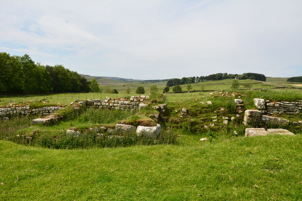
J. Collingwood Bruce, in his 1863 book "The Roman Wall" tells us: "Greatchesters, like Carrawburgh, does not extend north of the Wall but lies wholly to the south of its line. It measures 419ft by 355 feet over its ramparts, and has an area of just three acres …. the ancient name of the fort was Aesica, and its third-century garrison, according to the inscriptions, was the Second cohort of Asturians. The Sixth cohort of Nervians and the Sixth cohort of Raetians, as well as the irregulars, Raeti Gaesati, are also attested".
The fort is recorded as Pastscape Monument No. 15336, which adds this was "one of the final Wall forts (with Carrawburgh) to be built in circa AD 128-138". It is also scheduled as Historic England List ID 1010976.
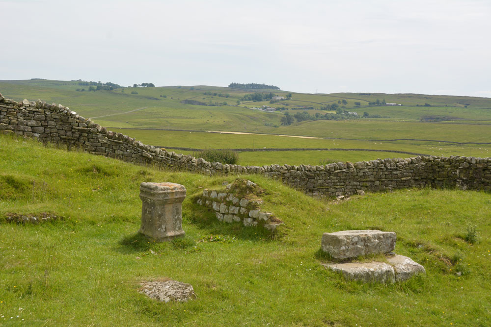
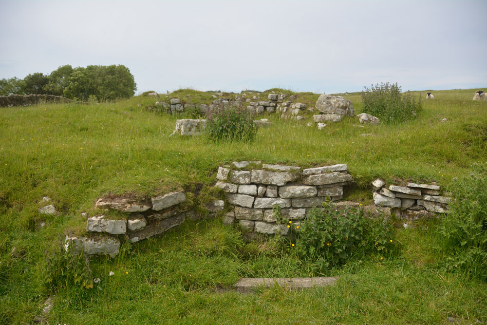
Today, only the earthwork remains of the fort remain. The north of the fort is cut by a modern farm track, the Hadrian's Wall path and an unrestored section of the Wall. To its western side are a series of banks and ditches, and during dry weather the foundations of internal buildings can be seen.
The remains of a bath house can be found some 100m to the south east of the fort. Discovered originally in 1897, it was excavated in 1908 but later more recently covered up with earth by English Heritage to preserve it. At the present time (June 2019) a so far dry summer has exposed some of the top of the stonework, so the outline of the bath-house can be seen.
My particular thanks to Tynedale U3A. Hadrian's Wall Group for their plan and photographs, which greatly assisted in understanding the layout of the fort. This Hadrian's Wall guide highlights that this fort was built on the site of Milecastle 43, which had to be demolished to accommodate the building.
You may be viewing yesterday's version of this page. To see the most up to date information please register for a free account.





Do not use the above information on other web sites or publications without permission of the contributor.
Click here to see more info for this site
Nearby sites
Key: Red: member's photo, Blue: 3rd party photo, Yellow: other image, Green: no photo - please go there and take one, Grey: site destroyed
Download sites to:
KML (Google Earth)
GPX (GPS waypoints)
CSV (Garmin/Navman)
CSV (Excel)
To unlock full downloads you need to sign up as a Contributory Member. Otherwise downloads are limited to 50 sites.
Turn off the page maps and other distractions
Nearby sites listing. In the following links * = Image available
347m SSW 210° Aesica Vallum Round Barrow* Round Barrow(s) (NY70196650)
1.3km E 95° Cawfield Roman Fort Stone Fort or Dun (NY71666667)
2.1km NE 39° Ventner's Hall Cairn (1)* Cairn (NY71696841)
2.2km ESE 102° Mare and Foal* Standing Stones (NY72536633)
2.2km W 267° Hadrian's Wall (Turret 44b)* Misc. Earthwork (NY6813866704)
2.3km NE 44° Ventner's Hall Cairn (2)* Cairn (NY7198068434)
2.3km W 266° King Arthur's Well (Walltown Gap)* Holy Well or Sacred Spring (NY68066664)
4.6km S 183° Broomhouse (Haltwhistle)* Ancient Village or Settlement (NY70126222)
4.9km E 88° The Sill* Museum (NY7527566896)
5.3km E 96° Smith's Shield Milestone* Marker Stone (NY7561766242)
5.7km NE 54° Chatley Crags Ring Cairn (NY75077012)
5.8km E 80° Hadrian's Wall - Milecastle 39* Stone Fort or Dun (NY76066773)
6.7km E 93° Vindolanda Roman Fort* Stone Fort or Dun (NY7705266352)
6.7km E 80° Hadrian's Wall* Misc. Earthwork (NY770679)
6.9km W 278° Gilsland Spa Well* Holy Well or Sacred Spring (NY6354067815)
6.9km W 281° Popping Stone* Natural Stone / Erratic / Other Natural Feature (NY63556815)
6.9km W 278° Gilsland Spa Sulphur Spring Holy Well or Sacred Spring (NY63476776)
7.0km W 265° Hadrian's Wall (Poltross Burn)* Stone Fort or Dun (NY6340166198)
7.5km E 92° Long Stone (Barcombe Hill)* Ancient Cross (NY77896646)
7.6km ENE 69° Greenlee Lough A* Rock Art (NY7751669468)
7.7km NW 311° Standingstone Rigg Standing Stone (Cumbria) Standing Stone (Menhir) (NY6458271969)
7.9km ENE 67° Ridley Common Enclosure* Ancient Village or Settlement (NY77676979)
7.9km E 89° Barcombe Hill Settlement* Ancient Village or Settlement (NY78306682)
7.9km ENE 68° Ridley Common* Stone Circle (NY77756977)
8.3km ENE 67° Greenlee Lough B* Rock Art (NY7806069988)
View more nearby sites and additional images




 We would like to know more about this location. Please feel free to add a brief description and any relevant information in your own language.
 Wir möchten mehr über diese Stätte erfahren. Bitte zögern Sie nicht, eine kurze Beschreibung und relevante Informationen in Deutsch hinzuzufügen.
 Nous aimerions en savoir encore un peu sur les lieux. S'il vous plaît n'hesitez pas à ajouter une courte description et tous les renseignements pertinents dans votre propre langue.
 Quisieramos informarnos un poco más de las lugares. No dude en añadir una breve descripción y otros datos relevantes en su propio idioma.