


<< Our Photo Pages >> Little Asby Scar Round Cairn - Round Cairn in England in Cumbria
Submitted by MonumentMan on Sunday, 04 October 2020 Page Views: 679
Neolithic and Bronze AgeSite Name: Little Asby Scar Round CairnCountry: England
NOTE: This site is 2.34 km away from the location you searched for.
County: Cumbria Type: Round Cairn
Nearest Town: Kirkby Stephen Nearest Village: Newbiggin-on-Lune
Map Ref: NY6920808493
Latitude: 54.470861N Longitude: 2.476627W
Condition:
| 5 | Perfect |
| 4 | Almost Perfect |
| 3 | Reasonable but with some damage |
| 2 | Ruined but still recognisable as an ancient site |
| 1 | Pretty much destroyed, possibly visible as crop marks |
| 0 | No data. |
| -1 | Completely destroyed |
| 5 | Superb |
| 4 | Good |
| 3 | Ordinary |
| 2 | Not Good |
| 1 | Awful |
| 0 | No data. |
| 5 | Can be driven to, probably with disabled access |
| 4 | Short walk on a footpath |
| 3 | Requiring a bit more of a walk |
| 2 | A long walk |
| 1 | In the middle of nowhere, a nightmare to find |
| 0 | No data. |
| 5 | co-ordinates taken by GPS or official recorded co-ordinates |
| 4 | co-ordinates scaled from a detailed map |
| 3 | co-ordinates scaled from a bad map |
| 2 | co-ordinates of the nearest village |
| 1 | co-ordinates of the nearest town |
| 0 | no data |
Internal Links:
External Links:
")
This is a link
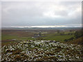
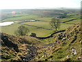
The Site commands a cliff top position just under Little Asby Scar, and overlooks Potts Valley Tarn. A prominent dry limestone ravine descends directly below the round cairn.
You may be viewing yesterday's version of this page. To see the most up to date information please register for a free account.
")
")
Do not use the above information on other web sites or publications without permission of the contributor.
Nearby Images from Geograph Britain and Ireland:
©2011(licence)
©2020(licence)
©2007(licence)
©2011(licence)
©2007(licence)
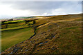
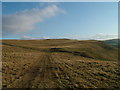
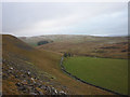
The above images may not be of the site on this page, they are loaded from Geograph.
Please Submit an Image of this site or go out and take one for us!
Click here to see more info for this site
Nearby sites
Key: Red: member's photo, Blue: 3rd party photo, Yellow: other image, Green: no photo - please go there and take one, Grey: site destroyed
Download sites to:
KML (Google Earth)
GPX (GPS waypoints)
CSV (Garmin/Navman)
CSV (Excel)
To unlock full downloads you need to sign up as a Contributory Member. Otherwise downloads are limited to 50 sites.
Turn off the page maps and other distractions
Nearby sites listing. In the following links * = Image available
1.2km W 264° Howes Well ring cairn* Ring Cairn (NY6804908373)
1.5km SSW 213° Raiset Pike* Long Barrow (NY68400725)
2.2km SE 141° Bent's Hill Round Cairn* Round Cairn (NY7060206780)
2.5km WNW 300° Muddygill Plain, Great Asby Scar* Cairn (NY6704309747)
2.7km W 280° Little Kinmond Cairn* Cairn (NY66540899)
3.1km NW 321° Asby Common Ancient Village or Settlement (NY673109)
3.4km SE 128° Crosby Garrett Ancient Village or Settlement (NY719064)
3.6km SSE 153° St. Helen's Well (Newbiggin-on-Lune)* Holy Well or Sacred Spring (NY7079905268)
3.6km NW 309° Ling Bank South Prehistoric Settlement/Enclosures* Ancient Village or Settlement (NY6639910793)
3.9km NW 308° Ling Bank North Settlement/Enclosures* Ancient Village or Settlement (NY6616310906)
3.9km NNW 345° Holborn Hill Ancient Village or Settlement (NY682123)
4.0km W 276° Raisbeck Wood* Round Cairn (NY65260896)
4.3km WNW 281° Castle Folds* Ancient Village or Settlement (NY64990936)
4.9km NNW 347° St Helen's Well (Great Asby)* Holy Well or Sacred Spring (NY6817813278)
5.1km NW 308° Hollin Stump Cairn* Cairn (NY652117)
5.2km W 266° Gamelands* Stone Circle (NY64010816)
5.2km WNW 301° Gaythorn Plain* Ring Cairn (NY647112)
5.6km SE 125° Rasett Hill* Round Cairn (NY73780531)
5.6km NW 308° Gaythorne Plain Round Cairns* Cairn (NY64811193)
6.6km WNW 287° Penhurrock* Multiple Stone Rows / Avenue (NY62881043)
7.0km WNW 286° Howe Robin Ancient Village or Settlement (NY625105)
7.1km NW 309° Raise Howe Cairn* Cairn (NY63711303)
7.6km E 96° Croglam Castle Ancient Village or Settlement (NY768077)
7.9km E 95° The Loki Stone* Early Christian Sculptured Stone (NY77130774)
8.0km WNW 298° Burwens Ancient Village or Settlement (NY622123)
View more nearby sites and additional images


 We would like to know more about this location. Please feel free to add a brief description and any relevant information in your own language.
 Wir möchten mehr über diese Stätte erfahren. Bitte zögern Sie nicht, eine kurze Beschreibung und relevante Informationen in Deutsch hinzuzufügen.
 Nous aimerions en savoir encore un peu sur les lieux. S'il vous plaît n'hesitez pas à ajouter une courte description et tous les renseignements pertinents dans votre propre langue.
 Quisieramos informarnos un poco más de las lugares. No dude en añadir una breve descripción y otros datos relevantes en su propio idioma.