


<< Text Pages >> Portillo De Guesal Tumulua - Round Barrow(s) in Spain in Pais Vasco
Submitted by holger_rix on Wednesday, 25 November 2015 Page Views: 849
Neolithic and Bronze AgeSite Name: Portillo De Guesal TumuluaCountry: Spain
NOTE: This site is 1.395 km away from the location you searched for.
Region: Pais Vasco Type: Round Barrow(s)
Latitude: 42.741990N Longitude: 2.429748W
Condition:
| 5 | Perfect |
| 4 | Almost Perfect |
| 3 | Reasonable but with some damage |
| 2 | Ruined but still recognisable as an ancient site |
| 1 | Pretty much destroyed, possibly visible as crop marks |
| 0 | No data. |
| -1 | Completely destroyed |
| 5 | Superb |
| 4 | Good |
| 3 | Ordinary |
| 2 | Not Good |
| 1 | Awful |
| 0 | No data. |
| 5 | Can be driven to, probably with disabled access |
| 4 | Short walk on a footpath |
| 3 | Requiring a bit more of a walk |
| 2 | A long walk |
| 1 | In the middle of nowhere, a nightmare to find |
| 0 | No data. |
| 5 | co-ordinates taken by GPS or official recorded co-ordinates |
| 4 | co-ordinates scaled from a detailed map |
| 3 | co-ordinates scaled from a bad map |
| 2 | co-ordinates of the nearest village |
| 1 | co-ordinates of the nearest town |
| 0 | no data |
Be the first person to rate this site - see the 'Contribute!' box in the right hand menu.
Internal Links:
External Links:
Round Barrow(s) in Pais Vasco
You may be viewing yesterday's version of this page. To see the most up to date information please register for a free account.
Do not use the above information on other web sites or publications without permission of the contributor.
Nearby Images from Flickr

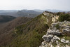
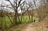
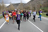


The above images may not be of the site on this page, but were taken nearby. They are loaded from Flickr so please click on them for image credits.
Click here to see more info for this site
Nearby sites
Click here to view sites on an interactive map of the areaKey: Red: member's photo, Blue: 3rd party photo, Yellow: other image, Green: no photo - please go there and take one, Grey: site destroyed
Download sites to:
KML (Google Earth)
GPX (GPS waypoints)
CSV (Garmin/Navman)
CSV (Excel)
To unlock full downloads you need to sign up as a Contributory Member. Otherwise downloads are limited to 50 sites.
Turn off the page maps and other distractions
Nearby sites listing. In the following links * = Image available
436m N 351° Arboro Eremu Tumularra Barrow Cemetery
698m NNW 337° Obi Eremu Tumularra Barrow Cemetery
4.7km NE 44° Raso Esate Eremu Tumularra Barrow Cemetery
5.3km ENE 68° Bitigarra Eremu Tumularra Barrow Cemetery
5.8km N 11° Lazeta Eremu Tumularra Barrow Cemetery
6.5km ENE 66° Santa Teodosia 1 Trikuharria* Burial Chamber or Dolmen
6.5km ENE 64° Santa Teodosia 4 Trikuharria Burial Chamber or Dolmen
6.7km ENE 62° Santa Teodosia 3 Trikuharria Burial Chamber or Dolmen
6.7km ENE 67° Santa Teodosia Eremu Tumularra Barrow Cemetery
6.8km N 6° Peña Blanca Eremu Tumularra Barrow Cemetery
7.5km NNE 15° Solonagua Zutarria Standing Stone (Menhir)
7.5km NNE 21° San Juan Trikuharria Burial Chamber or Dolmen
7.6km N 2° Ebiso Tumulo Round Barrow(s)
8.8km ENE 65° Kapitarte Eremu Tumularra Barrow Cemetery
8.8km ENE 65° Kapitarte Tumulua Round Barrow(s)
8.9km ENE 66° Kapitarte Zutarria Standing Stone (Menhir)
8.9km NE 43° Gaztelamendi 2 Trikuharria Burial Chamber or Dolmen
9.1km NE 48° Iturrieta Eremu Tumularra Barrow Cemetery
9.1km NE 44° Gaztelamendi Harrespila* Stone Circle
9.1km NE 43° Gaztelamendi 1 Trikuharria* Burial Chamber or Dolmen
9.1km NE 44° Gaztelamendi 1 Tumulua Round Barrow(s)
9.2km NE 47° Iturrieta Tumulua* Round Barrow(s)
9.2km NE 45° Gaztelamendi 2 Tumulua Round Barrow(s)
9.3km ENE 64° Kortagaña Trikuharria Burial Chamber or Dolmen
9.3km NE 42° Alangua 2 Trikuharria Burial Chamber or Dolmen
View more nearby sites and additional images


 We would like to know more about this location. Please feel free to add a brief description and any relevant information in your own language.
 Wir möchten mehr über diese Stätte erfahren. Bitte zögern Sie nicht, eine kurze Beschreibung und relevante Informationen in Deutsch hinzuzufügen.
 Nous aimerions en savoir encore un peu sur les lieux. S'il vous plaît n'hesitez pas à ajouter une courte description et tous les renseignements pertinents dans votre propre langue.
 Quisieramos informarnos un poco más de las lugares. No dude en añadir una breve descripción y otros datos relevantes en su propio idioma.