


<< Text Pages >> Cerro Cepero - Ancient Village or Settlement in Spain in Andalucía
Submitted by holger_rix on Wednesday, 23 December 2015 Page Views: 826
Multi-periodSite Name: Cerro Cepero Alternative Name: Ruinas ibero-romanas de BastiCountry: Spain
NOTE: This site is 36.313 km away from the location you searched for.
Region: Andalucía Type: Ancient Village or Settlement
Nearest Town: Baza
Latitude: 37.512017N Longitude: 2.732536W
Condition:
| 5 | Perfect |
| 4 | Almost Perfect |
| 3 | Reasonable but with some damage |
| 2 | Ruined but still recognisable as an ancient site |
| 1 | Pretty much destroyed, possibly visible as crop marks |
| 0 | No data. |
| -1 | Completely destroyed |
| 5 | Superb |
| 4 | Good |
| 3 | Ordinary |
| 2 | Not Good |
| 1 | Awful |
| 0 | No data. |
| 5 | Can be driven to, probably with disabled access |
| 4 | Short walk on a footpath |
| 3 | Requiring a bit more of a walk |
| 2 | A long walk |
| 1 | In the middle of nowhere, a nightmare to find |
| 0 | No data. |
| 5 | co-ordinates taken by GPS or official recorded co-ordinates |
| 4 | co-ordinates scaled from a detailed map |
| 3 | co-ordinates scaled from a bad map |
| 2 | co-ordinates of the nearest village |
| 1 | co-ordinates of the nearest town |
| 0 | no data |
Be the first person to rate this site - see the 'Contribute!' box in the right hand menu.
Internal Links:
External Links:
Ancient Village or Settlement in Andalucía
You may be viewing yesterday's version of this page. To see the most up to date information please register for a free account.
Do not use the above information on other web sites or publications without permission of the contributor.
Nearby Images from Flickr
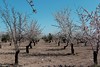
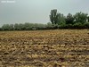
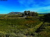
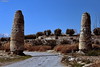
The above images may not be of the site on this page, but were taken nearby. They are loaded from Flickr so please click on them for image credits.
Click here to see more info for this site
Nearby sites
Click here to view sites on an interactive map of the areaKey: Red: member's photo, Blue: 3rd party photo, Yellow: other image, Green: no photo - please go there and take one, Grey: site destroyed
Download sites to:
KML (Google Earth)
GPX (GPS waypoints)
CSV (Garmin/Navman)
CSV (Excel)
To unlock full downloads you need to sign up as a Contributory Member. Otherwise downloads are limited to 50 sites.
Turn off the page maps and other distractions
Nearby sites listing. In the following links * = Image available
26.3km WSW 255° Parque Tematico Integral Sobre el Megalitismo, Gorafe* Burial Chamber or Dolmen
26.3km WSW 255° Gorafe 119 Burial Chamber or Dolmen
26.3km WSW 255° Gorafe 118 Burial Chamber or Dolmen
26.3km WSW 255° Gorafe 117 Burial Chamber or Dolmen
26.3km WSW 255° Gorafe 116* Burial Chamber or Dolmen
26.4km WSW 255° Gorafe 115 Burial Chamber or Dolmen
26.4km WSW 255° Sepulcher 239 Burial Chamber or Dolmen
26.4km WSW 255° Gorafe 132 Burial Chamber or Dolmen
26.4km WSW 256° Gorafe 114 Burial Chamber or Dolmen
26.4km WSW 255° Gorafe 133 Burial Chamber or Dolmen
26.4km WSW 255° Gorafe 134* Burial Chamber or Dolmen
26.4km WSW 254° Gorafe 142 Burial Chamber or Dolmen
26.4km WSW 256° Dolmen Gorafe 113* Burial Chamber or Dolmen
26.4km WSW 256° Dolmen Gorafe 112* Burial Chamber or Dolmen
26.4km WSW 256° Dolmen Gorafe 111* Burial Chamber or Dolmen
26.4km WSW 256° Dolmen Gorafe 110* Burial Chamber or Dolmen
26.4km WSW 254° Gorafe 136 Burial Chamber or Dolmen
26.4km WSW 256° Dolmen Gorafe 109* Burial Chamber or Dolmen
26.4km WSW 256° Dolmen Gorafe 108* Burial Chamber or Dolmen
26.4km WSW 254° Gorafe 137 Burial Chamber or Dolmen
26.4km WSW 255° Gorafe 135* Burial Chamber or Dolmen
26.5km WSW 256° Gorafe 107 Burial Chamber or Dolmen
26.5km WSW 254° Gorafe 138 Burial Chamber or Dolmen
26.5km WSW 254° Gorafe 139 Burial Chamber or Dolmen
26.5km WSW 254° Gorafe 143 Burial Chamber or Dolmen
View more nearby sites and additional images


 We would like to know more about this location. Please feel free to add a brief description and any relevant information in your own language.
 Wir möchten mehr über diese Stätte erfahren. Bitte zögern Sie nicht, eine kurze Beschreibung und relevante Informationen in Deutsch hinzuzufügen.
 Nous aimerions en savoir encore un peu sur les lieux. S'il vous plaît n'hesitez pas à ajouter une courte description et tous les renseignements pertinents dans votre propre langue.
 Quisieramos informarnos un poco más de las lugares. No dude en añadir una breve descripción y otros datos relevantes en su propio idioma.