


<< Our Photo Pages >> High Wall Well (Bramley Meade) - Holy Well or Sacred Spring in England in Lancashire
Submitted by Anne T on Wednesday, 20 February 2019 Page Views: 1211
Springs and Holy WellsSite Name: High Wall Well (Bramley Meade) Alternative Name: Hey Well; Hey Wall WellCountry: England
NOTE: This site is 1.108 km away from the location you searched for.
County: Lancashire Type: Holy Well or Sacred Spring
Nearest Town: Nelson Nearest Village: Bramley Meade / Whalley
Map Ref: SD73663702
Latitude: 53.828770N Longitude: 2.401665W
Condition:
| 5 | Perfect |
| 4 | Almost Perfect |
| 3 | Reasonable but with some damage |
| 2 | Ruined but still recognisable as an ancient site |
| 1 | Pretty much destroyed, possibly visible as crop marks |
| 0 | No data. |
| -1 | Completely destroyed |
| 5 | Superb |
| 4 | Good |
| 3 | Ordinary |
| 2 | Not Good |
| 1 | Awful |
| 0 | No data. |
| 5 | Can be driven to, probably with disabled access |
| 4 | Short walk on a footpath |
| 3 | Requiring a bit more of a walk |
| 2 | A long walk |
| 1 | In the middle of nowhere, a nightmare to find |
| 0 | No data. |
| 5 | co-ordinates taken by GPS or official recorded co-ordinates |
| 4 | co-ordinates scaled from a detailed map |
| 3 | co-ordinates scaled from a bad map |
| 2 | co-ordinates of the nearest village |
| 1 | co-ordinates of the nearest town |
| 0 | no data |
Be the first person to rate this site - see the 'Contribute!' box in the right hand menu.
Internal Links:
External Links:
 (PID:193940)")
Pastscape Monument No. 44487 tells us that this well is enclosed by a cone shaped structure of rough limestone, and in 1961 was still water filled. They add: "No evidence to associate it with a holy well was obtained".
The Journal of Antiquities also includes an entry for High Wall Well, Bramley Meade, Whalley, Lancashire, which tells us this well is in the grounds of the former Bramley Meade Maternity Hospital, and the structure is thought to date back to the times when Cistercian monks lived at the nearby abbey. "It has, however, never been considered to be a holy or medicinal well as such though it was used by the monks and, in more recent times, maybe by the maternity hospital itself".
The Journal includes photographs, a description (the well may originally have been a plunge pool or a baptistry?), plus a list of reference sources for more information.
Note: Have you visited this site? Do you have any photographs or information to add?
You may be viewing yesterday's version of this page. To see the most up to date information please register for a free account.
 (PID:193941)")
 (PID:193942)")
Do not use the above information on other web sites or publications without permission of the contributor.
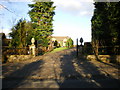
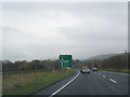
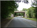
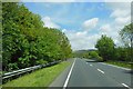
Nearby Images from Geograph Britain and Ireland:
©2009(licence)
©2014(licence)
©2016(licence)
©2015(licence)
©2012(licence)
The above images may not be of the site on this page, they are loaded from Geograph.
Please Submit an Image of this site or go out and take one for us!
Click here to see more info for this site
Nearby sites
Key: Red: member's photo, Blue: 3rd party photo, Yellow: other image, Green: no photo - please go there and take one, Grey: site destroyed
Download sites to:
KML (Google Earth)
GPX (GPS waypoints)
CSV (Garmin/Navman)
CSV (Excel)
To unlock full downloads you need to sign up as a Contributory Member. Otherwise downloads are limited to 50 sites.
Turn off the page maps and other distractions
Nearby sites listing. In the following links * = Image available
948m SSW 205° Whalley Crosses* Ancient Cross (SD73263616)
978m ENE 73° Wisa's Well (Wiswell)* Holy Well or Sacred Spring (SD746373)
987m SSW 201° St Mary and All Saints Church (Whalley)* Sculptured Stone (SD733361)
1.8km SSE 149° Portfield* Hillfort (SD7458135499)
2.5km ENE 71° Jeppe Knave's Grave* Cairn (SD75993782)
2.8km W 276° Winckley Lowe II* Round Barrow(s) (SD7084937308)
2.8km NW 312° The Great Mitton Cross* Ancient Cross (SD7156438954)
3.0km W 278° Winckley Lowe I* Round Barrow(s) (SD7064337457)
3.6km NW 316° Mitton Green Cross (Great Mitton) Ancient Cross (SD7121739613)
3.7km ENE 70° Coffin Stone (Sabden) Standing Stone (Menhir) (SD77173830)
3.8km W 277° Billington Round Barrow(s) (SD699375)
3.9km ENE 68° Solar Wheel Year Stone (Sabden) Rock Art (SD77323846)
4.0km ESE 103° Simon's Cross (Padiham)* Ancient Cross (SD77603609)
4.6km ENE 64° Lower Apronful of Stones (Pendle Hill) Cairn (SD778390)
4.7km NW 319° Withgill Cross (Great Mitton) Ancient Cross (SD70604062)
4.8km ENE 61° Devil's Apronful (Pendle Hill) Cairn (SD779393)
5.3km ENE 61° Badger Wells Cairn Cairn (SD783396)
5.6km N 360° Peg o'Nell's Well* Holy Well or Sacred Spring (SD73684266)
6.1km NW 304° Kemple End Cross* Ancient Cross (SD6864240438)
6.7km N 352° Pinder Hill (Waddington) Cairn (SD72724370)
6.8km NE 50° Pendle Hill* Round Barrow(s) (SD789414)
7.5km NE 34° Worsaw Hill Burial Mound* Round Barrow(s) (SD77934323)
8.3km W 262° St Saviour's Churchyard (Stydd) Ancient Cross (SD6539435971)
8.6km NNE 32° Great Stone (Downham)* Standing Stone (Menhir) (SD782443)
8.7km ENE 79° Newchurch-in-Pendle* Stone Circle (SD822387)
View more nearby sites and additional images


 We would like to know more about this location. Please feel free to add a brief description and any relevant information in your own language.
 Wir möchten mehr über diese Stätte erfahren. Bitte zögern Sie nicht, eine kurze Beschreibung und relevante Informationen in Deutsch hinzuzufügen.
 Nous aimerions en savoir encore un peu sur les lieux. S'il vous plaît n'hesitez pas à ajouter une courte description et tous les renseignements pertinents dans votre propre langue.
 Quisieramos informarnos un poco más de las lugares. No dude en añadir una breve descripción y otros datos relevantes en su propio idioma.