


<< Our Photo Pages >> Damery Camp - Hillfort in England in Gloucestershire
Submitted by 4clydesdale7 on Saturday, 02 July 2011 Page Views: 7720
Iron Age and Later PrehistorySite Name: Damery Camp Alternative Name: Damery Old CastleCountry: England
NOTE: This site is 2.232 km away from the location you searched for.
County: Gloucestershire Type: Hillfort
Nearest Town: Wotton-under-Edge Nearest Village: Damery/Alkington
Map Ref: ST70749440
Latitude: 51.647628N Longitude: 2.42429W
Condition:
| 5 | Perfect |
| 4 | Almost Perfect |
| 3 | Reasonable but with some damage |
| 2 | Ruined but still recognisable as an ancient site |
| 1 | Pretty much destroyed, possibly visible as crop marks |
| 0 | No data. |
| -1 | Completely destroyed |
| 5 | Superb |
| 4 | Good |
| 3 | Ordinary |
| 2 | Not Good |
| 1 | Awful |
| 0 | No data. |
| 5 | Can be driven to, probably with disabled access |
| 4 | Short walk on a footpath |
| 3 | Requiring a bit more of a walk |
| 2 | A long walk |
| 1 | In the middle of nowhere, a nightmare to find |
| 0 | No data. |
| 5 | co-ordinates taken by GPS or official recorded co-ordinates |
| 4 | co-ordinates scaled from a detailed map |
| 3 | co-ordinates scaled from a bad map |
| 2 | co-ordinates of the nearest village |
| 1 | co-ordinates of the nearest town |
| 0 | no data |
Internal Links:
External Links:
I have visited· I would like to visit
4clydesdale7 visited on 2nd Jul 2011 - their rating: Cond: 3 Amb: 4 Access: 3 Friendly resident most helpful - I rather liked this site - there was lots of atmosphere
")
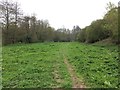
Iron age/Medieval Ring work or Defensive Enclosure cum hillfort guarding an important river crossing in the Little Avon Valley west of Wotton-under-Edge exhibiting some damage (by private encroachment). A stone schist found here in 1950 is now in the Bristol City Museum.
You may be viewing yesterday's version of this page. To see the most up to date information please register for a free account.
")
")
")
Do not use the above information on other web sites or publications without permission of the contributor.
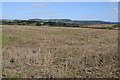
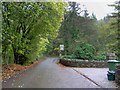
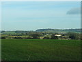
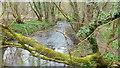
Nearby Images from Geograph Britain and Ireland:
©2015(licence)
©2009(licence)
©2012(licence)
©2012(licence)
©2017(licence)
The above images may not be of the site on this page, they are loaded from Geograph.
Please Submit an Image of this site or go out and take one for us!
Click here to see more info for this site
Nearby sites
Key: Red: member's photo, Blue: 3rd party photo, Yellow: other image, Green: no photo - please go there and take one, Grey: site destroyed
Download sites to:
KML (Google Earth)
GPX (GPS waypoints)
CSV (Garmin/Navman)
CSV (Excel)
To unlock full downloads you need to sign up as a Contributory Member. Otherwise downloads are limited to 50 sites.
Turn off the page maps and other distractions
Nearby sites listing. In the following links * = Image available
1.1km SSW 196° Tortworth Cross* Ancient Cross (ST7043393353)
2.0km S 176° Tortworth Stone* Standing Stone (Menhir) (ST7088092360)
3.4km SSW 212° Bloody Acre Camp* Hillfort (ST689915)
4.0km E 83° Brackenbury Ditches* Promontory Fort / Cliff Castle (ST74709485)
4.6km NE 39° Drakestone Camp* Misc. Earthwork (ST73679801)
5.1km W 263° Rockhampton Standing Stone* Marker Stone (ST65679378)
5.3km WSW 251° Camp Hill (Rockhampton)* Hillfort (ST657927)
5.7km WNW 296° Blisbury Hill Camp* Hillfort (ST65569692)
6.2km NE 53° The Broadwell* Holy Well or Sacred Spring (ST75749807)
6.4km NE 39° Dursley Merestone* Marker Stone (ST748993)
6.9km E 99° Blackquarries Hill* Chambered Tomb (ST77529323)
7.0km ENE 69° Folly Wood* Chambered Tomb (ST77339689)
7.2km NNW 346° Wanswell Holy Well or Sacred Spring (SO68980139)
7.4km SW 215° Tytherington Camp* Promontory Fort / Cliff Castle (ST66438834)
7.5km ENE 70° Rowden Wood* Chambered Tomb (ST77819692)
8.1km SW 225° Abbey Camp* Hillfort (ST65008870)
8.4km ENE 77° Wotton Under Edge Cursus Cursus (ST789963)
8.5km NE 53° Cam Long Down Hillfort* Hillfort (ST7753399507)
8.9km ENE 59° Uley Bury* Hillfort (ST78459891)
9.1km E 80° Symonds Hall Farm* Long Barrow (ST79719599)
9.1km NW 319° Lydney Harbour* Modern Stone Circle etc (SO64730126)
9.4km SE 139° Hawkesbury Knoll* Long Barrow (ST76838722)
9.6km SE 141° Hawkesbury Well Holy Well or Sacred Spring (ST7677586931)
9.8km W 260° The Toots (Oldbury)* Hillfort (ST611927)
9.8km WSW 258° Oldbury Standing Stone* Standing Stone (Menhir) (ST61169234)
View more nearby sites and additional images


 We would like to know more about this location. Please feel free to add a brief description and any relevant information in your own language.
 Wir möchten mehr über diese Stätte erfahren. Bitte zögern Sie nicht, eine kurze Beschreibung und relevante Informationen in Deutsch hinzuzufügen.
 Nous aimerions en savoir encore un peu sur les lieux. S'il vous plaît n'hesitez pas à ajouter une courte description et tous les renseignements pertinents dans votre propre langue.
 Quisieramos informarnos un poco más de las lugares. No dude en añadir una breve descripción y otros datos relevantes en su propio idioma.