

<< Our Photo Pages >> The Awen Stone - Modern Stone Circle etc in England in Gloucestershire
Submitted by MattUnsworthUK on Saturday, 04 August 2018 Page Views: 2696
Modern SitesSite Name: The Awen StoneCountry: England
NOTE: This site is 4.604 km away from the location you searched for.
County: Gloucestershire Type: Modern Stone Circle etc
Nearest Town: Dursley Nearest Village: Arlingham
Map Ref: SO7149809889
Latitude: 51.786927N Longitude: 2.414607W
Condition:
| 5 | Perfect |
| 4 | Almost Perfect |
| 3 | Reasonable but with some damage |
| 2 | Ruined but still recognisable as an ancient site |
| 1 | Pretty much destroyed, possibly visible as crop marks |
| 0 | No data. |
| -1 | Completely destroyed |
| 5 | Superb |
| 4 | Good |
| 3 | Ordinary |
| 2 | Not Good |
| 1 | Awful |
| 0 | No data. |
| 5 | Can be driven to, probably with disabled access |
| 4 | Short walk on a footpath |
| 3 | Requiring a bit more of a walk |
| 2 | A long walk |
| 1 | In the middle of nowhere, a nightmare to find |
| 0 | No data. |
| 5 | co-ordinates taken by GPS or official recorded co-ordinates |
| 4 | co-ordinates scaled from a detailed map |
| 3 | co-ordinates scaled from a bad map |
| 2 | co-ordinates of the nearest village |
| 1 | co-ordinates of the nearest town |
| 0 | no data |
Internal Links:
External Links:
")
A carved stone erected by the Spirit of Awen Camp team in 2015 and carved by one of the organisers.
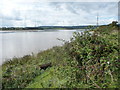
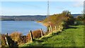
Beautiful stone sited in a U-bend of the River Severn, just to the northern side of the bottom of the loop, with beautiful views.
Awen is a Welsh, Cornish and Breton word for 'poetic inspiration' (source: Wikipedia - Awen).
You may be viewing yesterday's version of this page. To see the most up to date information please register for a free account.
Do not use the above information on other web sites or publications without permission of the contributor.
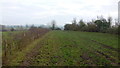
Nearby Images from Geograph Britain and Ireland:
©2019(licence)
©2012(licence)
©2012(licence)
©2023(licence)
©2019(licence)
The above images may not be of the site on this page, they are loaded from Geograph.
Please Submit an Image of this site or go out and take one for us!
Click here to see more info for this site
Nearby sites
Key: Red: member's photo, Blue: 3rd party photo, Yellow: other image, Green: no photo - please go there and take one, Grey: site destroyed
Download sites to:
KML (Google Earth)
GPX (GPS waypoints)
CSV (Garmin/Navman)
CSV (Excel)
To unlock full downloads you need to sign up as a Contributory Member. Otherwise downloads are limited to 50 sites.
Turn off the page maps and other distractions
Nearby sites listing. In the following links * = Image available
5.1km W 278° Dean Heritage Centre* Museum (SO664106)
5.4km W 277° Soudley Camp* Promontory Fort / Cliff Castle (SO66161058)
5.8km NW 314° Littledean Standing Stone* Marker Stone (SO6731713967)
5.8km W 267° Patten Stone Marker Stone (SO65640959)
6.1km W 261° Drummer Boys Grave Stone* Ancient Mine, Quarry or other Industry (SO65470898)
6.6km NW 326° Welshbury Hill Ancient Village or Settlement (SO678154)
6.7km NNW 327° Welshbury Cairn* Cairn (SO67831555)
6.8km NW 326° Welshbury Camp* Hillfort (SO67751555)
7.3km NW 323° St Anthony's Well (Cinderford)* Holy Well or Sacred Spring (SO67051574)
8.9km SSW 196° Wanswell Holy Well or Sacred Spring (SO68980139)
9.7km WNW 283° The Speech Stone* Marker Stone (SO62011212)
10.6km E 95° Haresfield Beacon tumulus* Round Barrow(s) (SO82030887)
10.8km E 94° Haresfield Beacon and Ring* Hillfort (SO823090)
11.0km SW 218° Lydney Harbour* Modern Stone Circle etc (SO64730126)
11.1km SSE 162° Dursley Merestone* Marker Stone (ST748993)
11.3km E 98° Shortwood Barrows* Round Barrow(s) (SO82670831)
11.4km ESE 105° Randwick Long Barrow* Long Barrow (SO82500690)
11.5km SE 137° Soldier's Grave* Round Barrow(s) (SO79350150)
11.5km ESE 104° Randwick Cross Dyke* Misc. Earthwork (SO82690707)
11.5km ESE 104° Randwick Barrows* Round Barrow(s) (SO82670699)
11.6km N 350° May Hill* Misc. Earthwork (SO69542128)
11.6km SE 137° Nympsfield* Long Barrow (SO79400132)
11.7km E 92° Cliff Well* Holy Well or Sacred Spring (SO83240944)
11.8km SE 135° Buckholt Wood* Chambered Tomb (SO79860157)
12.0km SSE 150° Cam Long Down Hillfort* Hillfort (ST7753399507)
View more nearby sites and additional images


 We would like to know more about this location. Please feel free to add a brief description and any relevant information in your own language.
 Wir möchten mehr über diese Stätte erfahren. Bitte zögern Sie nicht, eine kurze Beschreibung und relevante Informationen in Deutsch hinzuzufügen.
 Nous aimerions en savoir encore un peu sur les lieux. S'il vous plaît n'hesitez pas à ajouter une courte description et tous les renseignements pertinents dans votre propre langue.
 Quisieramos informarnos un poco más de las lugares. No dude en añadir una breve descripción y otros datos relevantes en su propio idioma.