

<< Our Photo Pages >> Church Hill Enclosure (Alton Pancras) - Artificial Mound in England in Dorset
Submitted by beaconhill on Sunday, 28 January 2018 Page Views: 1160
Multi-periodSite Name: Church Hill Enclosure (Alton Pancras) Alternative Name: weird square earthworkCountry: England
NOTE: This site is 0.712 km away from the location you searched for.
County: Dorset Type: Artificial Mound
Nearest Town: Cerne Abbas Nearest Village: Alton Pancras
Map Ref: ST7145403608
Latitude: 50.831296N Longitude: 2.406703W
Condition:
| 5 | Perfect |
| 4 | Almost Perfect |
| 3 | Reasonable but with some damage |
| 2 | Ruined but still recognisable as an ancient site |
| 1 | Pretty much destroyed, possibly visible as crop marks |
| 0 | No data. |
| -1 | Completely destroyed |
| 5 | Superb |
| 4 | Good |
| 3 | Ordinary |
| 2 | Not Good |
| 1 | Awful |
| 0 | No data. |
| 5 | Can be driven to, probably with disabled access |
| 4 | Short walk on a footpath |
| 3 | Requiring a bit more of a walk |
| 2 | A long walk |
| 1 | In the middle of nowhere, a nightmare to find |
| 0 | No data. |
| 5 | co-ordinates taken by GPS or official recorded co-ordinates |
| 4 | co-ordinates scaled from a detailed map |
| 3 | co-ordinates scaled from a bad map |
| 2 | co-ordinates of the nearest village |
| 1 | co-ordinates of the nearest town |
| 0 | no data |
Internal Links:
External Links:
 (PID:177705)")
Marked as an antiquity on the 1:25000 OS map as "Enclosure"
A nice place to visit - great views and a good walk with lots of other megaliths in the area. Cerne Abbas is a few km away.
You may be viewing yesterday's version of this page. To see the most up to date information please register for a free account.
Do not use the above information on other web sites or publications without permission of the contributor.
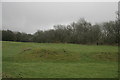
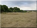
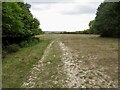
Nearby Images from Geograph Britain and Ireland:
©2016(licence)
©2022(licence)
©2022(licence)
©2019(licence)
©2008(licence)
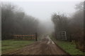
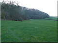
The above images may not be of the site on this page, they are loaded from Geograph.
Please Submit an Image of this site or go out and take one for us!
Click here to see more info for this site
Nearby sites
Key: Red: member's photo, Blue: 3rd party photo, Yellow: other image, Green: no photo - please go there and take one, Grey: site destroyed
Download sites to:
KML (Google Earth)
GPX (GPS waypoints)
CSV (Garmin/Navman)
CSV (Excel)
To unlock full downloads you need to sign up as a Contributory Member. Otherwise downloads are limited to 50 sites.
Turn off the page maps and other distractions
Nearby sites listing. In the following links * = Image available
2.3km E 100° Nettlecombe Tout* Promontory Fort / Cliff Castle (ST737032)
2.6km N 7° Brockhampton Green Standing Stone (Menhir) (ST718062)
3.2km E 97° Nordon Hill Tumulus* Round Barrow(s) (ST746032)
4.3km WSW 239° Alton Lane Field System Misc. Earthwork (ST677014)
4.5km NNW 327° Dungeon Hill* Hillfort (ST690074)
4.6km WSW 253° Bowl Barrow (Dorset) Round Barrow(s) (ST67030229)
4.6km ESE 114° Giant's Grave Sarsen Stone* Standing Stone (Menhir) (ST757017)
4.7km WSW 253° Giant Hill Settlement Ancient Village or Settlement (ST66950225)
4.8km SSE 149° Cheselbourne Round Barrow(s) (SY739995)
5.0km WSW 249° Giant Hill Bowl Barrow Round Barrow(s) (ST66760187)
5.1km WSW 249° Giant Hill Cross Ridge Dyke Misc. Earthwork (ST667018)
5.1km WSW 247° The Trendle* Misc. Earthwork (ST66730167)
5.2km WSW 248° Cerne Abbas Giant* Hill Figure or Geoglyph (ST66660168)
5.3km SW 233° Black Hill Farm Enclosure Ancient Village or Settlement (ST672005)
5.3km WSW 245° St Augustine's Well (Cerne Abbas)* Holy Well or Sacred Spring (ST6664001369)
5.3km SW 230° Oxencombe Bottom Bowl Barrow Round Barrow(s) (ST67380018)
5.6km W 267° Farm Hill Bowl Barrow Round Barrow(s) (ST65880334)
5.7km ENE 67° Rawlsbury Camp* Hillfort (ST76750580)
5.7km W 266° High Cank Henge Henge (ST65720319)
6.0km SW 224° Green Hill Field System Misc. Earthwork (SY672993)
6.1km SW 226° Green Hill Barrows Barrow Cemetery (SY67069943)
6.2km W 274° East Hill field System* Misc. Earthwork (ST65250405)
6.3km ENE 70° Bul Barrow Round Barrow(s) (ST774057)
6.4km WSW 251° Weam Commen Hill Field System Misc. Earthwork (ST654016)
6.4km W 279° St Mary's Well (Hermitage)* Holy Well or Sacred Spring (ST651047)
View more nearby sites and additional images


 We would like to know more about this location. Please feel free to add a brief description and any relevant information in your own language.
 Wir möchten mehr über diese Stätte erfahren. Bitte zögern Sie nicht, eine kurze Beschreibung und relevante Informationen in Deutsch hinzuzufügen.
 Nous aimerions en savoir encore un peu sur les lieux. S'il vous plaît n'hesitez pas à ajouter une courte description et tous les renseignements pertinents dans votre propre langue.
 Quisieramos informarnos un poco más de las lugares. No dude en añadir una breve descripción y otros datos relevantes en su propio idioma.