


<< Text Pages >> Trekutz Tumulua - Round Barrow(s) in Spain in Pais Vasco
Submitted by holger_rix on Sunday, 29 November 2015 Page Views: 577
Neolithic and Bronze AgeSite Name: Trekutz Tumulua Alternative Name: Irimo-Antzuola, Túmulo TrekutzCountry: Spain
NOTE: This site is 2.303 km away from the location you searched for.
Region: Pais Vasco Type: Round Barrow(s)
Latitude: 43.107205N Longitude: 2.354539W
Condition:
| 5 | Perfect |
| 4 | Almost Perfect |
| 3 | Reasonable but with some damage |
| 2 | Ruined but still recognisable as an ancient site |
| 1 | Pretty much destroyed, possibly visible as crop marks |
| 0 | No data. |
| -1 | Completely destroyed |
| 5 | Superb |
| 4 | Good |
| 3 | Ordinary |
| 2 | Not Good |
| 1 | Awful |
| 0 | No data. |
| 5 | Can be driven to, probably with disabled access |
| 4 | Short walk on a footpath |
| 3 | Requiring a bit more of a walk |
| 2 | A long walk |
| 1 | In the middle of nowhere, a nightmare to find |
| 0 | No data. |
| 5 | co-ordinates taken by GPS or official recorded co-ordinates |
| 4 | co-ordinates scaled from a detailed map |
| 3 | co-ordinates scaled from a bad map |
| 2 | co-ordinates of the nearest village |
| 1 | co-ordinates of the nearest town |
| 0 | no data |
Be the first person to rate this site - see the 'Contribute!' box in the right hand menu.
Internal Links:
External Links:
Round Barrow(s) in Pais Vasco
You may be viewing yesterday's version of this page. To see the most up to date information please register for a free account.
Do not use the above information on other web sites or publications without permission of the contributor.
Nearby Images from Flickr
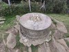
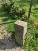
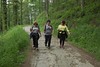
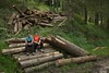
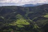
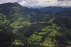
The above images may not be of the site on this page, but were taken nearby. They are loaded from Flickr so please click on them for image credits.
Click here to see more info for this site
Nearby sites
Click here to view sites on an interactive map of the areaKey: Red: member's photo, Blue: 3rd party photo, Yellow: other image, Green: no photo - please go there and take one, Grey: site destroyed
Download sites to:
KML (Google Earth)
GPX (GPS waypoints)
CSV (Garmin/Navman)
CSV (Excel)
To unlock full downloads you need to sign up as a Contributory Member. Otherwise downloads are limited to 50 sites.
Turn off the page maps and other distractions
Nearby sites listing. In the following links * = Image available
3.2km ENE 57° Elorrieta Tumulua Round Barrow(s)
3.3km NE 40° Oleta Tumulua Round Barrow(s)
3.8km S 185° Arrolamendi 3 Tumulua Round Barrow(s)
3.9km S 189° Arrolamendi 2 Tumulua Round Barrow(s)
4.2km NE 51° Iruarrieta 3 Trikuharria Burial Chamber or Dolmen
4.5km NE 53° Iruarrieta 1 Trikuharria* Burial Chamber or Dolmen
4.6km ENE 62° Pagobakarra Tumulua Round Barrow(s)
4.7km ENE 59° Iruarrieta 2 Trikuharria* Burial Chamber or Dolmen
4.8km ENE 66° Pagola Tumulua Round Barrow(s)
4.8km SSW 201° Arrolamendi 1 Tumulua Round Barrow(s)
4.8km NNW 338° Egizabalko Muñoa Tumulua Round Barrow(s)
5.2km N 353° Agerreburu Trikuharria* Burial Chamber or Dolmen
5.4km E 82° Antzetako Gaña Tumulua Round Barrow(s)
5.5km N 352° Frantsesbaso Trikuharria Burial Chamber or Dolmen
6.2km SSW 192° Jentiletxe Tumulua Round Barrow(s)
6.2km NNE 33° Arzabal Tumulua Round Barrow(s)
6.3km N 355° Maurketa Tumulua* Round Barrow(s)
6.8km N 354° Keixetako Egiya Hego Trikuharria* Burial Chamber or Dolmen
6.9km N 353° Keixetako Egiya Ipar Tumulua Round Barrow(s)
7.2km N 353° Keixeta Tumulua Round Barrow(s)
7.5km SSE 163° Aizaleku 2 Trikuharria Burial Chamber or Dolmen
7.5km SSE 164° Maribidaurre Trikuharria Burial Chamber or Dolmen
7.6km NNW 348° Aitzpuruko Zabala Trikuharria* Burial Chamber or Dolmen
7.6km SSE 162° Aizaleku 1 Trikuharria Burial Chamber or Dolmen
7.8km NNW 349° Kutzebakaar Tumulua Round Barrow(s)
View more nearby sites and additional images


 We would like to know more about this location. Please feel free to add a brief description and any relevant information in your own language.
 Wir möchten mehr über diese Stätte erfahren. Bitte zögern Sie nicht, eine kurze Beschreibung und relevante Informationen in Deutsch hinzuzufügen.
 Nous aimerions en savoir encore un peu sur les lieux. S'il vous plaît n'hesitez pas à ajouter une courte description et tous les renseignements pertinents dans votre propre langue.
 Quisieramos informarnos un poco más de las lugares. No dude en añadir una breve descripción y otros datos relevantes en su propio idioma.