

<< Our Photo Pages >> Sacred Spring, Bath - Holy Well or Sacred Spring in England in Somerset
Submitted by Andy B on Friday, 23 September 2022 Page Views: 14873
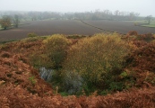
Springs and Holy WellsSite Name: Sacred Spring, Bath Alternative Name: Aquae Sulis, Roman Baths, Hot SpringCountry: England
NOTE: This site is 0.115 km away from the location you searched for.
County: Somerset Type: Holy Well or Sacred Spring
Nearest Town: Bath
Map Ref: ST7505364726
Latitude: 51.381030N Longitude: 2.359846W
Condition:
| 5 | Perfect |
| 4 | Almost Perfect |
| 3 | Reasonable but with some damage |
| 2 | Ruined but still recognisable as an ancient site |
| 1 | Pretty much destroyed, possibly visible as crop marks |
| 0 | No data. |
| -1 | Completely destroyed |
| 5 | Superb |
| 4 | Good |
| 3 | Ordinary |
| 2 | Not Good |
| 1 | Awful |
| 0 | No data. |
| 5 | Can be driven to, probably with disabled access |
| 4 | Short walk on a footpath |
| 3 | Requiring a bit more of a walk |
| 2 | A long walk |
| 1 | In the middle of nowhere, a nightmare to find |
| 0 | No data. |
| 5 | co-ordinates taken by GPS or official recorded co-ordinates |
| 4 | co-ordinates scaled from a detailed map |
| 3 | co-ordinates scaled from a bad map |
| 2 | co-ordinates of the nearest village |
| 1 | co-ordinates of the nearest town |
| 0 | no data |
Internal Links:
External Links:
I have visited· I would like to visit
lucasn visited on 31st May 2017 - their rating: Cond: 5 Amb: 4 Access: 4
Ramblesnbrambles visited on 19th Jan 2007 - their rating: Cond: 5 Amb: 5 Access: 3
SolarMegalith visited on 7th Nov 2006 - their rating: Cond: 5 Amb: 4 Access: 5
NorthernerInLondon visited - their rating: Cond: 3 Amb: 3 Access: 5
myf have visited here
Average ratings for this site from all visit loggers: Condition: 4.5 Ambience: 4 Access: 4.25
")
You may be viewing yesterday's version of this page. To see the most up to date information please register for a free account.
")
")
")
")
")
")
")
")
")
")
")
")
")
")
")
")
")
")
")
")
")
")
Do not use the above information on other web sites or publications without permission of the contributor.
Click here to see more info for this site
Nearby sites
Key: Red: member's photo, Blue: 3rd party photo, Yellow: other image, Green: no photo - please go there and take one, Grey: site destroyed
Download sites to:
KML (Google Earth)
GPX (GPS waypoints)
CSV (Garmin/Navman)
CSV (Excel)
To unlock full downloads you need to sign up as a Contributory Member. Otherwise downloads are limited to 50 sites.
Turn off the page maps and other distractions
Nearby sites listing. In the following links * = Image available
272m N 358° Bath Postal Museum* Museum (ST7504564998)
1.6km E 84° Bathampton Round Barrow 2* Round Barrow(s) (ST76616489)
1.6km NE 38° Kensington Meadows Holed Megalith Holed Stone
2.2km ENE 77° Bathampton* Standing Stones (ST772652)
2.4km E 83° Bathampton Camp* Hillfort (ST77456502)
2.6km N 354° St Mary's Well (Charlcombe)* Holy Well or Sacred Spring (ST748673)
3.7km NNE 29° Solsbury Hill* Hillfort (ST76876797)
4.2km NW 324° St Alphages Well* Holy Well or Sacred Spring (ST72606815)
4.5km SE 139° Shingle Bell* Holy Well or Sacred Spring (ST780613)
4.6km ESE 117° Conkwell well* Holy Well or Sacred Spring (ST791626)
4.8km ESE 113° Conkwell stone circle* Stone Circle (ST79456280)
4.9km ESE 110° Jug's Grave* Round Barrow(s) (ST79696305)
5.3km SSE 160° Hill Farm Barrow (Somerset) Round Barrow(s) (ST76855969)
5.4km E 79° Monk's Conduit (Monkton Farleigh)* Holy Well or Sacred Spring (ST8036265692)
5.4km SSE 169° The Giants Graves Cist (ST761594)
5.5km NW 319° Lansdown Camp* Misc. Earthwork (ST71446892)
5.8km NW 317° Lansdown Tumuli* Barrow Cemetery (ST7114968962)
5.9km NW 315° North Stoke Promontory Fort* Promontory Fort / Cliff Castle (ST70886888)
5.9km SSE 160° Beacon Barrow (Somerset) Round Barrow(s) (ST77095920)
6.0km NNW 342° Cold Ashton Round Barrows* Round Barrow(s) (ST73257045)
6.1km SSW 199° Twinhoe Stone Circle (ST730590)
6.2km SW 220° Duncorn Hill Hillfort (ST7160)
6.4km SE 130° Winsley Chambered Tomb (ST800606)
6.7km SE 126° Turleigh Trows* Holy Well or Sacred Spring (ST8044960725)
7.0km NE 40° Three Shires Stones* Modern Stone Circle etc (ST7961070021)
View more nearby sites and additional images


 We would like to know more about this location. Please feel free to add a brief description and any relevant information in your own language.
 Wir möchten mehr über diese Stätte erfahren. Bitte zögern Sie nicht, eine kurze Beschreibung und relevante Informationen in Deutsch hinzuzufügen.
 Nous aimerions en savoir encore un peu sur les lieux. S'il vous plaît n'hesitez pas à ajouter une courte description et tous les renseignements pertinents dans votre propre langue.
 Quisieramos informarnos un poco más de las lugares. No dude en añadir una breve descripción y otros datos relevantes en su propio idioma.