


<< Our Photo Pages >> Great Stone (Downham) - Standing Stone (Menhir) in England in Lancashire
Submitted by Anne T on Wednesday, 10 January 2018 Page Views: 1738
Neolithic and Bronze AgeSite Name: Great Stone (Downham) Alternative Name: Downham CrossCountry: England
NOTE: This site is 1.399 km away from the location you searched for.
County: Lancashire Type: Standing Stone (Menhir)
Nearest Town: Clitheroe Nearest Village: Downham
Map Ref: SD782443
Latitude: 53.894412N Longitude: 2.33321W
Condition:
| 5 | Perfect |
| 4 | Almost Perfect |
| 3 | Reasonable but with some damage |
| 2 | Ruined but still recognisable as an ancient site |
| 1 | Pretty much destroyed, possibly visible as crop marks |
| 0 | No data. |
| -1 | Completely destroyed |
| 5 | Superb |
| 4 | Good |
| 3 | Ordinary |
| 2 | Not Good |
| 1 | Awful |
| 0 | No data. |
| 5 | Can be driven to, probably with disabled access |
| 4 | Short walk on a footpath |
| 3 | Requiring a bit more of a walk |
| 2 | A long walk |
| 1 | In the middle of nowhere, a nightmare to find |
| 0 | No data. |
| 5 | co-ordinates taken by GPS or official recorded co-ordinates |
| 4 | co-ordinates scaled from a detailed map |
| 3 | co-ordinates scaled from a bad map |
| 2 | co-ordinates of the nearest village |
| 1 | co-ordinates of the nearest town |
| 0 | no data |
Be the first person to rate this site - see the 'Contribute!' box in the right hand menu.
Internal Links:
External Links:
 (PID:73043)")
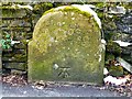
The Northern Antiquarian (TNA) features a page for this legendary rock (or possibly a monolith or marker stone) - see their entry for The Great Stone, Downham, Lancashire, which gives directions for finding this stone, photographs, local folklore and descriptions from 20th century reference books.
TNA tells us this stone rests underneath a stone wall in a beautiful village. This 'great stone' "thought by some as an old monolith; remains of a Roman milestone by others; whilst some just denote it as nowt but a small stone ... but the small pock-marked stone has been embedded in its present position for at least 150 years, as the growth of soil and tree behind it shows."
The Journal of Antiquities also features a page for this stone - see their entry for The Great Stone, Downham, Lancashire, which includes a photograph, a description and a discussion of its purpose. The Journal adds: "Apparently the Lord of the (Downham Hall) Manor had the stone placed under his wall for protection and that’s where it has lain for a hundred years or more."
You may be viewing yesterday's version of this page. To see the most up to date information please register for a free account.
 (PID:191041)")
 (PID:191040)")
Do not use the above information on other web sites or publications without permission of the contributor.
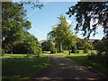
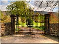
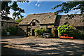
Nearby Images from Geograph Britain and Ireland:
©2011(licence)
©2015(licence)
©2013(licence)
©2014(licence)
©2015(licence)
The above images may not be of the site on this page, they are loaded from Geograph.
Please Submit an Image of this site or go out and take one for us!
Click here to see more info for this site
Nearby sites
Key: Red: member's photo, Blue: 3rd party photo, Yellow: other image, Green: no photo - please go there and take one, Grey: site destroyed
Download sites to:
KML (Google Earth)
GPX (GPS waypoints)
CSV (Garmin/Navman)
CSV (Excel)
To unlock full downloads you need to sign up as a Contributory Member. Otherwise downloads are limited to 50 sites.
Turn off the page maps and other distractions
Nearby sites listing. In the following links * = Image available
1.1km SSW 194° Worsaw Hill Burial Mound* Round Barrow(s) (SD77934323)
2.8km ESE 122° Pendle Hill Ringwork and Barrow Hillfort (SD806428)
3.0km SSE 166° Pendle Hill* Round Barrow(s) (SD789414)
4.7km S 179° Badger Wells Cairn Cairn (SD783396)
4.8km WSW 250° Peg o'Nell's Well* Holy Well or Sacred Spring (SD73684266)
4.9km NNE 20° Fooden Spring Holy Well or Sacred Spring (SD7993548892)
5.0km S 183° Devil's Apronful (Pendle Hill) Cairn (SD779393)
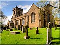
5.0km N 4° St Peter and St Paul's Church, Bolton-by-Bowland* Sculptured Stone (SD786493)
5.3km S 184° Lower Apronful of Stones (Pendle Hill) Cairn (SD778390)
5.5km W 263° Pinder Hill (Waddington) Cairn (SD72724370)
5.8km E 81° Middop Earthworks* Misc. Earthwork (SD839452)
5.9km S 188° Solar Wheel Year Stone (Sabden) Rock Art (SD77323846)
6.1km S 189° Coffin Stone (Sabden) Standing Stone (Menhir) (SD77173830)
6.4km SE 139° Jinny Well* Holy Well or Sacred Spring (SD8238039461)
6.8km SSW 199° Jeppe Knave's Grave* Cairn (SD75993782)
6.9km SE 144° Newchurch-in-Pendle* Stone Circle (SD822387)
6.9km ENE 61° Bomber Camp (Gisburn) Ancient Village or Settlement (SD8429547626)
7.1km ESE 111° Aedmer's Mound (Admergill)* Artificial Mound (SD8482941718)
7.1km SE 145° St Chad's Well, Tinedale Farm, Spen Brook.* Holy Well or Sacred Spring (SD82253845)
7.2km ENE 65° Primrose Hill (Gisburn) Misc. Earthwork (SD84764725)
7.4km NE 38° Little Painley* Round Barrow(s) (SD8284350125)
7.5km WNW 302° Walloper Well (Newton) Holy Well or Sacred Spring (SD7182348265)
7.6km ESE 108° Blacko Cross (Blacko Hill) Ancient Cross (SD85414187)
7.9km SSW 207° Wisa's Well (Wiswell)* Holy Well or Sacred Spring (SD746373)
8.0km NE 36° Castle Haugh Ringwork (Paythorne Bridge) Misc. Earthwork (SD8299650776)
View more nearby sites and additional images


 We would like to know more about this location. Please feel free to add a brief description and any relevant information in your own language.
 Wir möchten mehr über diese Stätte erfahren. Bitte zögern Sie nicht, eine kurze Beschreibung und relevante Informationen in Deutsch hinzuzufügen.
 Nous aimerions en savoir encore un peu sur les lieux. S'il vous plaît n'hesitez pas à ajouter une courte description et tous les renseignements pertinents dans votre propre langue.
 Quisieramos informarnos un poco más de las lugares. No dude en añadir una breve descripción y otros datos relevantes en su propio idioma.