

<< Our Photo Pages >> Tormarton 1 - Long Barrow in England in Gloucestershire
Submitted by TheCaptain on Tuesday, 18 September 2007 Page Views: 5507
Neolithic and Bronze AgeSite Name: Tormarton 1Country: England County: Gloucestershire Type: Long Barrow
Nearest Town: Chipping Sodbury Nearest Village: Tormarton
Map Ref: ST77957805
Latitude: 51.500952N Longitude: 2.319055W
Condition:
| 5 | Perfect |
| 4 | Almost Perfect |
| 3 | Reasonable but with some damage |
| 2 | Ruined but still recognisable as an ancient site |
| 1 | Pretty much destroyed, possibly visible as crop marks |
| 0 | No data. |
| -1 | Completely destroyed |
| 5 | Superb |
| 4 | Good |
| 3 | Ordinary |
| 2 | Not Good |
| 1 | Awful |
| 0 | No data. |
| 5 | Can be driven to, probably with disabled access |
| 4 | Short walk on a footpath |
| 3 | Requiring a bit more of a walk |
| 2 | A long walk |
| 1 | In the middle of nowhere, a nightmare to find |
| 0 | No data. |
| 5 | co-ordinates taken by GPS or official recorded co-ordinates |
| 4 | co-ordinates scaled from a detailed map |
| 3 | co-ordinates scaled from a bad map |
| 2 | co-ordinates of the nearest village |
| 1 | co-ordinates of the nearest town |
| 0 | no data |
Internal Links:
External Links:
I have visited· I would like to visit
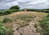
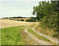
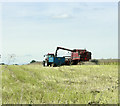
TheCaptain visited on 30th Sep 2022 Day out walking and stopped for a quick look here on the way home. The field has been harvested, leaving the long raised lump in the ground standing proud. No obviously easy way into the field, so I satisfied myself with a view from the road.
4clydesdale7 visited on 30th Jun 2011 - their rating: Amb: 3 Access: 4 Summer visit no marks in crop to confirm position - relied on OS Explorer which also showed accurately Fox Covert a site 'just across the road'
")
The more substantial remains of Tormarton 2 longbarrow (Fox Covert NW) can be found in the field just to the south of the lane nearby.
You may be viewing yesterday's version of this page. To see the most up to date information please register for a free account.
")
Do not use the above information on other web sites or publications without permission of the contributor.
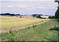
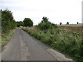
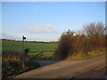
Nearby Images from Geograph Britain and Ireland:
©2009(licence)
©2013(licence)
©2007(licence)
©2009(licence)
©2009(licence)
The above images may not be of the site on this page, they are loaded from Geograph.
Please Submit an Image of this site or go out and take one for us!
Click here to see more info for this site
Nearby sites
Key: Red: member's photo, Blue: 3rd party photo, Yellow: other image, Green: no photo - please go there and take one, Grey: site destroyed
Download sites to:
KML (Google Earth)
GPX (GPS waypoints)
CSV (Garmin/Navman)
CSV (Excel)
To unlock full downloads you need to sign up as a Contributory Member. Otherwise downloads are limited to 50 sites.
Turn off the page maps and other distractions
Nearby sites listing. In the following links * = Image available
191m SE 137° Fox Covert NW* Chambered Tomb (ST78087791)
1.6km SW 222° West Littleton Down* Round Barrow(s) (ST769769)
2.9km WSW 246° Dyrham and Hinton Chambered Tomb (ST75307689)
4.1km WSW 250° Dyrham Camp* Hillfort (ST741767)
4.8km N 357° The Grickstone* Standing Stone (Menhir) (ST77698281)
4.9km NNW 337° Old Sodbury* Hillfort (ST76088258)
5.2km E 84° Lugbury* Chambered Tomb (ST83097856)
5.2km N 3° Grickstone Farm* Chambered Tomb (ST78278327)
5.6km SE 136° Bury Camp (Wiltshire)* Hillfort (ST818740)
5.9km NW 309° Chipping Sodbury Stone Circle* Modern Stone Circle etc (ST73398176)
6.0km ENE 78° Castle Coombe Cursus (ST838793)
6.3km NE 41° Luckington II* Chambered Tomb (ST82108284)
6.3km E 79° Castle Coombe Cursus (ST842792)
6.4km NE 39° Giant's Caves* Chambered Cairn (ST81998297)
6.5km SE 125° Colerne Cross Dyke* Misc. Earthwork (ST83267436)
6.5km NNW 346° Horton Camp* Hillfort (ST76438436)
7.4km SE 130° The Danes Tump* Round Barrow(s) (ST83547325)
7.4km SW 221° Labourer's Stone* Marker Stone (ST73057251)
8.0km SSE 150° Colerne Cross.* Ancient Cross (ST820711)
8.0km WSW 246° Abson Church* Sculptured Stone (ST70557485)
8.2km SSE 168° Three Shires Stones* Modern Stone Circle etc (ST7961070021)
8.9km SW 222° Freezing Hill Camp* Misc. Earthwork (ST72007148)
8.9km SSW 211° Cold Ashton Round Barrows* Round Barrow(s) (ST73257045)
9.0km N 352° Hawkesbury Well Holy Well or Sacred Spring (ST7677586931)
9.0km NE 42° Hancock's Well Holy Well or Sacred Spring (ST8403684687)
View more nearby sites and additional images


 We would like to know more about this location. Please feel free to add a brief description and any relevant information in your own language.
 Wir möchten mehr über diese Stätte erfahren. Bitte zögern Sie nicht, eine kurze Beschreibung und relevante Informationen in Deutsch hinzuzufügen.
 Nous aimerions en savoir encore un peu sur les lieux. S'il vous plaît n'hesitez pas à ajouter une courte description et tous les renseignements pertinents dans votre propre langue.
 Quisieramos informarnos un poco más de las lugares. No dude en añadir una breve descripción y otros datos relevantes en su propio idioma.