


<< Our Photo Pages >> Fell End Stone Circle - Modern Stone Circle etc in England in Cumbria
Submitted by MonumentMan on Monday, 21 October 2019 Page Views: 2942
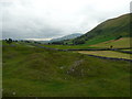
Modern SitesSite Name: Fell End Stone CircleCountry: England County: Cumbria Type: Modern Stone Circle etc
Nearest Town: Sedbergh Nearest Village: Ravenstonedale
Map Ref: NY73160023
Latitude: 54.396828N Longitude: 2.414898W
Condition:
| 5 | Perfect |
| 4 | Almost Perfect |
| 3 | Reasonable but with some damage |
| 2 | Ruined but still recognisable as an ancient site |
| 1 | Pretty much destroyed, possibly visible as crop marks |
| 0 | No data. |
| -1 | Completely destroyed |
| 5 | Superb |
| 4 | Good |
| 3 | Ordinary |
| 2 | Not Good |
| 1 | Awful |
| 0 | No data. |
| 5 | Can be driven to, probably with disabled access |
| 4 | Short walk on a footpath |
| 3 | Requiring a bit more of a walk |
| 2 | A long walk |
| 1 | In the middle of nowhere, a nightmare to find |
| 0 | No data. |
| 5 | co-ordinates taken by GPS or official recorded co-ordinates |
| 4 | co-ordinates scaled from a detailed map |
| 3 | co-ordinates scaled from a bad map |
| 2 | co-ordinates of the nearest village |
| 1 | co-ordinates of the nearest town |
| 0 | no data |
Internal Links:
External Links:
")
A circle of 5 large (1-1.5m) limestone boulders are spaced regularly around a central limestone boulder (1.5-1.8m) at NY 73135 00175. The circle of stones is about 15m across but is raised on a platformed earth bank 20-25m across. The central boulder is again raised on a mound somewhat above the 5 surrounding stones. The source of the boulders is believed to be from the local area east of the site which has many large limestone boulders broken off the escarpment of Fell End Clouds below Wild Boar Fell.
You may be viewing yesterday's version of this page. To see the most up to date information please register for a free account.
")
")
")
Do not use the above information on other web sites or publications without permission of the contributor.
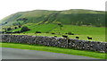
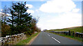
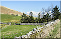
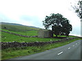
Nearby Images from Geograph Britain and Ireland:
©2019(licence)
©2021(licence)
©2022(licence)
©2006(licence)
©2008(licence)
The above images may not be of the site on this page, they are loaded from Geograph.
Please Submit an Image of this site or go out and take one for us!
Click here to see more info for this site
Nearby sites
Key: Red: member's photo, Blue: 3rd party photo, Yellow: other image, Green: no photo - please go there and take one, Grey: site destroyed
Download sites to:
KML (Google Earth)
GPX (GPS waypoints)
CSV (Garmin/Navman)
CSV (Excel)
To unlock full downloads you need to sign up as a Contributory Member. Otherwise downloads are limited to 50 sites.
Turn off the page maps and other distractions
Nearby sites listing. In the following links * = Image available
2.3km SSW 199° Uldale, Black Moss Marker Stone (SD7237398039)
2.6km W 260° Adamthwaite Standing Stone* Marker Stone (SD7062899794)
3.0km SW 216° Rawthey Bridge (Fell End)* Stone Circle (SD714978)
3.2km SSW 205° Rawthey Cave Cave or Rock Shelter (SD718973)
3.9km SSW 213° Rawthey Bridge Stone Circle (SD710970)
5.1km N 7° Rasett Hill* Round Cairn (NY73780531)
5.5km WSW 237° Cautley Spout Cairn Cairn (SD685973)
5.6km NNW 335° St. Helen's Well (Newbiggin-on-Lune)* Holy Well or Sacred Spring (NY7079905268)
6.1km NE 46° Round Hill, Birkett Common Round Cairns* Round Cairn (NY7764004444)
6.3km NNW 348° Crosby Garrett Ancient Village or Settlement (NY719064)
7.0km NNW 338° Bent's Hill Round Cairn* Round Cairn (NY7060206780)
7.7km WSW 251° Bush Howe* Hill Figure or Geoglyph (SD658978)
8.3km NNE 26° Croglam Castle Ancient Village or Settlement (NY768077)
8.5km NW 326° Raiset Pike* Long Barrow (NY68400725)
8.5km NNE 27° The Loki Stone* Early Christian Sculptured Stone (NY77130774)
9.1km NNW 334° Little Asby Scar Round Cairn* Round Cairn (NY6920808493)
9.6km NNW 328° Howes Well ring cairn* Ring Cairn (NY6804908373)
10.9km ENE 57° Nine Standards Rigg* Long Barrow (NY82400611)
11.0km NW 323° Little Kinmond Cairn* Cairn (NY66540899)
11.0km SW 222° Old Market Cross (Sedbergh) Ancient Cross (SD657921)
11.1km NE 56° Nine Standards* Cairn (NY824064)
11.3km NNW 327° Muddygill Plain, Great Asby Scar* Cairn (NY6704309747)
11.8km NW 318° Raisbeck Wood* Round Cairn (NY65260896)
12.1km NW 311° Gamelands* Stone Circle (NY64010816)
12.2km NNW 331° Asby Common Ancient Village or Settlement (NY673109)
View more nearby sites and additional images


 We would like to know more about this location. Please feel free to add a brief description and any relevant information in your own language.
 Wir möchten mehr über diese Stätte erfahren. Bitte zögern Sie nicht, eine kurze Beschreibung und relevante Informationen in Deutsch hinzuzufügen.
 Nous aimerions en savoir encore un peu sur les lieux. S'il vous plaît n'hesitez pas à ajouter une courte description et tous les renseignements pertinents dans votre propre langue.
 Quisieramos informarnos un poco más de las lugares. No dude en añadir una breve descripción y otros datos relevantes en su propio idioma.