


<< Our Photo Pages >> Whitelow - Cairn in England in Greater Manchester
Submitted by vicky on Friday, 27 February 2004 Page Views: 12810
Neolithic and Bronze AgeSite Name: WhitelowCountry: England
NOTE: This site is 2.009 km away from the location you searched for.
County: Greater Manchester Type: Cairn
Nearest Town: Bury Nearest Village: Shuttleworth
Map Ref: SD80501626 Landranger Map Number: 109
Latitude: 53.642484N Longitude: 2.29643W
Condition:
| 5 | Perfect |
| 4 | Almost Perfect |
| 3 | Reasonable but with some damage |
| 2 | Ruined but still recognisable as an ancient site |
| 1 | Pretty much destroyed, possibly visible as crop marks |
| 0 | No data. |
| -1 | Completely destroyed |
| 5 | Superb |
| 4 | Good |
| 3 | Ordinary |
| 2 | Not Good |
| 1 | Awful |
| 0 | No data. |
| 5 | Can be driven to, probably with disabled access |
| 4 | Short walk on a footpath |
| 3 | Requiring a bit more of a walk |
| 2 | A long walk |
| 1 | In the middle of nowhere, a nightmare to find |
| 0 | No data. |
| 5 | co-ordinates taken by GPS or official recorded co-ordinates |
| 4 | co-ordinates scaled from a detailed map |
| 3 | co-ordinates scaled from a bad map |
| 2 | co-ordinates of the nearest village |
| 1 | co-ordinates of the nearest town |
| 0 | no data |
Internal Links:
External Links:
")
This cairn is recorded as Pastscape Monument No. 45141, which tells us the remains of this cairn measure 14m in diameter, circa 0.6m high, with a substantially buitl retaining wall. It was discovered in 1960 and excavated in 1960 and 1962. A primary burial and seven secondary cremations, four in urns were found. All dated from the early to middle Bronze Age. Most of the finds are now in Bury Museum.
The Journal of Antiquities also includes an entry for Whitelow Cairn near Shuttleworth, Greater Manchester, which includes photographs, directions for finding this site, a description, and a list of reference sources for more information.
You may be viewing yesterday's version of this page. To see the most up to date information please register for a free account.
")
")
")
Do not use the above information on other web sites or publications without permission of the contributor.
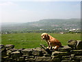
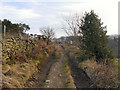
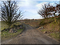
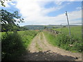
Nearby Images from Geograph Britain and Ireland:
©2007(licence)
©2013(licence)
©2013(licence)
©2015(licence)
©2015(licence)
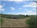
The above images may not be of the site on this page, they are loaded from Geograph.
Please Submit an Image of this site or go out and take one for us!
Click here to see more info for this site
Nearby sites
Key: Red: member's photo, Blue: 3rd party photo, Yellow: other image, Green: no photo - please go there and take one, Grey: site destroyed
Download sites to:
KML (Google Earth)
GPX (GPS waypoints)
CSV (Garmin/Navman)
CSV (Excel)
To unlock full downloads you need to sign up as a Contributory Member. Otherwise downloads are limited to 50 sites.
Turn off the page maps and other distractions
Nearby sites listing. In the following links * = Image available
3.1km ESE 115° Wind Hill Cheesden* Round Barrow(s) (SD8326214945)
3.4km SSE 154° Walmersley Golf Club stone* Modern Stone Circle etc (SD82011319)
3.5km SSW 193° Castlesteads (Walmersley)* Hillfort (SD797129)
3.9km WSW 247° Whippalow Hill* Barrow Cemetery (SD76921477)
4.1km NE 35° Waugh's Well (Edenfield) Holy Well or Sacred Spring (SD82871957)
4.2km NW 321° Robin Hood's Well, Haslingden* Holy Well or Sacred Spring (SD77861954)
4.4km SSE 149° Castle Hill, Heywood Hillfort (SD827125)
4.6km WSW 251° Dodd Lee* Barrow Cemetery (SD76121476)
5.0km W 266° Carve Hill Low* Barrow Cemetery (SD755159)
5.6km WSW 243° Affetside Cross (Lancashire) Ancient Cross (SD7546613689)
5.6km WSW 243° Affetside Cross (Bury)* Ancient Cross (SD7546613686)
5.9km E 93° Hunger Hill Cairn* Cairn (SD864159)
6.2km ENE 69° Hamer Hill* Stone Circle (SD863184)
7.0km E 92° Lowe Dunishbooth Promontory Fort / Cliff Castle (SD8756115960)
7.3km E 92° Lower Dunishbooth Promontory Fort / Cliff Castle (SD8779616025)
7.6km SW 224° Dry Hillock Marker Stone* Marker Stone (SD7511310830)
8.9km W 267° Cheetham Close* Stone Circle (SD71631586)
8.9km NNW 334° Thirteen Stone Hill* Stone Circle (SD7665324273)
9.4km NE 43° Bacup Natural History Society Museum* Museum (SD869231)
9.6km ESE 110° Broadfield Park Glacial Boulder* Natural Stone / Erratic / Other Natural Feature (SD896130)
10.0km NE 36° Broadclough Dykes, Bacup, Lancashire* Misc. Earthwork (SD864243)
10.0km SSW 202° Radcliffe Hillfort (SD767070)
10.1km NE 44° Wyrd of Stake Moss* Modern Stone Circle etc (SD876235)
10.8km SW 228° Haulgh (Bolton) Cairn (SD72420899)
10.9km SW 230° St Peter's Church (Bolton)* Ancient Cross (SD721093)
View more nearby sites and additional images


 We would like to know more about this location. Please feel free to add a brief description and any relevant information in your own language.
 Wir möchten mehr über diese Stätte erfahren. Bitte zögern Sie nicht, eine kurze Beschreibung und relevante Informationen in Deutsch hinzuzufügen.
 Nous aimerions en savoir encore un peu sur les lieux. S'il vous plaît n'hesitez pas à ajouter une courte description et tous les renseignements pertinents dans votre propre langue.
 Quisieramos informarnos un poco más de las lugares. No dude en añadir una breve descripción y otros datos relevantes en su propio idioma.