


<< Text Pages >> Castle Haugh Ringwork (Paythorne Bridge) - Misc. Earthwork in England in Lancashire
Submitted by Anne T on Wednesday, 20 February 2019 Page Views: 1202
Multi-periodSite Name: Castle Haugh Ringwork (Paythorne Bridge) Alternative Name: Cromwell's Basin (Newsholme)Country: England County: Lancashire Type: Misc. Earthwork
Nearest Town: Nelson Nearest Village: Paysthorne Bridge / Newsholme
Map Ref: SD8299650776
Latitude: 53.952797N Longitude: 2.260594W
Condition:
| 5 | Perfect |
| 4 | Almost Perfect |
| 3 | Reasonable but with some damage |
| 2 | Ruined but still recognisable as an ancient site |
| 1 | Pretty much destroyed, possibly visible as crop marks |
| 0 | No data. |
| -1 | Completely destroyed |
| 5 | Superb |
| 4 | Good |
| 3 | Ordinary |
| 2 | Not Good |
| 1 | Awful |
| 0 | No data. |
| 5 | Can be driven to, probably with disabled access |
| 4 | Short walk on a footpath |
| 3 | Requiring a bit more of a walk |
| 2 | A long walk |
| 1 | In the middle of nowhere, a nightmare to find |
| 0 | No data. |
| 5 | co-ordinates taken by GPS or official recorded co-ordinates |
| 4 | co-ordinates scaled from a detailed map |
| 3 | co-ordinates scaled from a bad map |
| 2 | co-ordinates of the nearest village |
| 1 | co-ordinates of the nearest town |
| 0 | no data |
Be the first person to rate this site - see the 'Contribute!' box in the right hand menu.
Internal Links:
External Links:
Misc. Earthwork in Lancashire
The Journal of Antiquities tells us about this ringwork - see their entry for
Castle Haugh, Paythorne Bridge, Newsholme, Lancashire, which includes photographs, a description, a debate as to its origin (is it the site of an early Norman castle mentioned in the Domesday Book, the site of a later manor house or was it built on top of a Bronze Age Burial Mound?)
The River Ribble has eaten away at least one third of the site, which has not been excavated. Local contact, Nick Livesey, told the JoA: "there are so many burial mounds near here is because of the River Ribble was a watery liminal place between the living and the dead. You often find burial mounds on parish boundaries or next to lakes or rivers". See the Journal web page for a list of reference sources for more information.
The site is also scheduled as Historic England List ID 1012521, which defines this as a ringwork - a fortification built and occupied from the late Anglo Saxon period to the later 12th century. Pastscape Monument No. 45548 classifies this site as a motte, adding it 25ft high with a ditch 7ft deep, still retaining an earth breastwork around the top.
Note: Have you visited this site? Do you have any photographs, information or comments to add?
You may be viewing yesterday's version of this page. To see the most up to date information please register for a free account.
Do not use the above information on other web sites or publications without permission of the contributor.
Nearby Images from Geograph Britain and Ireland:
©2020(licence)
©2012(licence)
©2011(licence)
©2021(licence)
©2018(licence)
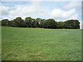
The above images may not be of the site on this page, they are loaded from Geograph.
Please Submit an Image of this site or go out and take one for us!
Click here to see more info for this site
Nearby sites
Key: Red: member's photo, Blue: 3rd party photo, Yellow: other image, Green: no photo - please go there and take one, Grey: site destroyed
Download sites to:
KML (Google Earth)
GPX (GPS waypoints)
CSV (Garmin/Navman)
CSV (Excel)
To unlock full downloads you need to sign up as a Contributory Member. Otherwise downloads are limited to 50 sites.
Turn off the page maps and other distractions
Nearby sites listing. In the following links * = Image available
668m SSW 193° Little Painley* Round Barrow(s) (SD8284350125)
3.4km SSE 157° Bomber Camp (Gisburn) Ancient Village or Settlement (SD8429547626)
3.6km WSW 238° Fooden Spring Holy Well or Sacred Spring (SD7993548892)
3.9km SSE 153° Primrose Hill (Gisburn) Misc. Earthwork (SD84764725)
4.5km NE 54° Cobers Laithe Camp (Nappa)* Misc. Earthwork (SD86695340)
4.6km WSW 251° St Peter and St Paul's Church, Bolton-by-Bowland* Sculptured Stone (SD786493)
5.6km S 171° Middop Earthworks* Misc. Earthwork (SD839452)
7.1km NE 52° Steeling Hill Enclosure Ancient Village or Settlement (SD8859255148)
7.5km ESE 109° Church Well (Thornton-in-Craven)* Holy Well or Sacred Spring (SD901483)
7.6km ESE 109° Church Well (Thornton-in-Craven)* Holy Well or Sacred Spring (SD902483)
7.8km E 90° St Peter (East Marton)* Ancient Cross (SD9080750694)
8.0km SE 132° Jinny Well, Salterforth* Holy Well or Sacred Spring (SD8898145411)
8.0km SW 216° Great Stone (Downham)* Standing Stone (Menhir) (SD782443)
8.3km SSW 196° Pendle Hill Ringwork and Barrow Hillfort (SD806428)
9.1km SSW 214° Worsaw Hill Burial Mound* Round Barrow(s) (SD77934323)
9.2km SSE 147° The Lark Hill Stone (Whitemoor)* Standing Stone (Menhir) (SD880431)
9.2km SSE 165° Blacko Cross (Blacko Hill) Ancient Cross (SD85414187)
9.2km SSE 168° Aedmer's Mound (Admergill)* Artificial Mound (SD8482941718)
9.9km NE 48° Lower Colgarth Hill Tumulus* Round Barrow(s) (SD9048157360)
10.0km SSE 165° Cock Hill Standing Stone* Standing Stone (Menhir) (SD85624110)
10.2km SSW 203° Pendle Hill* Round Barrow(s) (SD789414)
10.2km ESE 120° Bleara Moor Cairnfield (Earby) Cairn (SD919457)
10.4km SE 145° Tallers Cross* Ancient Cross (SD890423)
10.4km ESE 107° Hare Hill ring cairn* Cairn (SD9295347697)
10.5km ENE 73° The Garris* Ancient Village or Settlement (SD9306153776)
View more nearby sites and additional images


 We would like to know more about this location. Please feel free to add a brief description and any relevant information in your own language.
 Wir möchten mehr über diese Stätte erfahren. Bitte zögern Sie nicht, eine kurze Beschreibung und relevante Informationen in Deutsch hinzuzufügen.
 Nous aimerions en savoir encore un peu sur les lieux. S'il vous plaît n'hesitez pas à ajouter une courte description et tous les renseignements pertinents dans votre propre langue.
 Quisieramos informarnos un poco más de las lugares. No dude en añadir una breve descripción y otros datos relevantes en su propio idioma.