


<< Our Photo Pages >> West Littleton Down - Round Barrow(s) in England in Gloucestershire
Submitted by 4clydesdale7 on Friday, 01 July 2011 Page Views: 4850
Neolithic and Bronze AgeSite Name: West Littleton DownCountry: England
NOTE: This site is 3.479 km away from the location you searched for.
County: Gloucestershire Type: Round Barrow(s)
Nearest Village: Tormarton
Map Ref: ST769769
Latitude: 51.490570N Longitude: 2.334106W
Condition:
| 5 | Perfect |
| 4 | Almost Perfect |
| 3 | Reasonable but with some damage |
| 2 | Ruined but still recognisable as an ancient site |
| 1 | Pretty much destroyed, possibly visible as crop marks |
| 0 | No data. |
| -1 | Completely destroyed |
| 5 | Superb |
| 4 | Good |
| 3 | Ordinary |
| 2 | Not Good |
| 1 | Awful |
| 0 | No data. |
| 5 | Can be driven to, probably with disabled access |
| 4 | Short walk on a footpath |
| 3 | Requiring a bit more of a walk |
| 2 | A long walk |
| 1 | In the middle of nowhere, a nightmare to find |
| 0 | No data. |
| 5 | co-ordinates taken by GPS or official recorded co-ordinates |
| 4 | co-ordinates scaled from a detailed map |
| 3 | co-ordinates scaled from a bad map |
| 2 | co-ordinates of the nearest village |
| 1 | co-ordinates of the nearest town |
| 0 | no data |
Internal Links:
External Links:
I have visited· I would like to visit
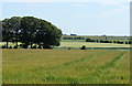
4clydesdale7 visited on 30th Jun 2011 - their rating: Amb: 4 Access: 2 Just arrived at the wrong time - haymaking in progress meant it was inconvenient to walk to site - but that walk is not short nor is it along footpaths so permission needed
")
Pasture being worked on as I arrived - access politely refused - might be granted at less busy time. Telephoto lens shot only possible - looks interesting
You may be viewing yesterday's version of this page. To see the most up to date information please register for a free account.
Do not use the above information on other web sites or publications without permission of the contributor.
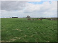
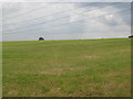
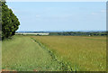
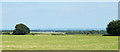
Nearby Images from Geograph Britain and Ireland:
©2013(licence)
©2009(licence)
©2010(licence)
©2010(licence)
©2010(licence)
The above images may not be of the site on this page, they are loaded from Geograph.
Please Submit an Image of this site or go out and take one for us!
Click here to see more info for this site
Nearby sites
Key: Red: member's photo, Blue: 3rd party photo, Yellow: other image, Green: no photo - please go there and take one, Grey: site destroyed
Download sites to:
KML (Google Earth)
GPX (GPS waypoints)
CSV (Garmin/Navman)
CSV (Excel)
To unlock full downloads you need to sign up as a Contributory Member. Otherwise downloads are limited to 50 sites.
Turn off the page maps and other distractions
Nearby sites listing. In the following links * = Image available
1.6km NE 49° Fox Covert NW* Chambered Tomb (ST78087791)
1.6km NE 42° Tormarton 1* Long Barrow (ST77957805)
1.6km W 269° Dyrham and Hinton Chambered Tomb (ST75307689)
2.8km W 266° Dyrham Camp* Hillfort (ST741767)
5.7km ESE 120° Bury Camp (Wiltshire)* Hillfort (ST818740)
5.7km N 352° Old Sodbury* Hillfort (ST76088258)
5.8km SW 221° Labourer's Stone* Marker Stone (ST73057251)
6.0km N 7° The Grickstone* Standing Stone (Menhir) (ST77698281)
6.0km NW 324° Chipping Sodbury Stone Circle* Modern Stone Circle etc (ST73398176)
6.4km ENE 75° Lugbury* Chambered Tomb (ST83097856)
6.5km NNE 12° Grickstone Farm* Chambered Tomb (ST78278327)
6.7km WSW 252° Abson Church* Sculptured Stone (ST70557485)
6.8km ESE 112° Colerne Cross Dyke* Misc. Earthwork (ST83267436)
7.3km ENE 71° Castle Coombe Cursus (ST838793)
7.3km SW 222° Freezing Hill Camp* Misc. Earthwork (ST72007148)
7.4km SSE 158° Three Shires Stones* Modern Stone Circle etc (ST7961070021)
7.4km SSW 209° Cold Ashton Round Barrows* Round Barrow(s) (ST73257045)
7.5km N 356° Horton Camp* Hillfort (ST76438436)
7.6km ESE 119° The Danes Tump* Round Barrow(s) (ST83547325)
7.6km ENE 72° Castle Coombe Cursus (ST842792)
7.7km SE 138° Colerne Cross.* Ancient Cross (ST820711)
7.9km NE 41° Luckington II* Chambered Tomb (ST82108284)
7.9km NE 40° Giant's Caves* Chambered Cairn (ST81998297)
8.1km SW 231° Wick Burial Chamber (Gloucestershire)* Burial Chamber or Dolmen (ST70587188)
8.4km WSW 256° St Anne’s well (Siston)* Holy Well or Sacred Spring (ST68697494)
View more nearby sites and additional images


 We would like to know more about this location. Please feel free to add a brief description and any relevant information in your own language.
 Wir möchten mehr über diese Stätte erfahren. Bitte zögern Sie nicht, eine kurze Beschreibung und relevante Informationen in Deutsch hinzuzufügen.
 Nous aimerions en savoir encore un peu sur les lieux. S'il vous plaît n'hesitez pas à ajouter une courte description et tous les renseignements pertinents dans votre propre langue.
 Quisieramos informarnos un poco más de las lugares. No dude en añadir una breve descripción y otros datos relevantes en su propio idioma.