


<< Our Photo Pages >> Lindow - Ancient Trackway in England in Cheshire
Submitted by vicky on Friday, 27 June 2003 Page Views: 25000
Multi-periodSite Name: Lindow Alternative Name: Lindow Man, Pete MarshCountry: England County: Cheshire Type: Ancient Trackway
Nearest Town: Wilmslow Nearest Village: Knolls Green
Map Ref: SJ810800 Landranger Map Number: 109
Latitude: 53.316586N Longitude: 2.28666W
Condition:
| 5 | Perfect |
| 4 | Almost Perfect |
| 3 | Reasonable but with some damage |
| 2 | Ruined but still recognisable as an ancient site |
| 1 | Pretty much destroyed, possibly visible as crop marks |
| 0 | No data. |
| -1 | Completely destroyed |
| 5 | Superb |
| 4 | Good |
| 3 | Ordinary |
| 2 | Not Good |
| 1 | Awful |
| 0 | No data. |
| 5 | Can be driven to, probably with disabled access |
| 4 | Short walk on a footpath |
| 3 | Requiring a bit more of a walk |
| 2 | A long walk |
| 1 | In the middle of nowhere, a nightmare to find |
| 0 | No data. |
| 5 | co-ordinates taken by GPS or official recorded co-ordinates |
| 4 | co-ordinates scaled from a detailed map |
| 3 | co-ordinates scaled from a bad map |
| 2 | co-ordinates of the nearest village |
| 1 | co-ordinates of the nearest town |
| 0 | no data |
Internal Links:
External Links:
")
This possible prehistoric trackway on the west side of Lindow Moss was recorded by a Mr Norbury in the 19th century. In 1884 he wrote:
‘one Peter Cash found, somewhere on the Mobberley side of Lindow, what appeared to be a roadway made of logs and timber placed end to end, with sleepers across laid close together, and this I am told continued for some length up the Moss, and I think it was at the bottom of the bog, but of this I am not sure.’ A similar prehistoric trackway was found during excavations for the second runway at Manchester Airport on the Oversley Farm site. Further details can be found in the Cheshire Archaeology Newsletter Spring 1999.
Lindow Moss has a number of other interesting features dating from the Neolithic through to the Iron Age. During a recent survey of the wetlands in Cheshire a small scatter of Neolithic flints was discovered on one of the sand islands to the west of the Moss. Radiocarbon dates from charcoal found in the area have given a date of c3970-3640BC, suggesting that clearing and burning was taking place at this time. Also it was not far from here (at GR: SJ82508150) that the body of Lindow Man, or Pete Marsh as he is more commonly known, and another male known as Lindow III were discovered in the 1980s.
References
W.Norbury “Lindow Common as a Peat Bog: Its Age and its People”, TLCAS Volume 7, 1884.
M.D.Leach et al “The Wetlands of Cheshire, NW Wetlands Survey 4”, 1993-1995.
Forthcoming - V & P Morgan 'Prehistoric Cheshire', Landmark Publishing February 2004.
You may be viewing yesterday's version of this page. To see the most up to date information please register for a free account.
Do not use the above information on other web sites or publications without permission of the contributor.
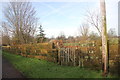
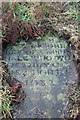
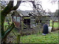
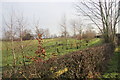
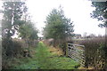
Nearby Images from Geograph Britain and Ireland:
©2013(licence)
©2013(licence)
©2011(licence)
©2013(licence)
©2013(licence)
The above images may not be of the site on this page, they are loaded from Geograph.
Please Submit an Image of this site or go out and take one for us!
Click here to see more info for this site
Nearby sites
Key: Red: member's photo, Blue: 3rd party photo, Yellow: other image, Green: no photo - please go there and take one, Grey: site destroyed
Download sites to:
KML (Google Earth)
GPX (GPS waypoints)
CSV (Garmin/Navman)
CSV (Excel)
To unlock full downloads you need to sign up as a Contributory Member. Otherwise downloads are limited to 50 sites.
Turn off the page maps and other distractions
Nearby sites listing. In the following links * = Image available
5.3km ESE 114° Wizard's Well* Holy Well or Sacred Spring (SJ858778)
5.3km ESE 115° Armada Beacon* Round Barrow(s) (SJ858777)
5.3km ESE 113° Holy Well (Alderley Edge)* Holy Well or Sacred Spring (SJ85907786)
5.4km ESE 111° Findlow Marker Stone (SJ86027808)
5.5km WNW 285° Tatton Neolithic posthole and pit* Ancient Village or Settlement (SJ757814)
5.5km ESE 113° Druidical Circle* Modern Stone Circle etc (SJ86077788)
5.5km ESE 115° Wishing Well (Alderley Edge)* Holy Well or Sacred Spring (SJ860777)
5.5km WNW 286° Tatton Iron Age roundhouse and pit* Ancient Village or Settlement (SJ757815)
5.5km ESE 113° Wizard's Cave Cave or Rock Shelter (SJ86087782)
5.6km WSW 254° Nether Knutsford* Round Barrow(s) (SJ756785)
5.6km ESE 115° Engine Vein, Alderley Edge Copper Mines* Ancient Mine, Quarry or other Industry (SJ861776)
5.6km ESE 115° Golden Stone (Alderley Edge)* Standing Stone (Menhir) (SJ861776)
5.7km W 281° Tatton Neolithic hearth* Ancient Village or Settlement (SJ754811)
6.0km ESE 122° Great Merestone Marker Stone (SJ86137677)
6.2km S 179° Astle Park Round Barrow(s) (SJ811738)
6.6km ESE 104° Mottram St Andrew Mines Ancient Mine, Quarry or other Industry (SJ874784)
6.9km SSE 152° Sodger's Hump* Round Barrow(s) (SJ842739)
7.2km SE 140° Birtles Hall Round Barrow(s) (SJ856745)
7.5km SSE 158° Capesthorne Hall (NW) Round Barrow(s) (SJ838730)
7.6km S 182° Old Withington* Barrow Cemetery (SJ80677240)
7.6km WNW 299° Rostherne Celtic Head* Sculptured Stone (SJ743837)
7.8km SSE 155° Capesthorne Hall (NE)* Round Barrow(s) (SJ843729)
8.2km SSE 155° Capesthorne Hall (SE)* Round Barrow(s) (SJ845726)
9.0km WNW 286° Bucklow Hill* Round Barrow(s) (SJ7235582567)
9.1km E 92° Adlington Hall pre-Norman cross* Ancient Cross (SJ901797)
View more nearby sites and additional images


 We would like to know more about this location. Please feel free to add a brief description and any relevant information in your own language.
 Wir möchten mehr über diese Stätte erfahren. Bitte zögern Sie nicht, eine kurze Beschreibung und relevante Informationen in Deutsch hinzuzufügen.
 Nous aimerions en savoir encore un peu sur les lieux. S'il vous plaît n'hesitez pas à ajouter une courte description et tous les renseignements pertinents dans votre propre langue.
 Quisieramos informarnos un poco más de las lugares. No dude en añadir una breve descripción y otros datos relevantes en su propio idioma.