


<< Image Pages >> Stoney Knowe Hillfort - Hillfort in Scotland in Scottish Borders
Submitted by durhamnature on Thursday, 06 September 2012 Page Views: 3274
Iron Age and Later PrehistorySite Name: Stoney Knowe Hillfort Alternative Name: Kelso Cleugh Hillfort, Kelso Cleuch HillfortCountry: Scotland
NOTE: This site is 3.283 km away from the location you searched for.
County: Scottish Borders Type: Hillfort
Nearest Town: Kirk Yetholm
Map Ref: NT855170
Latitude: 55.446651N Longitude: 2.230774W
Condition:
| 5 | Perfect |
| 4 | Almost Perfect |
| 3 | Reasonable but with some damage |
| 2 | Ruined but still recognisable as an ancient site |
| 1 | Pretty much destroyed, possibly visible as crop marks |
| 0 | No data. |
| -1 | Completely destroyed |
| 5 | Superb |
| 4 | Good |
| 3 | Ordinary |
| 2 | Not Good |
| 1 | Awful |
| 0 | No data. |
| 5 | Can be driven to, probably with disabled access |
| 4 | Short walk on a footpath |
| 3 | Requiring a bit more of a walk |
| 2 | A long walk |
| 1 | In the middle of nowhere, a nightmare to find |
| 0 | No data. |
| 5 | co-ordinates taken by GPS or official recorded co-ordinates |
| 4 | co-ordinates scaled from a detailed map |
| 3 | co-ordinates scaled from a bad map |
| 2 | co-ordinates of the nearest village |
| 1 | co-ordinates of the nearest town |
| 0 | no data |
Internal Links:
External Links:
")
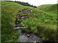
Large Hillfort and settlement, one of a dozen in the upper Bowmont Water catchment. Number 16 on the map accompanying the Calroust Hillfort entry.
You may be viewing yesterday's version of this page. To see the most up to date information please register for a free account.
Do not use the above information on other web sites or publications without permission of the contributor.
Nearby Images from Geograph Britain and Ireland:
©2015(licence)
©2015(licence)
©2008(licence)
©2015(licence)
©2015(licence)
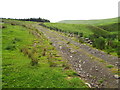
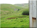
The above images may not be of the site on this page, they are loaded from Geograph.
Please Submit an Image of this site or go out and take one for us!
Click here to see more info for this site
Nearby sites
Key: Red: member's photo, Blue: 3rd party photo, Yellow: other image, Green: no photo - please go there and take one, Grey: site destroyed
Download sites to:
KML (Google Earth)
GPX (GPS waypoints)
CSV (Garmin/Navman)
CSV (Excel)
To unlock full downloads you need to sign up as a Contributory Member. Otherwise downloads are limited to 50 sites.
Turn off the page maps and other distractions
Nearby sites listing. In the following links * = Image available
2.3km N 9° Bonnielaws Hillfort* Hillfort (NT8589319312)
2.9km NNW 345° Sourhope Hillfort* Hillfort (NT8475219825)
3.4km N 350° Fasset Hill (Sourhope)* Ancient Village or Settlement (NT8492520359)
3.5km NW 309° Calroust Hillfort* Hillfort (NT828192)
6.0km NNE 25° Mounthooly (College Valley)* Ancient Village or Settlement (NT8803022426)
6.8km WNW 289° The Shearers* Stone Row / Alignment (NT79101925)
6.9km WNW 290° Hownam Rings Hill Fort* Hillfort (NT79041939)
7.0km WNW 286° Horseshoe Wood (Hownam)* Standing Stone (Menhir) (NT78741890)
7.2km WNW 285° Horseshoe Wood Settlement* Ancient Village or Settlement (NT78511891)
7.5km W 266° Dodlaw Cairn Round Cairn (NT77991655)
7.6km W 270° Little Heuch Law Cairn* Cairn (NT77921705)
7.7km NW 310° Hownam Law Hillfort* Hillfort (NT7964022000)
7.7km W 268° Dodlaw Burn* Standing Stone (Menhir) (NT77791681)
7.7km NE 36° Dunsdale (College Valley)* Ancient Village or Settlement (NT9005823240)
8.1km NNE 27° Coldburn (College Valley)* Ancient Village or Settlement (NT8924924207)
8.1km WSW 240° Standard Knowe Cairn (NT78411300)
8.3km NNE 21° Southernknowe Farmstead (College Valley)* Ancient Village or Settlement (NT8854124761)
8.8km W 267° Chatto Craig* Hillfort (NT76701662)
8.8km NNE 22° Southernknowe (College Valley)* Ancient Village or Settlement (NT88842520)
9.7km W 264° Dere Street stone* Standing Stone (Menhir) (NT75801604)
9.8km WSW 243° Woden Law* Hillfort (NT76771254)
10.0km N 357° Stob Rig (Yetholm)* Misc. Earthwork (NT85092704)
10.1km N 358° Stob Stones* Standing Stones (NT85142710)
10.1km SW 236° Hindhope Hill Cairn* Cairn (NT7710811310)
10.2km W 269° Five Stanes A* Stone Circle (NT75261686)
View more nearby sites and additional images


 We would like to know more about this location. Please feel free to add a brief description and any relevant information in your own language.
 Wir möchten mehr über diese Stätte erfahren. Bitte zögern Sie nicht, eine kurze Beschreibung und relevante Informationen in Deutsch hinzuzufügen.
 Nous aimerions en savoir encore un peu sur les lieux. S'il vous plaît n'hesitez pas à ajouter une courte description et tous les renseignements pertinents dans votre propre langue.
 Quisieramos informarnos un poco más de las lugares. No dude en añadir una breve descripción y otros datos relevantes en su propio idioma.