
, Aubrey Burl")
<< Text Pages >> Old Wife's Spring (Snaizeholme) - Holy Well or Sacred Spring in England in Yorkshire (North)
Submitted by Anne T on Thursday, 07 December 2017 Page Views: 1144
Springs and Holy WellsSite Name: Old Wife''s Spring (Snaizeholme)Country: England
NOTE: This site is 7.021 km away from the location you searched for.
County: Yorkshire (North) Type: Holy Well or Sacred Spring
Nearest Town: Hawes Nearest Village: Snaizeholme
Map Ref: SD834847
Latitude: 54.257698N Longitude: 2.256313W
Condition:
| 5 | Perfect |
| 4 | Almost Perfect |
| 3 | Reasonable but with some damage |
| 2 | Ruined but still recognisable as an ancient site |
| 1 | Pretty much destroyed, possibly visible as crop marks |
| 0 | No data. |
| -1 | Completely destroyed |
| 5 | Superb |
| 4 | Good |
| 3 | Ordinary |
| 2 | Not Good |
| 1 | Awful |
| 0 | No data. |
| 5 | Can be driven to, probably with disabled access |
| 4 | Short walk on a footpath |
| 3 | Requiring a bit more of a walk |
| 2 | A long walk |
| 1 | In the middle of nowhere, a nightmare to find |
| 0 | No data. |
| 5 | co-ordinates taken by GPS or official recorded co-ordinates |
| 4 | co-ordinates scaled from a detailed map |
| 3 | co-ordinates scaled from a bad map |
| 2 | co-ordinates of the nearest village |
| 1 | co-ordinates of the nearest town |
| 0 | no data |
Be the first person to rate this site - see the 'Contribute!' box in the right hand menu.
Internal Links:
External Links:
Holy Well or Sacred Spring in Yorkshire (North)
Old Wife’s Spring, Snaizeholme, North Yorkshire, which gives directions for finding this spring, together with photographs, and a brief archaeology & history.
TNA says: "The waters emerge from this very steep slope, surrounded by plenty of thorns and thistles, on a part of the hill where the land itself is slowly coming away. After a long dry-spell no doubt, this might be a little more secure; but when we came here she’d been raining on-and-off like h*ll and the waters were a-plenty. It’s difficult to actually locate the exact spot where the water first appears – but like I said, it seems to have, long ago, come from much further up the hill ... the water’s nice n’ clear, good-tasting, and then continues along its downward stream – known as the Old Wife’s Gill – until hitting the small river at the valley bottom."
Note: Have you visited this site? Do you have any photographs or information to add?
You may be viewing yesterday's version of this page. To see the most up to date information please register for a free account.
Do not use the above information on other web sites or publications without permission of the contributor.
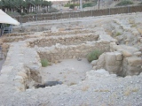
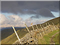
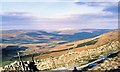
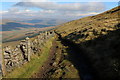
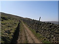
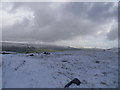
Nearby Images from Geograph Britain and Ireland:
©2009(licence)
©2008(licence)
©2015(licence)
©2012(licence)
©2014(licence)
The above images may not be of the site on this page, they are loaded from Geograph.
Please Submit an Image of this site or go out and take one for us!
Click here to see more info for this site
Nearby sites
Key: Red: member's photo, Blue: 3rd party photo, Yellow: other image, Green: no photo - please go there and take one, Grey: site destroyed
Download sites to:
KML (Google Earth)
GPX (GPS waypoints)
CSV (Garmin/Navman)
CSV (Excel)
To unlock full downloads you need to sign up as a Contributory Member. Otherwise downloads are limited to 50 sites.
Turn off the page maps and other distractions
Nearby sites listing. In the following links * = Image available
2.5km ESE 118° Mêni Mabbin Stone Row / Alignment (SD856835)
8.4km SE 129° Yockenthwaite* Ring Cairn (SD8995779376)
9.2km SW 231° Batty Wife Hole Ring Cairn (SD76227895)
10.0km SW 230° Sleights Pasture Round Barrow* Round Cairn (SD75677836)
10.1km SW 228° Sleights Pasture Propped Stone* Rock Outcrop (SD7579578018)
11.0km SW 231° Philpin Sleights* Rock Outcrop (SD7486677760)
11.1km SSW 206° Skirtful of Stones (Ingleborough) Cairn (SD785747)
11.4km SW 229° Keld Bank (Ingleborough)* Rock Art (SD7475977253)
11.4km ENE 73° Devil's Stone (Bainbridge) Natural Stone / Erratic / Other Natural Feature (SD94358799)
11.4km SW 230° Keld Bank Settlement* Ancient Village or Settlement (SD74657734)
11.6km SSE 169° Giant's Graves (Halton Gill) Cairn (SD8564873346)
11.7km ENE 73° Addlebrough* Cairn (SD94598812)
11.8km ENE 74° Addlebrough Cup-Marked Rock Rock Art (SD948879)
11.8km E 79° Stoney Raise* Cairn (SD95068691)
13.0km ENE 61° Askrigg Cross* Ancient Cross (SD9480591026)
13.5km ENE 78° Dove Stones (Thornton Rust Moor) Rock Art (SD9663487493)
13.7km SW 222° Ingleborough Camp* Hillfort (SD7419374511)
13.8km WSW 244° Apron Full of Stones* Ring Cairn (SD709787)
14.2km WSW 246° Yordas cave* Cave or Rock Shelter (SD704790)
14.7km NNE 31° Muker Stone Circle (SD911973)
15.0km E 80° Castle Dykes* Henge (SD9823187289)
15.7km SW 234° Twisleton Scar Rock Outcrop (SD70597563)
16.0km SW 227° White Scars Cairn (SD717738)
16.2km SSW 205° Norber Erratics Natural Stone / Erratic / Other Natural Feature (SD76597003)
16.5km ENE 71° Carperby Stone Circle* Stone Circle (SD99009013)
View more nearby sites and additional images


 We would like to know more about this location. Please feel free to add a brief description and any relevant information in your own language.
 Wir möchten mehr über diese Stätte erfahren. Bitte zögern Sie nicht, eine kurze Beschreibung und relevante Informationen in Deutsch hinzuzufügen.
 Nous aimerions en savoir encore un peu sur les lieux. S'il vous plaît n'hesitez pas à ajouter une courte description et tous les renseignements pertinents dans votre propre langue.
 Quisieramos informarnos un poco más de las lugares. No dude en añadir una breve descripción y otros datos relevantes en su propio idioma.