


<< Text Pages >> Mêni Mabbin - Stone Row / Alignment in England in Cumbria
Submitted by cumbrianlad on Tuesday, 22 June 2021 Page Views: 347
Date UncertainSite Name: Mêni Mabbin Alternative Name: Heversham HeadCountry: England
NOTE: This site is 4.647 km away from the location you searched for.
County: Cumbria Type: Stone Row / Alignment
Nearest Town: Heversham
Map Ref: SD856835
Latitude: 54.246981N Longitude: 2.222485W
Condition:
| 5 | Perfect |
| 4 | Almost Perfect |
| 3 | Reasonable but with some damage |
| 2 | Ruined but still recognisable as an ancient site |
| 1 | Pretty much destroyed, possibly visible as crop marks |
| 0 | No data. |
| -1 | Completely destroyed |
| 5 | Superb |
| 4 | Good |
| 3 | Ordinary |
| 2 | Not Good |
| 1 | Awful |
| 0 | No data. |
| 5 | Can be driven to, probably with disabled access |
| 4 | Short walk on a footpath |
| 3 | Requiring a bit more of a walk |
| 2 | A long walk |
| 1 | In the middle of nowhere, a nightmare to find |
| 0 | No data. |
| 5 | co-ordinates taken by GPS or official recorded co-ordinates |
| 4 | co-ordinates scaled from a detailed map |
| 3 | co-ordinates scaled from a bad map |
| 2 | co-ordinates of the nearest village |
| 1 | co-ordinates of the nearest town |
| 0 | no data |
Internal Links:
External Links:
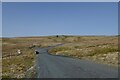
A potential ancient site, consists of what appears to be a stone alighnment on the hillside of Heversham Head. Nearby a hall is named Mabbin Hall, and takes its name from a Brythonic deity name.
The site has therefore been named Mêni Mabbin, which is the reconstructed Brythonic for 'stones of Mabon'.
You may be viewing yesterday's version of this page. To see the most up to date information please register for a free account.
Do not use the above information on other web sites or publications without permission of the contributor.
Nearby Images from Geograph Britain and Ireland:
©2006(licence)
©2008(licence)
©2007(licence)
©2006(licence)
©2021(licence)
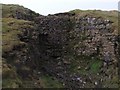
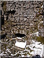
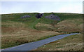
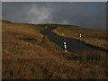
The above images may not be of the site on this page, they are loaded from Geograph.
Please Submit an Image of this site or go out and take one for us!
Click here to see more info for this site
Nearby sites
Key: Red: member's photo, Blue: 3rd party photo, Yellow: other image, Green: no photo - please go there and take one, Grey: site destroyed
Download sites to:
KML (Google Earth)
GPX (GPS waypoints)
CSV (Garmin/Navman)
CSV (Excel)
To unlock full downloads you need to sign up as a Contributory Member. Otherwise downloads are limited to 50 sites.
Turn off the page maps and other distractions
Nearby sites listing. In the following links * = Image available
2.5km WNW 298° Old Wife's Spring (Snaizeholme) Holy Well or Sacred Spring (SD834847)
6.0km SE 133° Yockenthwaite* Ring Cairn (SD8995779376)
9.8km ENE 63° Devil's Stone (Bainbridge) Natural Stone / Erratic / Other Natural Feature (SD94358799)
10.0km ENE 70° Stoney Raise* Cairn (SD95068691)
10.1km ENE 63° Addlebrough* Cairn (SD94598812)
10.1km S 180° Giant's Graves (Halton Gill) Cairn (SD8564873346)
10.2km ENE 64° Addlebrough Cup-Marked Rock Rock Art (SD948879)
10.4km WSW 244° Batty Wife Hole Ring Cairn (SD76227895)
11.2km WSW 242° Sleights Pasture Round Barrow* Round Cairn (SD75677836)
11.2km WSW 241° Sleights Pasture Propped Stone* Rock Outcrop (SD7579578018)
11.3km SW 219° Skirtful of Stones (Ingleborough) Cairn (SD785747)
11.7km ENE 70° Dove Stones (Thornton Rust Moor) Rock Art (SD9663487493)
11.9km NE 50° Askrigg Cross* Ancient Cross (SD9480591026)
12.1km WSW 242° Philpin Sleights* Rock Outcrop (SD7486677760)
12.5km WSW 240° Keld Bank (Ingleborough)* Rock Art (SD7475977253)
12.5km WSW 240° Keld Bank Settlement* Ancient Village or Settlement (SD74657734)
13.2km ENE 73° Castle Dykes* Henge (SD9823187289)
14.5km SW 232° Ingleborough Camp* Hillfort (SD7419374511)
14.6km SSE 148° Blue Scar (Arncliffe)* Ancient Village or Settlement (SD93237100)
14.8km ESE 122° Tor Dike Ancient Village or Settlement (SD98137551)
14.8km NNE 22° Muker Stone Circle (SD911973)
14.9km ENE 63° Carperby Stone Circle* Stone Circle (SD99009013)
15.1km SSE 158° Dewbottoms (Arncliffe) Ancient Village or Settlement (SD912695)
15.1km ESE 121° Little Hunters Sleets Cairn Cairn (SD98647576)
15.4km WSW 252° Apron Full of Stones* Ring Cairn (SD709787)
View more nearby sites and additional images


 We would like to know more about this location. Please feel free to add a brief description and any relevant information in your own language.
 Wir möchten mehr über diese Stätte erfahren. Bitte zögern Sie nicht, eine kurze Beschreibung und relevante Informationen in Deutsch hinzuzufügen.
 Nous aimerions en savoir encore un peu sur les lieux. S'il vous plaît n'hesitez pas à ajouter une courte description et tous les renseignements pertinents dans votre propre langue.
 Quisieramos informarnos un poco más de las lugares. No dude en añadir una breve descripción y otros datos relevantes en su propio idioma.