


<< Text Pages >> Great Merestone - Marker Stone in England in Cheshire
Submitted by coldrum on Monday, 10 August 2009 Page Views: 3871
Multi-periodSite Name: Great MerestoneCountry: England County: Cheshire Type: Marker Stone
Map Ref: SJ86137677
Latitude: 53.287713N Longitude: 2.209515W
Condition:
| 5 | Perfect |
| 4 | Almost Perfect |
| 3 | Reasonable but with some damage |
| 2 | Ruined but still recognisable as an ancient site |
| 1 | Pretty much destroyed, possibly visible as crop marks |
| 0 | No data. |
| -1 | Completely destroyed |
| 5 | Superb |
| 4 | Good |
| 3 | Ordinary |
| 2 | Not Good |
| 1 | Awful |
| 0 | No data. |
| 5 | Can be driven to, probably with disabled access |
| 4 | Short walk on a footpath |
| 3 | Requiring a bit more of a walk |
| 2 | A long walk |
| 1 | In the middle of nowhere, a nightmare to find |
| 0 | No data. |
| 5 | co-ordinates taken by GPS or official recorded co-ordinates |
| 4 | co-ordinates scaled from a detailed map |
| 3 | co-ordinates scaled from a bad map |
| 2 | co-ordinates of the nearest village |
| 1 | co-ordinates of the nearest town |
| 0 | no data |
Be the first person to rate this site - see the 'Contribute!' box in the right hand menu.
Internal Links:
External Links:
Marker Stone in Cheshire
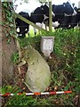
Medieval boundary marker, which includes a large half buried sandstone boulder, about 1.3 metres in diameter, and 0.40 metres in height. Damaged carved cross visible on the top surface.
From Pastscape:
https://www.pastscape.org.uk/hob.aspx?hob_id=1346450
You may be viewing yesterday's version of this page. To see the most up to date information please register for a free account.
Do not use the above information on other web sites or publications without permission of the contributor.
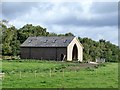
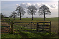
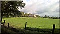
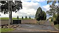
Nearby Images from Geograph Britain and Ireland:
©2018(licence)
©2017(licence)
©2018(licence)
©2018(licence)
©2019(licence)
The above images may not be of the site on this page, they are loaded from Geograph.
Please Submit an Image of this site or go out and take one for us!
Click here to see more info for this site
Nearby sites
Key: Red: member's photo, Blue: 3rd party photo, Yellow: other image, Green: no photo - please go there and take one, Grey: site destroyed
Download sites to:
KML (Google Earth)
GPX (GPS waypoints)
CSV (Garmin/Navman)
CSV (Excel)
To unlock full downloads you need to sign up as a Contributory Member. Otherwise downloads are limited to 50 sites.
Turn off the page maps and other distractions
Nearby sites listing. In the following links * = Image available
830m N 358° Golden Stone (Alderley Edge)* Standing Stone (Menhir) (SJ861776)
830m N 358° Engine Vein, Alderley Edge Copper Mines* Ancient Mine, Quarry or other Industry (SJ861776)
939m N 352° Wishing Well (Alderley Edge)* Holy Well or Sacred Spring (SJ860777)
986m NNW 340° Armada Beacon* Round Barrow(s) (SJ858777)
1.1km N 357° Wizard's Cave Cave or Rock Shelter (SJ86087782)
1.1km NNW 342° Wizard's Well* Holy Well or Sacred Spring (SJ858778)
1.1km N 357° Druidical Circle* Modern Stone Circle etc (SJ86077788)
1.1km NNW 348° Holy Well (Alderley Edge)* Holy Well or Sacred Spring (SJ85907786)
1.3km N 355° Findlow Marker Stone (SJ86027808)
2.1km NE 38° Mottram St Andrew Mines Ancient Mine, Quarry or other Industry (SJ874784)
2.3km SSW 193° Birtles Hall Round Barrow(s) (SJ856745)
3.5km SSW 214° Sodger's Hump* Round Barrow(s) (SJ842739)
3.9km ESE 115° Prestbury Road (Macclesfield)* Ancient Cross (SJ89727511)
3.9km E 88° St Peter (Prestbury)* Ancient Cross (SJ9008676910)
4.3km SSW 205° Capesthorne Hall (NE)* Round Barrow(s) (SJ843729)
4.4km SSW 211° Capesthorne Hall (NW) Round Barrow(s) (SJ838730)
4.5km SSW 201° Capesthorne Hall (SE)* Round Barrow(s) (SJ845726)
4.7km SSE 147° New Farm, Henbury* Stone Circle (SJ887728)
4.8km ENE 71° Bonis Hall Lane* Round Barrow(s) (SJ907783)
4.8km ENE 71° Butley Barrow* Round Barrow(s) (SJ9072278334)
4.9km NE 53° Adlington Hall pre-Norman cross* Ancient Cross (SJ901797)
4.9km SSE 165° Bearhurst Farm* Round Barrow(s) (SJ874720)
5.0km ENE 76° Butley Stone Circle (SJ9178)
5.2km ESE 116° Macclesfield Cemetery* Round Barrow(s) (SJ908745)
5.6km S 169° Lower Pexhill Round Barrow(s) (SJ872713)
View more nearby sites and additional images


 We would like to know more about this location. Please feel free to add a brief description and any relevant information in your own language.
 Wir möchten mehr über diese Stätte erfahren. Bitte zögern Sie nicht, eine kurze Beschreibung und relevante Informationen in Deutsch hinzuzufügen.
 Nous aimerions en savoir encore un peu sur les lieux. S'il vous plaît n'hesitez pas à ajouter une courte description et tous les renseignements pertinents dans votre propre langue.
 Quisieramos informarnos un poco más de las lugares. No dude en añadir una breve descripción y otros datos relevantes en su propio idioma.