

<< Our Photo Pages >> Puckwell - Holy Well or Sacred Spring in England in Wiltshire
Submitted by kernunos on Sunday, 24 April 2005 Page Views: 5244
Springs and Holy WellsSite Name: PuckwellCountry: England County: Wiltshire Type: Holy Well or Sacred Spring
Nearest Town: Mere Nearest Village: West Knoyle
Map Ref: ST856319
Latitude: 51.086232N Longitude: 2.20697W
Condition:
| 5 | Perfect |
| 4 | Almost Perfect |
| 3 | Reasonable but with some damage |
| 2 | Ruined but still recognisable as an ancient site |
| 1 | Pretty much destroyed, possibly visible as crop marks |
| 0 | No data. |
| -1 | Completely destroyed |
| 5 | Superb |
| 4 | Good |
| 3 | Ordinary |
| 2 | Not Good |
| 1 | Awful |
| 0 | No data. |
| 5 | Can be driven to, probably with disabled access |
| 4 | Short walk on a footpath |
| 3 | Requiring a bit more of a walk |
| 2 | A long walk |
| 1 | In the middle of nowhere, a nightmare to find |
| 0 | No data. |
| 5 | co-ordinates taken by GPS or official recorded co-ordinates |
| 4 | co-ordinates scaled from a detailed map |
| 3 | co-ordinates scaled from a bad map |
| 2 | co-ordinates of the nearest village |
| 1 | co-ordinates of the nearest town |
| 0 | no data |
Internal Links:
External Links:
")
Now just a muddy and stagnant hollow in the ground. Not the kind of place I would want to live if I was a goblin. However, the name does indicate that, unlike the majority of named wells in the UK and Eire, it has never been Christianised.
'Puca' is Old English for goblin and tends to be used only for wells that remain pagan, presumably deemed to be too demonic to be Christianised.
To visit this well park in the small carpark opposite Puckwell Cottages and take the track leading southeast along the side of Puckwell Coppice. Just before the coppice becomes a field, enter the coppice (on your right). Once in the coppice various paths lead to the well which is in a hollow near the southeastern corner of the coppice. The instructions that we had said the well was best located from the field behind the coppice but this appeared to be no longer the case due to thick brambles. While it appears to be just a muddy patch, I was able to push a stick into the mud to a depth of at least four feet with no great effort. When you are finished at the well you might like to turn right from the carpark and visit the grotesques at West Knoyle Church, or maybe not … it all depends on your taste in grotesques!
You may be viewing yesterday's version of this page. To see the most up to date information please register for a free account.
Do not use the above information on other web sites or publications without permission of the contributor.
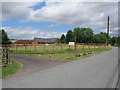
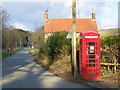
Nearby Images from Geograph Britain and Ireland:
©2016(licence)
©2008(licence)
©2008(licence)
©2006(licence)
©2009(licence)
The above images may not be of the site on this page, they are loaded from Geograph.
Please Submit an Image of this site or go out and take one for us!
Click here to see more info for this site
Nearby sites
Key: Red: member's photo, Blue: 3rd party photo, Yellow: other image, Green: no photo - please go there and take one, Grey: site destroyed
Download sites to:
KML (Google Earth)
GPX (GPS waypoints)
CSV (Garmin/Navman)
CSV (Excel)
To unlock full downloads you need to sign up as a Contributory Member. Otherwise downloads are limited to 50 sites.
Turn off the page maps and other distractions
Nearby sites listing. In the following links * = Image available
2.8km ESE 120° St Mary the Virgin (East Knoyle)* Ancient Cross (ST880305)
5.0km NW 318° Rodmead Barrow Cemetery Barrow Cemetery (ST823356)
5.3km NW 319° Rodmead Hill Enclosure Ancient Village or Settlement (ST82123593)
5.7km NNE 16° Pertwood Down Long Barrow Long Barrow (ST872374)
5.8km WNW 297° Whitesheet Castle* Hillfort (ST804346)
6.3km WNW 301° Whitesheet Hill* Ancient Village or Settlement (ST80163518)
7.3km SW 222° Gillingham Vicarage (Dorset) Ancient Cross (ST80682656)
7.6km SSE 154° Castle Rings* Hillfort (ST889251)
8.0km W 265° Bourton Monolith* Standing Stone (Menhir) (ST7757731221)
8.2km W 265° Egbert's Stone Standing Stone (Menhir) (ST774312)
8.6km ENE 61° Grim's Ditch 3 (Wiltshire) Misc. Earthwork (ST931361)
9.0km NW 322° Town Well (Maiden Bradley) Holy Well or Sacred Spring (ST8010039028)
9.6km WNW 287° Park Hill Camp* Hillfort (ST76383471)
9.7km ESE 102° Tisbury Circle* Stone Circle (ST951299)
10.1km WNW 290° St. Peter's Pump* Holy Well or Sacred Spring (ST761354)
10.5km NNE 16° Sutton Common Henge* Henge (ST88544194)
10.6km N 11° Robin Hood's Bower Ancient Village or Settlement (ST87684234)
11.0km WSW 246° St Barbara's Well* Holy Well or Sacred Spring
11.0km SSE 154° Chapel Well (Donhead St Mary) Holy Well or Sacred Spring (ST90372196)
11.3km NE 41° Corton Long Barrow Long Barrow (ST9307740336)
11.3km ESE 108° Castle Ditches (Wiltshire)* Hillfort (ST963283)
11.6km SE 132° White Sheet Hill Long Barrow (ST94242419)
11.9km N 353° Nutball Stone Standing Stone (Menhir) (ST842437)
12.0km NE 47° Golden Barrow Round Barrow(s) (ST944401)
12.6km SE 128° Gallows Hill, Wiltshire Round Barrow(s) (ST95542411)
View more nearby sites and additional images


 We would like to know more about this location. Please feel free to add a brief description and any relevant information in your own language.
 Wir möchten mehr über diese Stätte erfahren. Bitte zögern Sie nicht, eine kurze Beschreibung und relevante Informationen in Deutsch hinzuzufügen.
 Nous aimerions en savoir encore un peu sur les lieux. S'il vous plaît n'hesitez pas à ajouter une courte description et tous les renseignements pertinents dans votre propre langue.
 Quisieramos informarnos un poco más de las lugares. No dude en añadir una breve descripción y otros datos relevantes en su propio idioma.