

<< Our Photo Pages >> Swettenham Hall - Round Barrow(s) in England in Cheshire
Submitted by vicky on Friday, 03 January 2003 Page Views: 9987
Neolithic and Bronze AgeSite Name: Swettenham HallCountry: England
NOTE: This site is 3.882 km away from the location you searched for.
County: Cheshire Type: Round Barrow(s)
Nearest Town: Holmes Chapel Nearest Village: Swettenham
Map Ref: SJ813667 Landranger Map Number: 118
Latitude: 53.197047N Longitude: 2.28137W
Condition:
| 5 | Perfect |
| 4 | Almost Perfect |
| 3 | Reasonable but with some damage |
| 2 | Ruined but still recognisable as an ancient site |
| 1 | Pretty much destroyed, possibly visible as crop marks |
| 0 | No data. |
| -1 | Completely destroyed |
| 5 | Superb |
| 4 | Good |
| 3 | Ordinary |
| 2 | Not Good |
| 1 | Awful |
| 0 | No data. |
| 5 | Can be driven to, probably with disabled access |
| 4 | Short walk on a footpath |
| 3 | Requiring a bit more of a walk |
| 2 | A long walk |
| 1 | In the middle of nowhere, a nightmare to find |
| 0 | No data. |
| 5 | co-ordinates taken by GPS or official recorded co-ordinates |
| 4 | co-ordinates scaled from a detailed map |
| 3 | co-ordinates scaled from a bad map |
| 2 | co-ordinates of the nearest village |
| 1 | co-ordinates of the nearest town |
| 0 | no data |
Internal Links:
External Links:
")
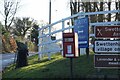
Only a small unploughed hump remains of this Bronze Age round barrow which can be found in the grounds of Swettenham Hall.
Note: Please note this barrow is located on private land but can be easily viewed from the road at the entrance to the Hall.
You may be viewing yesterday's version of this page. To see the most up to date information please register for a free account.
")
Do not use the above information on other web sites or publications without permission of the contributor.
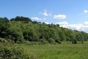
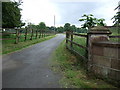
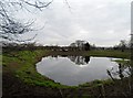
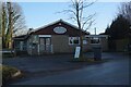
Nearby Images from Geograph Britain and Ireland:
©2007(licence)
©2015(licence)

©2011(licence)
©2022(licence)
©2022(licence)
The above images may not be of the site on this page, they are loaded from Geograph.
Please Submit an Image of this site or go out and take one for us!
Click here to see more info for this site
Nearby sites
Key: Red: member's photo, Blue: 3rd party photo, Yellow: other image, Green: no photo - please go there and take one, Grey: site destroyed
Download sites to:
KML (Google Earth)
GPX (GPS waypoints)
CSV (Garmin/Navman)
CSV (Excel)
To unlock full downloads you need to sign up as a Contributory Member. Otherwise downloads are limited to 50 sites.
Turn off the page maps and other distractions
Nearby sites listing. In the following links * = Image available
1.3km WNW 291° St Peter (Swettenham) Ancient Cross (SJ80086718)
2.2km S 185° Somerford Round Barrow Round Barrow(s) (SJ811645)
3.7km SSE 153° Loachbrook Farm* Long Barrow (SJ830634)
4.3km NNW 329° Jodrell Bank* Barrow Cemetery (SJ791704)
4.6km NNW 328° Axstone cross* Ancient Cross (SJ789706)
5.7km N 353° Old Withington* Barrow Cemetery (SJ80677240)
6.0km SE 129° Congleton Museum* Museum (SJ859629)
6.0km SSE 148° Astbury Churchyard* Round Barrow(s) (SJ845616)
6.2km SSE 147° St Marys (Astbury)* Ancient Cross (SJ847615)
6.7km NNE 28° Capesthorne Hall (SE)* Round Barrow(s) (SJ845726)
6.8km NNE 21° Capesthorne Hall (NW) Round Barrow(s) (SJ838730)
6.9km NNE 26° Capesthorne Hall (NE)* Round Barrow(s) (SJ843729)
7.1km N 358° Astle Park Round Barrow(s) (SJ811738)
7.5km NE 52° Lower Pexhill Round Barrow(s) (SJ872713)
7.8km NNE 22° Sodger's Hump* Round Barrow(s) (SJ842739)
8.0km SW 222° Sandbach Crosses* Ancient Cross (SJ7587760825)
8.0km SSE 166° Little Moreton Hall* Round Barrow(s) (SJ832589)
8.1km NE 49° Bearhurst Farm* Round Barrow(s) (SJ874720)
8.9km NNE 29° Birtles Hall Round Barrow(s) (SJ856745)
9.6km NE 50° New Farm, Henbury* Stone Circle (SJ887728)
9.7km ESE 108° Bosley Cloud (1)* Standing Stone (Menhir) (SJ905636)
9.8km ESE 109° Bosley Cloud (2)* Standing Stone (Menhir) (SJ906634)
10.3km ESE 116° The Bridestones (Cheshire)* Chambered Tomb (SJ9058962190)
10.4km SE 127° Shepherd's Cross* Standing Stone (Menhir) (SJ89626042)
10.6km ENE 74° Woodhouse End* Round Barrow(s) (SJ915696)
View more nearby sites and additional images


 We would like to know more about this location. Please feel free to add a brief description and any relevant information in your own language.
 Wir möchten mehr über diese Stätte erfahren. Bitte zögern Sie nicht, eine kurze Beschreibung und relevante Informationen in Deutsch hinzuzufügen.
 Nous aimerions en savoir encore un peu sur les lieux. S'il vous plaît n'hesitez pas à ajouter une courte description et tous les renseignements pertinents dans votre propre langue.
 Quisieramos informarnos un poco más de las lugares. No dude en añadir una breve descripción y otros datos relevantes en su propio idioma.