


<< Our Photo Pages >> St Mary's Well (Straloch) - Holy Well or Sacred Spring in Scotland in Aberdeenshire
Submitted by KiwiBetsy on Sunday, 08 October 2006 Page Views: 5490
Springs and Holy WellsSite Name: St Mary's Well (Straloch)Country: Scotland
NOTE: This site is 2.306 km away from the location you searched for.
County: Aberdeenshire Type: Holy Well or Sacred Spring
Nearest Town: Old Meldrum
Map Ref: NJ858213
Latitude: 57.282106N Longitude: 2.237174W
Condition:
| 5 | Perfect |
| 4 | Almost Perfect |
| 3 | Reasonable but with some damage |
| 2 | Ruined but still recognisable as an ancient site |
| 1 | Pretty much destroyed, possibly visible as crop marks |
| 0 | No data. |
| -1 | Completely destroyed |
| 5 | Superb |
| 4 | Good |
| 3 | Ordinary |
| 2 | Not Good |
| 1 | Awful |
| 0 | No data. |
| 5 | Can be driven to, probably with disabled access |
| 4 | Short walk on a footpath |
| 3 | Requiring a bit more of a walk |
| 2 | A long walk |
| 1 | In the middle of nowhere, a nightmare to find |
| 0 | No data. |
| 5 | co-ordinates taken by GPS or official recorded co-ordinates |
| 4 | co-ordinates scaled from a detailed map |
| 3 | co-ordinates scaled from a bad map |
| 2 | co-ordinates of the nearest village |
| 1 | co-ordinates of the nearest town |
| 0 | no data |
Internal Links:
External Links:
 (PID:24773)")
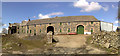
St Mary’s Well is located on private land in the middle of a lawn in a garden. St Mary’s Chapel stood nearby but has long since disappeared.
You may be viewing yesterday's version of this page. To see the most up to date information please register for a free account.
Do not use the above information on other web sites or publications without permission of the contributor.
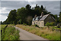
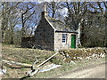
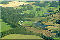
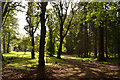
Nearby Images from Geograph Britain and Ireland:
©2019(licence)
©2008(licence)
©2018(licence)
©2019(licence)
©2008(licence)
The above images may not be of the site on this page, they are loaded from Geograph.
Please Submit an Image of this site or go out and take one for us!
Click here to see more info for this site
Nearby sites
Key: Red: member's photo, Blue: 3rd party photo, Yellow: other image, Green: no photo - please go there and take one, Grey: site destroyed
Download sites to:
KML (Google Earth)
GPX (GPS waypoints)
CSV (Garmin/Navman)
CSV (Excel)
To unlock full downloads you need to sign up as a Contributory Member. Otherwise downloads are limited to 50 sites.
Turn off the page maps and other distractions
Nearby sites listing. In the following links * = Image available
3.3km SSE 156° Monykebbuck* Standing Stone (Menhir) (NJ8715418291)
4.3km WSW 239° Peathill* Standing Stone (Menhir) (NJ8210419068)
5.0km NW 316° Sheldon (Aberdeenshire)* Stone Circle (NJ82292494)
5.4km SSW 204° Fintray Cursus Cursus (NJ83571633)
5.5km SSW 204° Mill of Fintray Cursus Multiple Stone Rows / Avenue (NJ835163)
5.5km SSW 199° Donald's Hillock* Cairn (NJ84001609)
5.8km SW 232° Greenlands* Ancient Village or Settlement (NJ81231778)
5.9km SSE 165° St Medden's Kirkyard* Class I Pictish Symbol Stone (NJ873156)
6.1km SSE 164° Dyce Pictish Stones* Class I / Class II Hybrid Pictish Symbol Stone (NJ875154)
6.4km WNW 303° Bourtie Pictish Stone* Class I Pictish Symbol Stone (NJ80462485)
6.6km SSW 201° Gouk Stone* Standing Stone (Menhir) (NJ8344815171)
6.7km WNW 302° Kirkton Of Bourtie* Stone Circle (NJ80092488)
7.0km W 270° Keith Hall* Class I Pictish Symbol Stone (NJ78802136)
7.0km NW 309° Hill of Barra* Hillfort (NJ803257)
7.1km SSW 194° The Slacks* Cairn (NJ841144)
7.8km W 265° Inverurie 1* Class I Pictish Symbol Stone (NJ78022063)
7.8km SSW 208° Kinellar Churchyard* Stone Circle (NJ82161440)
7.8km SSW 208° Kinellar Pictish Symbol Stone* Class I Pictish Symbol Stone (NJ821144)
8.0km W 259° Broomend of Crichie North circle Stone Circle (NJ779198)
8.0km WSW 258° Broomend of Crichie Pictish Symbol Stone* Class I Pictish Symbol Stone (NJ77921967)
8.0km WSW 258° Broomend Of Crichie Stone Circle / Henge* Henge (NJ77911968)
8.0km WSW 258° Broomend of Crichie Avenue* Multiple Stone Rows / Avenue (NJ7791419653)
8.0km WSW 258° Broomend of Crichie Stone Row / Alignment (NJ7792119591)
8.1km WSW 257° Broomend of Crichie Row Mid Stone Row / Alignment (NJ7792919479)
8.1km S 179° Tyrebagger* Stone Circle (NJ85951322)
View more nearby sites and additional images


 We would like to know more about this location. Please feel free to add a brief description and any relevant information in your own language.
 Wir möchten mehr über diese Stätte erfahren. Bitte zögern Sie nicht, eine kurze Beschreibung und relevante Informationen in Deutsch hinzuzufügen.
 Nous aimerions en savoir encore un peu sur les lieux. S'il vous plaît n'hesitez pas à ajouter une courte description et tous les renseignements pertinents dans votre propre langue.
 Quisieramos informarnos un poco más de las lugares. No dude en añadir una breve descripción y otros datos relevantes en su propio idioma.