 with our Megalithic Portal iPhone app")


<< Our Photo Pages >> Colerne Cross Dyke - Misc. Earthwork in England in Wiltshire
Submitted by 4clydesdale7 on Thursday, 10 November 2011 Page Views: 4628
Multi-periodSite Name: Colerne Cross DykeCountry: England
NOTE: This site is 1.254 km away from the location you searched for.
County: Wiltshire Type: Misc. Earthwork
Nearest Town: Chippenham Nearest Village: Slaughterford
Map Ref: ST83267436
Latitude: 51.467957N Longitude: 2.242381W
Condition:
| 5 | Perfect |
| 4 | Almost Perfect |
| 3 | Reasonable but with some damage |
| 2 | Ruined but still recognisable as an ancient site |
| 1 | Pretty much destroyed, possibly visible as crop marks |
| 0 | No data. |
| -1 | Completely destroyed |
| 5 | Superb |
| 4 | Good |
| 3 | Ordinary |
| 2 | Not Good |
| 1 | Awful |
| 0 | No data. |
| 5 | Can be driven to, probably with disabled access |
| 4 | Short walk on a footpath |
| 3 | Requiring a bit more of a walk |
| 2 | A long walk |
| 1 | In the middle of nowhere, a nightmare to find |
| 0 | No data. |
| 5 | co-ordinates taken by GPS or official recorded co-ordinates |
| 4 | co-ordinates scaled from a detailed map |
| 3 | co-ordinates scaled from a bad map |
| 2 | co-ordinates of the nearest village |
| 1 | co-ordinates of the nearest town |
| 0 | no data |
Internal Links:
External Links:
I have visited· I would like to visit
4clydesdale7 visited on 10th Nov 2011 - their rating: Cond: 3 Amb: 4 Access: 3 This is a little jewel - and there is much more to be found in the area
")
The Cross Dyke cannot be seen directly from the Colerne to Ford back road because in the South it lies just below the brow of the field and in the North it merges with a field boundary. But take a walk and you will enjoy the experience -
The Cross Dyke is about 300m long and is a single bank and ditch which runs from one deep scarp to the NW and to an even deeper scarp in the SE - a classic defensive earthwork, first mentioned in Aubrey's Topological Collections for Wiltshire 1659-70
Mentioned in pastscape 208463 parish Colerne - well worth a visit
You may be viewing yesterday's version of this page. To see the most up to date information please register for a free account.
")
")
Do not use the above information on other web sites or publications without permission of the contributor.
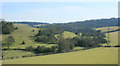
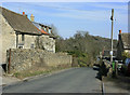
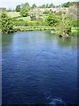
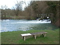
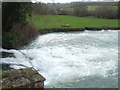
Nearby Images from Geograph Britain and Ireland:
©2010(licence)
©2010(licence)
©2007(licence)
©2020(licence)
©2020(licence)
The above images may not be of the site on this page, they are loaded from Geograph.
Please Submit an Image of this site or go out and take one for us!
Click here to see more info for this site
Nearby sites
Key: Red: member's photo, Blue: 3rd party photo, Yellow: other image, Green: no photo - please go there and take one, Grey: site destroyed
Download sites to:
KML (Google Earth)
GPX (GPS waypoints)
CSV (Garmin/Navman)
CSV (Excel)
To unlock full downloads you need to sign up as a Contributory Member. Otherwise downloads are limited to 50 sites.
Turn off the page maps and other distractions
Nearby sites listing. In the following links * = Image available
1.1km SSE 166° The Danes Tump* Round Barrow(s) (ST83547325)
1.5km WSW 256° Bury Camp (Wiltshire)* Hillfort (ST818740)
3.5km SSW 201° Colerne Cross.* Ancient Cross (ST820711)
4.2km N 357° Lugbury* Chambered Tomb (ST83097856)
4.5km E 85° Lanhill* Long Barrow (ST87737471)
4.9km N 11° Castle Coombe Cursus (ST842792)
5.0km N 6° Castle Coombe Cursus (ST838793)
5.0km ESE 109° Holy Well (Biddestone)* Holy Well or Sacred Spring (ST8802772733)
5.7km SW 220° Three Shires Stones* Modern Stone Circle etc (ST7961070021)
5.7km S 189° Box Rock Circus* Modern Stone Circle etc (ST823687)
6.0km S 187° Becket's Well (Box) Holy Well or Sacred Spring (ST825684)
6.1km S 178° Hazelbury Manor Menhirs* Modern Stone Circle etc (ST83476830)
6.3km NW 304° Fox Covert NW* Chambered Tomb (ST78087791)
6.5km NW 305° Tormarton 1* Long Barrow (ST77957805)
6.8km WNW 292° West Littleton Down* Round Barrow(s) (ST769769)
8.3km WNW 287° Dyrham and Hinton Chambered Tomb (ST75307689)
8.6km N 352° Luckington II* Chambered Tomb (ST82108284)
8.7km N 351° Giant's Caves* Chambered Cairn (ST81998297)
9.0km SW 225° Solsbury Hill* Hillfort (ST76876797)
9.1km SSW 198° Monk's Conduit (Monkton Farleigh)* Holy Well or Sacred Spring (ST8036265692)
9.4km WNW 284° Dyrham Camp* Hillfort (ST741767)
10.1km NNW 326° The Grickstone* Standing Stone (Menhir) (ST77698281)
10.2km NNW 331° Grickstone Farm* Chambered Tomb (ST78278327)
10.3km W 260° Labourer's Stone* Marker Stone (ST73057251)
10.4km N 4° Hancock's Well Holy Well or Sacred Spring (ST8403684687)
View more nearby sites and additional images


 We would like to know more about this location. Please feel free to add a brief description and any relevant information in your own language.
 Wir möchten mehr über diese Stätte erfahren. Bitte zögern Sie nicht, eine kurze Beschreibung und relevante Informationen in Deutsch hinzuzufügen.
 Nous aimerions en savoir encore un peu sur les lieux. S'il vous plaît n'hesitez pas à ajouter une courte description et tous les renseignements pertinents dans votre propre langue.
 Quisieramos informarnos un poco más de las lugares. No dude en añadir una breve descripción y otros datos relevantes en su propio idioma.