


<< Our Photo Pages >> Westloch House East - Ancient Village or Settlement in Scotland in Scottish Borders
Submitted by SolarMegalith on Thursday, 13 July 2017 Page Views: 907
Multi-periodSite Name: Westloch House EastCountry: Scotland
NOTE: This site is 3.509 km away from the location you searched for.
County: Scottish Borders Type: Ancient Village or Settlement
Nearest Town: Eyemouth Nearest Village: Coldingham
Map Ref: NT89556792
Latitude: 55.904277N Longitude: 2.168711W
Condition:
| 5 | Perfect |
| 4 | Almost Perfect |
| 3 | Reasonable but with some damage |
| 2 | Ruined but still recognisable as an ancient site |
| 1 | Pretty much destroyed, possibly visible as crop marks |
| 0 | No data. |
| -1 | Completely destroyed |
| 5 | Superb |
| 4 | Good |
| 3 | Ordinary |
| 2 | Not Good |
| 1 | Awful |
| 0 | No data. |
| 5 | Can be driven to, probably with disabled access |
| 4 | Short walk on a footpath |
| 3 | Requiring a bit more of a walk |
| 2 | A long walk |
| 1 | In the middle of nowhere, a nightmare to find |
| 0 | No data. |
| 5 | co-ordinates taken by GPS or official recorded co-ordinates |
| 4 | co-ordinates scaled from a detailed map |
| 3 | co-ordinates scaled from a bad map |
| 2 | co-ordinates of the nearest village |
| 1 | co-ordinates of the nearest town |
| 0 | no data |
Internal Links:
External Links:
I have visited· I would like to visit
SolarMegalith visited on 12th Jul 2017 - their rating: Cond: 2 Amb: 3 Access: 4
")
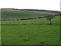
This rectilinear settlement, possibly Iron Age in date, was heavily dagamed by quarrying, nevertheless its outline with several hut circles inside is still distinguishable. It is enclosed with a single bank which is spread up to 3.3m of thickness.
Canmore entry.
You may be viewing yesterday's version of this page. To see the most up to date information please register for a free account.
")
")
")
")
Do not use the above information on other web sites or publications without permission of the contributor.
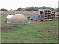
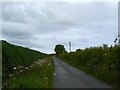
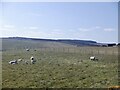
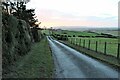
Nearby Images from Geograph Britain and Ireland:
©2022(licence)
©2009(licence)
©2021(licence)
©2021(licence)
©2011(licence)
The above images may not be of the site on this page, they are loaded from Geograph.
Please Submit an Image of this site or go out and take one for us!
Click here to see more info for this site
Nearby sites
Key: Red: member's photo, Blue: 3rd party photo, Yellow: other image, Green: no photo - please go there and take one, Grey: site destroyed
Download sites to:
KML (Google Earth)
GPX (GPS waypoints)
CSV (Garmin/Navman)
CSV (Excel)
To unlock full downloads you need to sign up as a Contributory Member. Otherwise downloads are limited to 50 sites.
Turn off the page maps and other distractions
Nearby sites listing. In the following links * = Image available
648m NW 319° Westloch House West* Ancient Village or Settlement (NT8912168407)
828m NNE 23° Coldingham Loch Fort* Hillfort (NT89886868)
850m NNW 330° Westerside* Ancient Village or Settlement (NT89136866)
907m NNE 27° Coldingham Loch Long Barrow* Long Barrow (NT89966873)
1.3km NNW 344° Earn's Heugh* Promontory Fort / Cliff Castle (NT8921069130)
1.5km ENE 61° Mire Loch North* Ancient Village or Settlement (NT90846863)
1.5km ENE 78° Mire Loch South* Ancient Village or Settlement (NT91066824)
1.6km NE 46° Pettico Wick* Promontory Fort / Cliff Castle (NT90676900)
2.0km SE 132° The Creel Path* Ancient Trackway (NT910666)
4.5km WNW 293° Dowlaw (Lowrie Knowes)* Misc. Earthwork (NT85376970)
5.8km SE 126° Wellbraes* Holy Well or Sacred Spring (NT9424664542)
6.1km WNW 284° Dowlaw (Harlie Darlies)* Misc. Earthwork (NT83636941)
7.9km W 263° Winding Cairn Cairn (NT81666691)
8.2km W 261° Harelawside Rock Art (NT814667)
9.0km WSW 251° Grantshouse Rock Art* Rock Art (NT8165)
9.5km WNW 287° St. Helen's on the Lea (Old Cambus)* Sculptured Stone (NT8037870676)
9.6km SE 144° Chester Hill (Greystonelees)* Promontory Fort / Cliff Castle (NT95266018)
10.3km SSE 152° Habchester Hillfort (NT94425881)
10.8km SSW 207° The Pech Stane* Standing Stone (Menhir) (NT84685831)
11.5km SW 230° Drakemire hillforts* Hillfort (NT80726051)
12.5km WNW 285° Cockburnspath Cross* Ancient Cross (NT7743071100)
13.1km SW 229° Preston Cleugh Fort* Hillfort (NT79555941)
13.1km SW 235° Elba copper mines* Ancient Mine, Quarry or other Industry (NT787605)
13.9km SSW 209° Edrom Sculptured Stone (NT828558)
14.4km WSW 238° Edin's Hall* Broch or Nuraghe (NT7724060310)
View more nearby sites and additional images


 We would like to know more about this location. Please feel free to add a brief description and any relevant information in your own language.
 Wir möchten mehr über diese Stätte erfahren. Bitte zögern Sie nicht, eine kurze Beschreibung und relevante Informationen in Deutsch hinzuzufügen.
 Nous aimerions en savoir encore un peu sur les lieux. S'il vous plaît n'hesitez pas à ajouter une courte description et tous les renseignements pertinents dans votre propre langue.
 Quisieramos informarnos un poco más de las lugares. No dude en añadir una breve descripción y otros datos relevantes en su propio idioma.