


<< Our Photo Pages >> Badgeworth Round Barrow - Round Barrow(s) in England in Gloucestershire
Submitted by 4clydesdale7 on Thursday, 01 March 2012 Page Views: 5586
Neolithic and Bronze AgeSite Name: Badgeworth Round Barrow Alternative Name: Hunt Court Barrow, Brockworth Round BarrowCountry: England
NOTE: This site is 0.733 km away from the location you searched for.
County: Gloucestershire Type: Round Barrow(s)
Nearest Town: Cheltenham Nearest Village: Badgeworth
Map Ref: SO90071750
Latitude: 51.855999N Longitude: 2.145584W
Condition:
| 5 | Perfect |
| 4 | Almost Perfect |
| 3 | Reasonable but with some damage |
| 2 | Ruined but still recognisable as an ancient site |
| 1 | Pretty much destroyed, possibly visible as crop marks |
| 0 | No data. |
| -1 | Completely destroyed |
| 5 | Superb |
| 4 | Good |
| 3 | Ordinary |
| 2 | Not Good |
| 1 | Awful |
| 0 | No data. |
| 5 | Can be driven to, probably with disabled access |
| 4 | Short walk on a footpath |
| 3 | Requiring a bit more of a walk |
| 2 | A long walk |
| 1 | In the middle of nowhere, a nightmare to find |
| 0 | No data. |
| 5 | co-ordinates taken by GPS or official recorded co-ordinates |
| 4 | co-ordinates scaled from a detailed map |
| 3 | co-ordinates scaled from a bad map |
| 2 | co-ordinates of the nearest village |
| 1 | co-ordinates of the nearest town |
| 0 | no data |
Internal Links:
External Links:
")
Probably unexcavated it was not discovered by Victorian and even later archaeologists until 1967 when, relying at first on local folklore, it was found by the renowned Mrs E M Clifford. It was later confirmed by T C Darvill and L V Grinsell in their Gloucestershire Barrows supplement for the Bristol & Gloucestershire Archaeological Society 1989 Vol 107 p70. It first appeared on OS maps in 1990.
Its diameter is about 20m and it stands about 0.75m high.
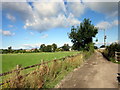
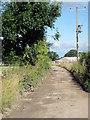
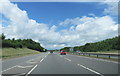
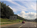
When planting the community wood the Forestry (Commission) Authority were careful not to disturb the barrow; the barrow sleeps peacefully tended by deer hares and rabbits whilst the world rushes by on the A417 dual carriageway (in a cutting) about 400m to the south. A nice spot on the boundary of the Badgeworth and Brockworth parishes. There is a superb Tithe Barn in Brockworth and a Roman Villa in Great Witcombe close-by.
Mentioned on pastscape Gloucestershire; Tewkesbury; Badgeworth; 117469
You may be viewing yesterday's version of this page. To see the most up to date information please register for a free account.
")
")
")
Do not use the above information on other web sites or publications without permission of the contributor.
Nearby Images from Geograph Britain and Ireland:
©2014(licence)
©2014(licence)
©2020(licence)
©2017(licence)
©2014(licence)
The above images may not be of the site on this page, they are loaded from Geograph.
Please Submit an Image of this site or go out and take one for us!
Click here to see more info for this site
Nearby sites
Key: Red: member's photo, Blue: 3rd party photo, Yellow: other image, Green: no photo - please go there and take one, Grey: site destroyed
Download sites to:
KML (Google Earth)
GPX (GPS waypoints)
CSV (Garmin/Navman)
CSV (Excel)
To unlock full downloads you need to sign up as a Contributory Member. Otherwise downloads are limited to 50 sites.
Turn off the page maps and other distractions
Nearby sites listing. In the following links * = Image available
2.4km NW 305° Churchdown Hill Camp* Hillfort (SO881189)
3.1km ESE 117° Crickley Hill* Hillfort (SO928161)
3.3km E 92° Crippet's Barrow* Chambered Tomb (SO93421739)
3.4km SE 137° Birdlip Camp* Hillfort (SO924150)
3.5km E 96° Dry Heathfield Barrow Round Barrow(s) (SO93521711)
3.6km S 186° Tile Well* Holy Well or Sacred Spring (SO89721395)
3.6km SE 140° Birdlip standing stones* Modern Stone Circle etc (SO9235214746)
3.7km ESE 116° Barrow Wake Barrow Round Barrow(s) (SO93381585)
3.7km ESE 115° Emma's Grove Round Barrows Round Barrow(s) (SO93481594)
3.8km SE 129° Birdlip Barrow* Round Barrow(s) (SO9301015150)
3.8km SSW 194° High Brotheridge* Misc. Earthwork (SO89121381)
4.4km SSE 166° West Tump* Long Barrow (SO9112213241)
4.5km SE 136° Birdlip Roundhouse Ancient Village or Settlement (SO932143)
4.6km SSW 200° Cranham Corner Earthworks* Misc. Earthwork (SO88501313)
4.8km E 79° Leckhampton Hill* Hillfort (SO948184)
4.9km E 80° Leckhampton Hill Barrow* Round Barrow(s) (SO94911838)
5.1km SSE 166° Bucks Head Round Barrow* Round Barrow(s) (SO91321260)
5.7km WSW 247° Red Well (Matson)* Holy Well or Sacred Spring (SO8479615289)
5.7km ESE 109° Coberley* Chambered Tomb (SO95521564)
5.8km SSE 164° Climperwell Round Barrows* Round Barrow(s) (SO91641196)
5.9km SSE 162° Climperwell* Holy Well or Sacred Spring (SO91891192)
6.3km SSW 210° Painswick Beacon* Hillfort (SO869121)
6.3km WSW 253° Well House (Gloucester)* Holy Well or Sacred Spring (SO84001561)
6.5km WSW 247° Robins Wood Hill Standing Stones (SO841150)
6.6km E 95° Seven Springs (Gloucestershire)* Holy Well or Sacred Spring (SO96631694)
View more nearby sites and additional images


 We would like to know more about this location. Please feel free to add a brief description and any relevant information in your own language.
 Wir möchten mehr über diese Stätte erfahren. Bitte zögern Sie nicht, eine kurze Beschreibung und relevante Informationen in Deutsch hinzuzufügen.
 Nous aimerions en savoir encore un peu sur les lieux. S'il vous plaît n'hesitez pas à ajouter une courte description et tous les renseignements pertinents dans votre propre langue.
 Quisieramos informarnos un poco más de las lugares. No dude en añadir una breve descripción y otros datos relevantes en su propio idioma.