


<< Text Pages >> Kings Low - Long Barrow in England in Staffordshire
Submitted by bat400 on Saturday, 15 February 2014 Page Views: 5334
Neolithic and Bronze AgeSite Name: Kings LowCountry: England
NOTE: This site is 3.74 km away from the location you searched for.
County: Staffordshire Type: Long Barrow
Nearest Town: Stafford Nearest Village: Tixall
Map Ref: SJ9567023990
Latitude: 52.813440N Longitude: 2.06567W
Condition:
| 5 | Perfect |
| 4 | Almost Perfect |
| 3 | Reasonable but with some damage |
| 2 | Ruined but still recognisable as an ancient site |
| 1 | Pretty much destroyed, possibly visible as crop marks |
| 0 | No data. |
| -1 | Completely destroyed |
| 5 | Superb |
| 4 | Good |
| 3 | Ordinary |
| 2 | Not Good |
| 1 | Awful |
| 0 | No data. |
| 5 | Can be driven to, probably with disabled access |
| 4 | Short walk on a footpath |
| 3 | Requiring a bit more of a walk |
| 2 | A long walk |
| 1 | In the middle of nowhere, a nightmare to find |
| 0 | No data. |
| 5 | co-ordinates taken by GPS or official recorded co-ordinates |
| 4 | co-ordinates scaled from a detailed map |
| 3 | co-ordinates scaled from a bad map |
| 2 | co-ordinates of the nearest village |
| 1 | co-ordinates of the nearest town |
| 0 | no data |
Be the first person to rate this site - see the 'Contribute!' box in the right hand menu.
Internal Links:
External Links:
I have visited· I would like to visit
BrownEdger would like to visit
On Tixall Heath, King's Low, is situated in Blackheath Covert just north-west of the road between Ingestre and Stafford. It is 120 feet in diameter and survives to a height of 9 feet.
It was excavated by the Stoke on Trent Museum Archaeological Society between 1986 and 1992 and the results published in West Midlands Archaeology in 1986 and 1987. All of the finds are held at Stoke on Trent City Museum and Art Gallery.
Excavation history is documented in
Excavations at King's Low and Queen's Low: Two Early Bronze Age Barrows in Tixall, North Staffordshire, Jan 2014, Dick Spicer, Hollins Winston, Gary R. Lock.
You may be viewing yesterday's version of this page. To see the most up to date information please register for a free account.
Do not use the above information on other web sites or publications without permission of the contributor.
Nearby Images from Geograph Britain and Ireland:
©2011(licence)
©2007(licence)

©2011(licence)
©2011(licence)
©2010(licence)
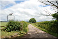
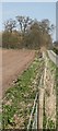
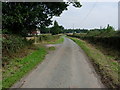
The above images may not be of the site on this page, they are loaded from Geograph.
Please Submit an Image of this site or go out and take one for us!
Click here to see more info for this site
Nearby sites
Key: Red: member's photo, Blue: 3rd party photo, Yellow: other image, Green: no photo - please go there and take one, Grey: site destroyed
Download sites to:
KML (Google Earth)
GPX (GPS waypoints)
CSV (Garmin/Navman)
CSV (Excel)
To unlock full downloads you need to sign up as a Contributory Member. Otherwise downloads are limited to 50 sites.
Turn off the page maps and other distractions
Nearby sites listing. In the following links * = Image available
675m E 97° Queens Low Long Barrow (SJ9634323909)
6.4km NNW 339° St Rufin's Well Holy Well or Sacred Spring (SJ93372995)
6.4km ESE 123° Oakedge Stone* Marker Stone (SK0106220493)
7.5km WSW 248° Berry Ring* Hillfort (SJ887212)
8.6km ESE 122° Bower Farm* Cave or Rock Shelter (SK030195)
9.8km NNW 346° Hollywood enclosure* Misc. Earthwork (SJ9338033501)
9.8km SW 230° Webb Stone* Standing Stone (Menhir) (SJ881177)
10.7km WNW 295° All Saints (Chebsey)* Ancient Cross (SJ85982856)
11.4km W 275° St Anne's Well (nr Lawnhead) Holy Well or Sacred Spring (SJ84262498)
12.2km ESE 119° Cawarden Spring Holy Well or Sacred Spring (SK064181)
13.9km WNW 292° Holy Trinity Church, Eccleshall* Ancient Cross (SJ82752917)
14.0km NNW 328° Bury Bank (Staffordshire)* Hillfort (SJ883359)
14.2km WSW 238° St Edith's Well (Church Eaton)* Holy Well or Sacred Spring (SJ83521653)
14.2km SE 142° Castle Ring (Staffordshire)* Hillfort (SK045128)
14.3km ESE 117° Hill Ridware* Cursus (SK08471759)
14.3km ESE 117° Mavesyn Ridware Cursus Cursus (SK08471759)
14.7km ESE 119° Mavesyn Ridware* Causewayed Enclosure (SK0853816800)
14.8km SE 145° Nun's Well (Cannock Wood)* Holy Well or Sacred Spring (SK04151180)
15.1km NNW 327° Saxon's Lowe* Round Barrow(s) (SJ8750136662)
15.6km NW 316° Swynnerton bowl barrow* Barrow Cemetery (SJ8474635109)
15.6km NNE 27° St Mary and All Saints (Checkley)* Ancient Cross (SK02783787)
16.3km ENE 58° Maiden's Well* Holy Well or Sacred Spring (SK09493264)
16.4km ENE 61° Toot Hill Barrow (2)* Round Barrow(s) (SK10143184)
17.0km NE 53° Pennycroft Well Holy Well or Sacred Spring (SK09293422)
17.1km WNW 293° St. Catherine's Well (Sugnall)* Holy Well or Sacred Spring (SJ798306)
View more nearby sites and additional images


 We would like to know more about this location. Please feel free to add a brief description and any relevant information in your own language.
 Wir möchten mehr über diese Stätte erfahren. Bitte zögern Sie nicht, eine kurze Beschreibung und relevante Informationen in Deutsch hinzuzufügen.
 Nous aimerions en savoir encore un peu sur les lieux. S'il vous plaît n'hesitez pas à ajouter une courte description et tous les renseignements pertinents dans votre propre langue.
 Quisieramos informarnos un poco más de las lugares. No dude en añadir una breve descripción y otros datos relevantes en su propio idioma.