


<< Our Photo Pages >> Chad Well (Twyning) - Holy Well or Sacred Spring in England in Gloucestershire
Submitted by 4clydesdale7 on Monday, 08 July 2013 Page Views: 5778
Springs and Holy WellsSite Name: Chad Well (Twyning) Alternative Name: St Chads WellCountry: England County: Gloucestershire Type: Holy Well or Sacred Spring
Nearest Town: Tewkesbury Nearest Village: Twyning
Map Ref: SO90363617
Latitude: 52.023861N Longitude: 2.141903W
Condition:
| 5 | Perfect |
| 4 | Almost Perfect |
| 3 | Reasonable but with some damage |
| 2 | Ruined but still recognisable as an ancient site |
| 1 | Pretty much destroyed, possibly visible as crop marks |
| 0 | No data. |
| -1 | Completely destroyed |
| 5 | Superb |
| 4 | Good |
| 3 | Ordinary |
| 2 | Not Good |
| 1 | Awful |
| 0 | No data. |
| 5 | Can be driven to, probably with disabled access |
| 4 | Short walk on a footpath |
| 3 | Requiring a bit more of a walk |
| 2 | A long walk |
| 1 | In the middle of nowhere, a nightmare to find |
| 0 | No data. |
| 5 | co-ordinates taken by GPS or official recorded co-ordinates |
| 4 | co-ordinates scaled from a detailed map |
| 3 | co-ordinates scaled from a bad map |
| 2 | co-ordinates of the nearest village |
| 1 | co-ordinates of the nearest town |
| 0 | no data |
Internal Links:
External Links:
I have visited· I would like to visit
SteveJJones has visited here
 (PID:110191)")
It is marked on old large scale Ordnance Survey maps (Explorer/Pathfinder and better) and lies 500m south along a public footpath which starts from the site of the old Twyning Fleet ferry across the Avon (to the west of Bredon Worcs) and leads the energetic walker southwards to the town of Tewkesbury - to be a little more precise the Well site is about 60m south of the second 'kissing' gate along the footpath -
Currently the Well is in rather a forlorn state which is a great shame particularly when only about 5 years ago work was carried out which has caused the present 'mess' - despite the fact that no fatal accident or even lesser incident near the Well had ever been reported, some 'bright spark' decided that the Well should be fenced - it now serves as a repository for plastic and other rubbish (five empty bottles which had at recent times contained a brown American fizzy drink - bottles now removed by your reporter) for the fencing has brought an appearance to the Well of a local Council rubbish bin!! And it is surrounded by a heavy growth of stinging nettles -
The Well in its original state - about 1m diameter and stone lined - can still just be seen - there are other websites which have old photographs which show that the Well lay flush with the surface of the field forming the river bank - the site is mentioned in:-
(1) Rudders History of Gloucestershire 1779 p780
(2) R C Hope - Holy Wells of England 1897
(3) John Leland's Itinerary
(4) R C Skyring Walters - Ancient Wells Springs and Holy Wells of Gloucestershire 1928 pp 44 to 51
(5) the Pastscape website; Gloucestershire: Tewkesbury: Twyning: Monument No. 117861
However what is somewhat fascinating is the derivation of its name upon which there are two theories - the Well is more frequently referred to as 'Chad Well' rather than 'St Chad's Well' and I for one believe that the fact that reference to the 'saint' is more frequently omitted is fundamental in chosing which theory to accept -
There are almost 50 wells in the UK named in a form close to 'Chad Well' - Chadwell, Chatwell, Shatwell and St Chad's Well - the more famous are those at Stowe Church (close to the Cathedral) Lichfield (within the Diocese to which St Chad was once assigned), Lastingham Yorkshire (St Chad was the Abbot of the local monastery), by the River Fleet near King's Cross London, Chad's Well at Chadshunt Warwickshire, another at Tilbury and at Chadskirk, Romiley, Stockport Cheshire, St Chad's Well at Midsomer Norton Somerset, Chad Well at Gnosall Staffordshire and at Wilne Derbyshire and Chadwell at Ware Hertfordshire - there are eight in Essex alone - few have been formally dedicated by the Church to St Chad
More interestingly however it has to be noticed that all such sites would have been called in Saxon times 'cealdwiella' which translates literally as 'cold well' - (and yes there are some thermal spas within the UK but) the vast majority of wells in the UK are 'cold' - phoenetically 'cealdwiella' would be pronounced 'chad well' - although Birmingham Cathedral and many Churches within the realm are dedicated to St Chad it has to be remembered that he was a member of the Celtic Church which became the minority group within the Early Church around AD 650 - three 'Chad Wells' are mentioned in the Domesday Book (Essex,Suffolk and Norfolk) but none enjoys the 'St' prefix -
History reports that at Twyning 'the local people used it as drinking water because of its coolness and clearness (sic)', 'the water is very pure cold and good for the eyes' and 'its water was beneficial to the eyes' - more recently in the 19th Century it was reported that vegetable matter close to the Well had a 'yellowish hue' consistent with sources of ochre nearby -
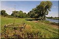
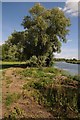
The Well is in a lovely area, picturesque and peaceful - the local Anglers Association seem happy to cut swathes through the nettle-ridden banks of the Avon for competition pegs - perhaps they could be persuaded to trim the Wellhead - nice pub at the Fleet where you can park
You may be viewing yesterday's version of this page. To see the most up to date information please register for a free account.
 (PID:264509)")
 (PID:264508)")
 (PID:110192)")
Do not use the above information on other web sites or publications without permission of the contributor.
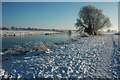
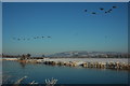
Nearby Images from Geograph Britain and Ireland:
©2015(licence)
©2010(licence)
©2015(licence)
©2010(licence)
©2010(licence)
The above images may not be of the site on this page, they are loaded from Geograph.
Please Submit an Image of this site or go out and take one for us!
Click here to see more info for this site
Nearby sites
Key: Red: member's photo, Blue: 3rd party photo, Yellow: other image, Green: no photo - please go there and take one, Grey: site destroyed
Download sites to:
KML (Google Earth)
GPX (GPS waypoints)
CSV (Garmin/Navman)
CSV (Excel)
To unlock full downloads you need to sign up as a Contributory Member. Otherwise downloads are limited to 50 sites.
Turn off the page maps and other distractions
Nearby sites listing. In the following links * = Image available
2.5km WNW 288° Towbury Camp* Hillfort (SO88003695)
3.8km SSW 197° Tewkesbury Abbey holy well* Holy Well or Sacred Spring (SO892325)
4.9km ENE 59° The King and Queen Stones* Standing Stones (SO9456738632)
6.4km ESE 111° The Tibblestone* Standing Stone (Menhir) (SO96333384)
6.5km NE 50° St. Catherine's Well (Eckington)* Holy Well or Sacred Spring (SO95364030)
6.6km NE 53° Kemerton Camp* Hillfort (SO957401)
7.2km ENE 72° Conderton Camp* Promontory Fort / Cliff Castle (SO972384)
8.4km SE 125° The Knolls* Ancient Village or Settlement (SO97253135)
8.5km ENE 62° Elmley Castle* Hillfort (SO979402)
10.5km ESE 113° Alderton Cursus Cursus (SP00023199)
10.5km SE 130° Odo and Dodo* Standing Stones (SO98402935)
11.2km SE 134° Nottingham Hill* Hillfort (SO984284)
11.5km SE 133° Nottingham Hill Carving (Gotherington)* Rock Art (SO98752835)
11.6km NE 38° Wick B Cursus Cursus (SO975453)
11.9km WSW 247° Gadbury Bank* Hillfort (SO793316)
12.0km SE 135° Cleeve Hill Barrows Round Barrow(s) (SO98872767)
12.2km NNE 31° Wick A Cursus Cursus (SO96704665)
12.5km SE 140° The Ring (Gloucestershire)* Ancient Village or Settlement (SO98472659)
12.8km ESE 110° The Warren Hillfort (SP024318)
12.9km SE 140° Cleeve Hill Cross Dyke* Misc. Earthwork (SO98562625)
13.1km NE 47° St Michael (Cropthorne)* Ancient Cross (SP00014512)
13.4km SE 143° Cleeve Hill (Gloucestershire)* Hillfort (SO98492546)
13.9km SSE 160° The Wish Stone* Marker Stone (SO950231)
14.1km NNW 337° Kempsey Cross* Ancient Cross (SO8482149096)
14.3km W 275° Midsummer Hill* Hillfort (SO761375)
View more nearby sites and additional images


 We would like to know more about this location. Please feel free to add a brief description and any relevant information in your own language.
 Wir möchten mehr über diese Stätte erfahren. Bitte zögern Sie nicht, eine kurze Beschreibung und relevante Informationen in Deutsch hinzuzufügen.
 Nous aimerions en savoir encore un peu sur les lieux. S'il vous plaît n'hesitez pas à ajouter une courte description et tous les renseignements pertinents dans votre propre langue.
 Quisieramos informarnos un poco más de las lugares. No dude en añadir una breve descripción y otros datos relevantes en su propio idioma.