


<< Text Pages >> Aizkorri Túmulo - Round Barrow(s) in Spain in Navarra
Submitted by Klingon on Monday, 22 September 2008 Page Views: 1296
Neolithic and Bronze AgeSite Name: Aizkorri TúmuloCountry: Spain
NOTE: This site is 1.846 km away from the location you searched for.
Region: Navarra Type: Round Barrow(s)
Nearest Town: Baztan Nearest Village: Zudaire
Latitude: 42.781152N Longitude: 2.092049W
Condition:
| 5 | Perfect |
| 4 | Almost Perfect |
| 3 | Reasonable but with some damage |
| 2 | Ruined but still recognisable as an ancient site |
| 1 | Pretty much destroyed, possibly visible as crop marks |
| 0 | No data. |
| -1 | Completely destroyed |
| 5 | Superb |
| 4 | Good |
| 3 | Ordinary |
| 2 | Not Good |
| 1 | Awful |
| 0 | No data. |
| 5 | Can be driven to, probably with disabled access |
| 4 | Short walk on a footpath |
| 3 | Requiring a bit more of a walk |
| 2 | A long walk |
| 1 | In the middle of nowhere, a nightmare to find |
| 0 | No data. |
| 5 | co-ordinates taken by GPS or official recorded co-ordinates |
| 4 | co-ordinates scaled from a detailed map |
| 3 | co-ordinates scaled from a bad map |
| 2 | co-ordinates of the nearest village |
| 1 | co-ordinates of the nearest town |
| 0 | no data |
Be the first person to rate this site - see the 'Contribute!' box in the right hand menu.
Internal Links:
External Links:
Round Barrow(s) in Community of Sierra De Urbas
Have you visited this site? Please add a comment below.
You may be viewing yesterday's version of this page. To see the most up to date information please register for a free account.
Do not use the above information on other web sites or publications without permission of the contributor.
Nearby Images from Flickr
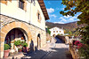
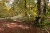
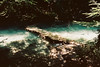
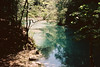
The above images may not be of the site on this page, but were taken nearby. They are loaded from Flickr so please click on them for image credits.
Click here to see more info for this site
Nearby sites
Click here to view sites on an interactive map of the areaKey: Red: member's photo, Blue: 3rd party photo, Yellow: other image, Green: no photo - please go there and take one, Grey: site destroyed
Download sites to:
KML (Google Earth)
GPX (GPS waypoints)
CSV (Garmin/Navman)
CSV (Excel)
To unlock full downloads you need to sign up as a Contributory Member. Otherwise downloads are limited to 50 sites.
Turn off the page maps and other distractions
Nearby sites listing. In the following links * = Image available
911m NW 312° Lizardoia Túmulo Round Barrow(s)
1.8km N 354° Raso de Armendi Túmulo Ring Cairn
2.2km NNW 346° Peña Alta Menhir Standing Stone (Menhir)
2.3km NNW 346° Raso de los Corrales de Eraul Fondo Cabaña Ancient Village or Settlement
2.7km NW 305° Aseki Dolmen Burial Chamber or Dolmen
2.7km SE 146° Iturza Túmulo Round Barrow(s)
2.8km SE 145° Iturza Menhir Standing Stone (Menhir)
2.9km NW 312° Los Céspedes Túmulo Round Barrow(s)
2.9km E 81° Ekaiza Menhir Standing Stone (Menhir)
3.0km NW 307° Puerto Viejo De Bakedano Dolmen 2 Burial Chamber or Dolmen
3.0km SSE 155° Iturza Tumulo De Anillo Ring Cairn
3.2km NW 313° Los Avellanos Túmulo Round Barrow(s)
3.3km SSE 152° Sangris Tumulo De Anillo Ring Cairn
3.4km NW 314° Puerto Viejo De Bakedano Dolmen 1 Burial Chamber or Dolmen
3.5km NNW 342° Zelaizaranako Gaña Tumulo De Anillo Ring Cairn
3.8km ENE 65° Ulantz Hego Túmulo Anillo Round Barrow(s)
3.8km SSE 152° Regalbar Túmulo 3 Round Barrow(s)
3.8km SSE 152° Regalbar Fondo Cabaña 2 Ancient Village or Settlement
3.8km SSE 152° Regalbar Fondo Cabaña 1 Ancient Village or Settlement
3.9km SSE 152° Regalbar Túmulo 1 Round Barrow(s)
3.9km SSE 152° Regalbar Túmulo 2 Round Barrow(s)
4.0km NW 313° Ubaba Tumulo De Anillo Ring Cairn
4.1km N 353° Bardoiza Túmulo 4 Ring Cairn
4.1km ENE 59° Aguabenditera Tumulo De Anillo Ring Cairn
4.1km ENE 61° Dulantzko Kaskoa Tumulo De Anillo Ring Cairn
View more nearby sites and additional images


 We would like to know more about this location. Please feel free to add a brief description and any relevant information in your own language.
 Wir möchten mehr über diese Stätte erfahren. Bitte zögern Sie nicht, eine kurze Beschreibung und relevante Informationen in Deutsch hinzuzufügen.
 Nous aimerions en savoir encore un peu sur les lieux. S'il vous plaît n'hesitez pas à ajouter une courte description et tous les renseignements pertinents dans votre propre langue.
 Quisieramos informarnos un poco más de las lugares. No dude en añadir una breve descripción y otros datos relevantes en su propio idioma.