

, Aubrey Burl")
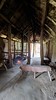
<< Other Photo Pages >> Les Varines - Ancient Village or Settlement in Channel Islands and Isle of Man in Jersey
Submitted by Andy B on Monday, 14 August 2023 Page Views: 568
Mesolithic, Palaeolithic and EarlierSite Name: Les VarinesCountry: Channel Islands and Isle of Man
NOTE: This site is 1.599 km away from the location you searched for.
Island: Jersey Type: Ancient Village or Settlement
Nearest Town: St Helier Nearest Village: St Saviours
Latitude: 49.187220N Longitude: 2.08407W
Condition:
| 5 | Perfect |
| 4 | Almost Perfect |
| 3 | Reasonable but with some damage |
| 2 | Ruined but still recognisable as an ancient site |
| 1 | Pretty much destroyed, possibly visible as crop marks |
| 0 | No data. |
| -1 | Completely destroyed |
| 5 | Superb |
| 4 | Good |
| 3 | Ordinary |
| 2 | Not Good |
| 1 | Awful |
| 0 | No data. |
| 5 | Can be driven to, probably with disabled access |
| 4 | Short walk on a footpath |
| 3 | Requiring a bit more of a walk |
| 2 | A long walk |
| 1 | In the middle of nowhere, a nightmare to find |
| 0 | No data. |
| 5 | co-ordinates taken by GPS or official recorded co-ordinates |
| 4 | co-ordinates scaled from a detailed map |
| 3 | co-ordinates scaled from a bad map |
| 2 | co-ordinates of the nearest village |
| 1 | co-ordinates of the nearest town |
| 0 | no data |
Internal Links:
External Links:
")
Magdalenian artefacts were initially discovered as a ploughzone scatter in 2000. Excavations uncovered a discreet series of head deposits, rich in lithic artefacts. Below this lay an apparent land surface revealing a complex spatial arrangement of hearths, granite paving, imported stones and artefactual material. All plaquettes have been deposited with Jersey Museum.
Read More: Artists on the edge of the world: An integrated approach to the study of Magdalenian engraved stone plaquettes from Jersey
https://journals.plos.org/plosone/article?id=10.1371/journal.pone.0236875
More explanation and articles in the comments below.
Note: Earliest art in the British Isles discovered on Jersey (first announced in 2020 but wanted to add)
You may be viewing yesterday's version of this page. To see the most up to date information please register for a free account.
")
")
")
Do not use the above information on other web sites or publications without permission of the contributor.
Nearby Images from Flickr


The above images may not be of the site on this page, but were taken nearby. They are loaded from Flickr so please click on them for image credits.
Click here to see more info for this site
Nearby sites
Click here to view sites on an interactive map of the areaKey: Red: member's photo, Blue: 3rd party photo, Yellow: other image, Green: no photo - please go there and take one, Grey: site destroyed
Download sites to:
KML (Google Earth)
GPX (GPS waypoints)
CSV (Garmin/Navman)
CSV (Excel)
To unlock full downloads you need to sign up as a Contributory Member. Otherwise downloads are limited to 50 sites.
Turn off the page maps and other distractions
Nearby sites listing. In the following links * = Image available
1.7km SSE 151° Le Mont Ubé* Passage Grave
2.1km NE 45° La Hougue Bie* Chambered Tomb
2.2km SSE 158° La Dame Blanche* Standing Stone (Menhir)
3.0km S 170° La Motte (Jersey)* Cist
3.5km WNW 287° Ville ès Nouaux* Burial Chamber or Dolmen
4.5km ENE 67° Faldouet Dolmen* Burial Chamber or Dolmen
6.3km WSW 255° La Hougue de Vinde* Chambered Tomb
6.3km NE 34° Le Couperon* Passage Grave
6.7km N 357° La Roche a la Fee* Cist
6.8km N 350° La Hougue des Platons* Chambered Tomb
7.4km NW 324° La Hougue Boëte* Chambered Tomb
7.7km W 260° La Cotte de St Brelade* Cave or Rock Shelter
9.5km W 277° La Tête des Quennevais Ancient Village or Settlement
9.6km W 265° The Beauport Dolmen Chambered Tomb
9.7km W 275° Great Menhir, The* Standing Stone (Menhir)
9.7km W 278° Broken Menhir, The* Standing Stone (Menhir)
9.7km W 277° The Ossuary* Chambered Tomb
9.8km W 277° Little Menhir, The* Standing Stone (Menhir)
10.0km WNW 285° The White Menhir Standing Stone (Menhir)
10.1km W 271° La Rocque ès Jovaies* Standing Stone (Menhir)
10.1km WNW 287° Les Trois Rocques* Standing Stones
10.7km W 269° La Sergenté* Passage Grave
11.2km W 267° La Table des Marthes* Natural Stone / Erratic / Other Natural Feature
11.2km WNW 296° Les Mont de Grantez* Passage Grave
11.8km NW 307° La Hougue des Géonnais* Passage Grave
View more nearby sites and additional images


 We would like to know more about this location. Please feel free to add a brief description and any relevant information in your own language.
 Wir möchten mehr über diese Stätte erfahren. Bitte zögern Sie nicht, eine kurze Beschreibung und relevante Informationen in Deutsch hinzuzufügen.
 Nous aimerions en savoir encore un peu sur les lieux. S'il vous plaît n'hesitez pas à ajouter une courte description et tous les renseignements pertinents dans votre propre langue.
 Quisieramos informarnos un poco más de las lugares. No dude en añadir una breve descripción y otros datos relevantes en su propio idioma.