


<< Our Photo Pages >> Hunstanworth Moor north - Standing Stone (Menhir) in England in County Durham
Submitted by HarperFox on Tuesday, 22 July 2014 Page Views: 2696
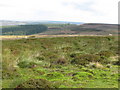
Neolithic and Bronze AgeSite Name: Hunstanworth Moor northCountry: England
NOTE: This site is 2.683 km away from the location you searched for.
County: County Durham Type: Standing Stone (Menhir)
Nearest Town: Stanhope Nearest Village: Townfield
Map Ref: NY9398546500
Latitude: 54.813321N Longitude: 2.095118W
Condition:
| 5 | Perfect |
| 4 | Almost Perfect |
| 3 | Reasonable but with some damage |
| 2 | Ruined but still recognisable as an ancient site |
| 1 | Pretty much destroyed, possibly visible as crop marks |
| 0 | No data. |
| -1 | Completely destroyed |
| 5 | Superb |
| 4 | Good |
| 3 | Ordinary |
| 2 | Not Good |
| 1 | Awful |
| 0 | No data. |
| 5 | Can be driven to, probably with disabled access |
| 4 | Short walk on a footpath |
| 3 | Requiring a bit more of a walk |
| 2 | A long walk |
| 1 | In the middle of nowhere, a nightmare to find |
| 0 | No data. |
| 5 | co-ordinates taken by GPS or official recorded co-ordinates |
| 4 | co-ordinates scaled from a detailed map |
| 3 | co-ordinates scaled from a bad map |
| 2 | co-ordinates of the nearest village |
| 1 | co-ordinates of the nearest town |
| 0 | no data |
Internal Links:
External Links:
I have visited· I would like to visit
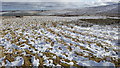
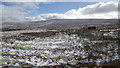
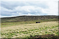
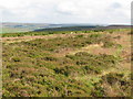
Anne T visited on 28th Aug 2017 - their rating: Cond: 3 Amb: 3 Access: 5 Hunstanworth Moor North, Townhead: Being the day of the Blanchland and Hunstanworth Show, this road was very busy, and it was difficult to stop as the road was narrow and there were no obvious lay-bys or pull-off points (there being a nice ditch at the western side of the road and a steep bank up to the field on the east).
Spotted this stone as we were passing by on the way to the stone approx. 575m south and retraced our steps to photograph it.
Again, after having done searches on the internet, not been able to find out anything about it, like it’s ‘partner’ further up the hill.
")
I'm very interested in two roadside stones on the road that leads from Townfield to Rookhope on the border between Northumberland and County Durham. I suspect they might just be marker or boundary stones but they're still intriguing and I wondered if anyone had any info. They're on the right hand side of the road as you travel northwest towards Townfield. They're about quarter of a mile apart, and I think intervisible. Bolt's Law hill rises behind them - they're edge-on to it. They're four-to-five feet tall and heavily covered with lichen. I can't see any surface marks or carvings. The first stone inclines sharply, the second is upright.
You may be viewing yesterday's version of this page. To see the most up to date information please register for a free account.
")
")
")
Do not use the above information on other web sites or publications without permission of the contributor.
Nearby Images from Geograph Britain and Ireland:
©2017(licence)
©2017(licence)
©2019(licence)
©2007(licence)
©2007(licence)
The above images may not be of the site on this page, they are loaded from Geograph.
Please Submit an Image of this site or go out and take one for us!
Click here to see more info for this site
Nearby sites
Key: Red: member's photo, Blue: 3rd party photo, Yellow: other image, Green: no photo - please go there and take one, Grey: site destroyed
Download sites to:
KML (Google Earth)
GPX (GPS waypoints)
CSV (Garmin/Navman)
CSV (Excel)
To unlock full downloads you need to sign up as a Contributory Member. Otherwise downloads are limited to 50 sites.
Turn off the page maps and other distractions
Nearby sites listing. In the following links * = Image available
568m SSW 201° Hunstanworth Moor south* Standing Stone (Menhir) (NY9377745971)
2.7km ENE 65° Old Man's Grave (Edmunbyers)* Marker Stone (NY96464763)
3.5km ESE 112° Dead Friar's Stone (Stanhope)* Marker Stone (NY9721545194)
4.7km NNE 34° St Mary the Virgin (Blanchland)* Ancient Cross (NY9659850408)
6.5km ESE 114° Feldon Plain (Muggleswick)* Marker Stone (NY9988843816)
6.6km ESE 105° Edmundbyers Cross (Muggleswick)* Ancient Cross (NZ0040244761)
7.1km SE 138° Heathery Burn Cave* Cave or Rock Shelter (NY98764118)
9.0km SE 137° Crawley Edge* Barrow Cemetery (NZ0007139875)
11.0km NNW 328° Burntridge Moor Rock Art (NY8811155864)
11.5km NNW 329° Crawberry Hill* Stone Circle (NY880563)
12.8km NE 43° St George's Well (Minsteracres)* Holy Well or Sacred Spring (NZ0274555884)
13.2km ESE 118° Tunstall Reservoir Rock Art (NZ0573040360)
14.2km NNW 330° Stobs Cross (Tynedale) Rock Art (NY8697458832)
14.2km NNW 340° Jingling Gate* Ancient Village or Settlement (NY89145984)
14.8km WNW 283° Limestone Brae (West Allen)* Ancient Cross (NY79534973)
14.8km NW 326° Bulman's Rigg (Allendale) Rock Art (NY8569958770)
14.8km S 188° Carr Crags 16 Rock Art (NY9187831833)
14.8km S 188° Carr Crags 18 Rock Art (NY9192231825)
14.9km NW 313° Tommy Stout's Well (Thornley Gate)* Holy Well or Sacred Spring (NY83065661)
14.9km S 188° Carr Crags 17 Rock Art (NY9183731785)
14.9km S 188° Carr Crags 7 Rock Art (NY9191431763)
14.9km S 188° Carr Crags 5 Rock Art (NY9191331759)
14.9km S 188° Carr Crags 6 Rock Art (NY9191231759)
14.9km S 188° Carr Crags 8 Rock Art (NY9190631754)
14.9km S 188° Carr Crags 4 Rock Art (NY9192231747)
View more nearby sites and additional images


 We would like to know more about this location. Please feel free to add a brief description and any relevant information in your own language.
 Wir möchten mehr über diese Stätte erfahren. Bitte zögern Sie nicht, eine kurze Beschreibung und relevante Informationen in Deutsch hinzuzufügen.
 Nous aimerions en savoir encore un peu sur les lieux. S'il vous plaît n'hesitez pas à ajouter une courte description et tous les renseignements pertinents dans votre propre langue.
 Quisieramos informarnos un poco más de las lugares. No dude en añadir una breve descripción y otros datos relevantes en su propio idioma.