

<< Text Pages >> Carr Crags 18 - Rock Art in England in County Durham
Submitted by Anne T on Friday, 27 April 2018 Page Views: 1369
Rock ArtSite Name: Carr Crags 18 Alternative Name: ERA-1380; SMR/HER D3858Country: England
NOTE: This site is 5.563 km away from the location you searched for.
County: County Durham Type: Rock Art
Nearest Town: Middleton-in-Teesdale Nearest Village: Newbeggin
Map Ref: NY9192231825
Latitude: 54.681415N Longitude: 2.126805W
Condition:
| 5 | Perfect |
| 4 | Almost Perfect |
| 3 | Reasonable but with some damage |
| 2 | Ruined but still recognisable as an ancient site |
| 1 | Pretty much destroyed, possibly visible as crop marks |
| 0 | No data. |
| -1 | Completely destroyed |
| 5 | Superb |
| 4 | Good |
| 3 | Ordinary |
| 2 | Not Good |
| 1 | Awful |
| 0 | No data. |
| 5 | Can be driven to, probably with disabled access |
| 4 | Short walk on a footpath |
| 3 | Requiring a bit more of a walk |
| 2 | A long walk |
| 1 | In the middle of nowhere, a nightmare to find |
| 0 | No data. |
| 5 | co-ordinates taken by GPS or official recorded co-ordinates |
| 4 | co-ordinates scaled from a detailed map |
| 3 | co-ordinates scaled from a bad map |
| 2 | co-ordinates of the nearest village |
| 1 | co-ordinates of the nearest town |
| 0 | no data |
Be the first person to rate this site - see the 'Contribute!' box in the right hand menu.
Internal Links:
External Links:
Rock Art in County Durham
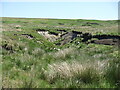
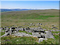
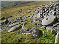
This rock art panel is recorded by NADRAP as having two very large bowls, but these are believed to be glacial remnants.
For basic information see England's Rock Art entry for ERA-1380 Carr Crags 18, which includes NADRAP's notes and two sketches of the rock and its motifs.
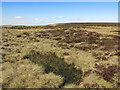
This rock art panel is located on Open Access land.
Note: Have you seen this rock art panel? Do you have any photographs, comments or information to add?
You may be viewing yesterday's version of this page. To see the most up to date information please register for a free account.
Do not use the above information on other web sites or publications without permission of the contributor.
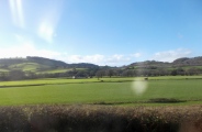
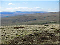
Nearby Images from Geograph Britain and Ireland:
©2023(licence)
©2023(licence)
©2023(licence)
©2010(licence)
©2023(licence)
The above images may not be of the site on this page, they are loaded from Geograph.
Please Submit an Image of this site or go out and take one for us!
Click here to see more info for this site
Nearby sites
Key: Red: member's photo, Blue: 3rd party photo, Yellow: other image, Green: no photo - please go there and take one, Grey: site destroyed
Download sites to:
KML (Google Earth)
GPX (GPS waypoints)
CSV (Garmin/Navman)
CSV (Excel)
To unlock full downloads you need to sign up as a Contributory Member. Otherwise downloads are limited to 50 sites.
Turn off the page maps and other distractions
Nearby sites listing. In the following links * = Image available
45m W 280° Carr Crags 16 Rock Art (NY9187831833)
62m S 187° Carr Crags 7 Rock Art (NY9191431763)
67m S 188° Carr Crags 5 Rock Art (NY9191331759)
67m S 188° Carr Crags 6 Rock Art (NY9191231759)
73m SSW 193° Carr Crags 8 Rock Art (NY9190631754)
78m S 180° Carr Crags 4 Rock Art (NY9192231747)
83m S 176° Carr Crags 3 Rock Art (NY9192731742)
89m S 180° Carr Crags 1, 12 & 13 Rock Art (NY9192131736)
90m S 175° Carr Crags 4a Rock Art (NY9192931735)
92m S 182° Carr Crags 2, 9 & 10 Rock Art (NY9191931733)
94m WSW 245° Carr Crags 17 Rock Art (NY9183731785)
98m SSW 194° Carr Crags 14 Rock Art (NY9189831730)
100m S 188° Carr Crags 15 Rock Art (NY9190831726)
118m S 187° Carr Crags 11 Rock Art (NY9190731708)
3.8km SSW 199° Bowlees, Keedholm Scar Rock Art (NY9066028210)
5.3km W 262° Moking Cave* Cave or Rock Shelter (NY867311)
8.3km SSE 166° Kirkcarrion Round Barrow(s) (NY939238)
9.1km SE 137° Eggleston Stone Circle (NY982252)
9.9km SE 140° Swinkley Knoll* Round Barrow(s) (NY98352425)
11.4km NE 45° Crawley Edge* Barrow Cemetery (NZ0007139875)
11.6km NE 36° Heathery Burn Cave* Cave or Rock Shelter (NY98764118)
11.6km SSE 157° Romaldkirk Moor 2 Rock Art (NY9640021100)
11.6km SSE 158° Romaldkirk Moor 1 Rock Art (NY9632621055)
11.7km SSE 159° Romaldkirk Moor 3 Rock Art (NY9614820923)
11.8km SE 132° Stobgreen Plantation 2* Rock Art (NZ0072824000)
View more nearby sites and additional images


 We would like to know more about this location. Please feel free to add a brief description and any relevant information in your own language.
 Wir möchten mehr über diese Stätte erfahren. Bitte zögern Sie nicht, eine kurze Beschreibung und relevante Informationen in Deutsch hinzuzufügen.
 Nous aimerions en savoir encore un peu sur les lieux. S'il vous plaît n'hesitez pas à ajouter une courte description et tous les renseignements pertinents dans votre propre langue.
 Quisieramos informarnos un poco más de las lugares. No dude en añadir una breve descripción y otros datos relevantes en su propio idioma.