<< Our Photo Pages >> Brecken Hills - Hillfort in England in Northumberland
Submitted by Anne T on Thursday, 25 March 2004 Page Views: 5806
Iron Age and Later PrehistorySite Name: Brecken Hills Alternative Name: Blue CragsCountry: England
NOTE: This site is 1.35 km away from the location you searched for.
County: Northumberland Type: Hillfort
Nearest Town: Corbridge Nearest Village: Colwell
Map Ref: NY946760 Landranger Map Number: 87
Latitude: 55.078422N Longitude: 2.086115W
Condition:
| 5 | Perfect |
| 4 | Almost Perfect |
| 3 | Reasonable but with some damage |
| 2 | Ruined but still recognisable as an ancient site |
| 1 | Pretty much destroyed, possibly visible as crop marks |
| 0 | No data. |
| -1 | Completely destroyed |
| 5 | Superb |
| 4 | Good |
| 3 | Ordinary |
| 2 | Not Good |
| 1 | Awful |
| 0 | No data. |
| 5 | Can be driven to, probably with disabled access |
| 4 | Short walk on a footpath |
| 3 | Requiring a bit more of a walk |
| 2 | A long walk |
| 1 | In the middle of nowhere, a nightmare to find |
| 0 | No data. |
| 5 | co-ordinates taken by GPS or official recorded co-ordinates |
| 4 | co-ordinates scaled from a detailed map |
| 3 | co-ordinates scaled from a bad map |
| 2 | co-ordinates of the nearest village |
| 1 | co-ordinates of the nearest town |
| 0 | no data |
Internal Links:
External Links:
I have visited· I would like to visit
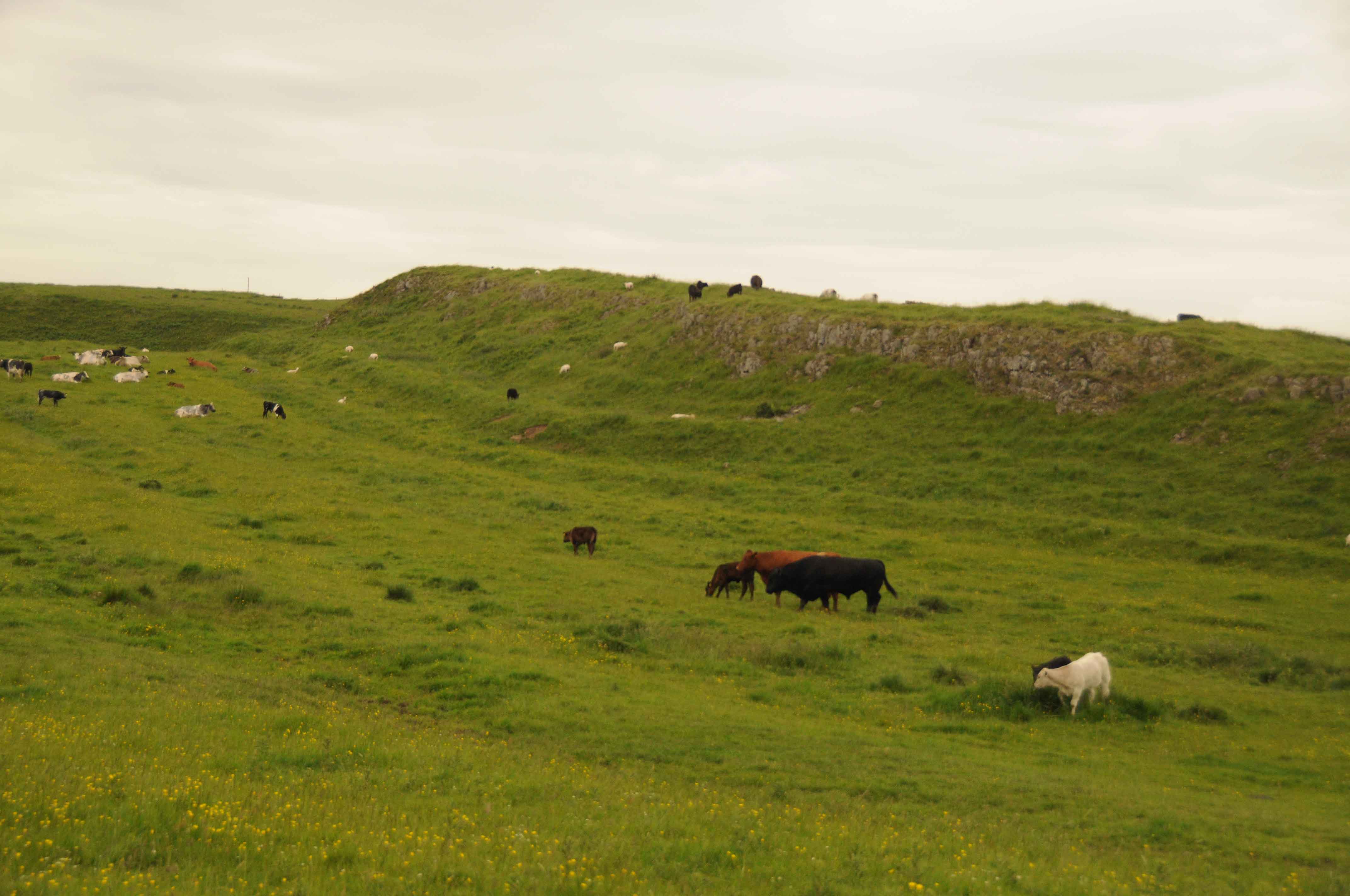
Anne T visited on 10th Apr 2016 - their rating: Cond: 3 Amb: 4 Access: 4 Revisit to Blue Crags (Brecken Hills) Hillfort: The last time we visited this site we had to stop at the gate to the field on the Colwell Village side of the site, admiring the outcrop/settlement from a distance. My memory sees at least 3 enormous bulls, feet planted wide, staring at us, daring us to come nearer. Needless to say, we didn't.
This time we approached the site from its northern side, using the public bridleway/access road to Swinburne Quarry from the A68. The HER records (site number N9202) tell me this site covers about an acre and forms a wedge with the whinstone forming natural defensive northern edge and ramparts at the side, the highest part of the site being 600 feet above ground level (although it didn't see that high).
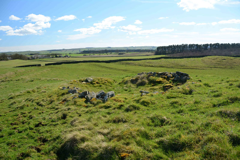
Walking up into the site is easiest from the far edge (near the gate to the footpath to Colwell village), where the site drops virtually to ground level. Walking up the slope to the entrance, a well-preserved hut circle sits to the left hand side of the path. Within the site there are more hut circles - we've never seen such well preserved ones in Northumberland and it was easy to imagine how our ancestors lived and used this space.
The north eastern side of the whin sill has been quarried away, but does not impact upon the site itself.
Well worth a visit.
On the opposite side of the track, to the north, lies the not so well preserved Dunn Crags settlement and enclosure.
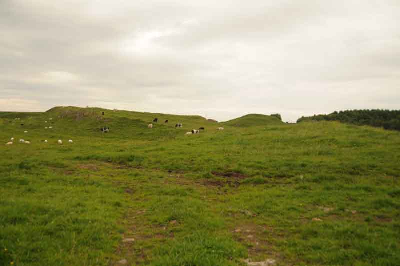
Anne T visited on 13th Jun 2014 - their rating: Cond: 2 Amb: 4 Access: 4 We know this site as 'Blue Crags Hillfort', rather than 'Brecken Hills', so both names are in use. The English Heritage Schedule describes Blue Crags Hillfort as a 'defended settlement of Iron Age/Romano-British date'. It makes excellent use of an existing outcrop of rock (whinstone, from the official records) as part of the defences, and there are very clear ramparts/defensive earthworks on the east, west and south sides of the site, with the main entrance appearing to be to the south west.
We originally went to look at the wells in Colwell (Pricky's well and Coley's Well), but spotted the extensive earthworks of the hillfort marked on the Ordnance Survey map just north west of Colwell, and went to take a look. Blue Crags is situated to the east of the course of Dere Street, with the A68 running between the hillfort and Dere Street.
There is a marked footpath running up to the fort from the west of Colwell, although the visible route vanishes when it reaches the field immediately south of the site, so we followed a vague track through the grass to a large barn which sits at the southern most edge of the hillfort.
The hillfort itself is impressively large and imposing as you walk up to it, as it sits on a hill above you. There is a further footpath that runs north west towards woodland, which would give a superb view of the fort and the outcrop on which it sits, but there were several large bulls, together with cows and their calves in this field, so we trod gingerly trying to get the best photographs from the area around the field entrance to illustrate the site.
On returning home, I logged onto the UK Grid Finder website. The aerial views show about 12 very clear hut circles on the platform of the fort. I will certainly go back in the autumn/early winter to have a closer look.
Average ratings for this site from all visit loggers: Condition: 2.5 Ambience: 4 Access: 4

We know this site as 'Blue Crags Hillfort', rather than 'Brecken Hills', so both names are in use. The English Heritage Schedule describes Blue Crags Hillfort as a 'defended settlement of Iron Age/Romano-British date'. It makes excellent use of an existing outcrop of rock (whinstone, from the official records) as part of the defences, and there are very clear ramparts/defensive earthworks on the east, west and south sides of the site, with the main entrance appearing to be to the south west.
We originally went to look at the wells in Colwell (Pricky's well and Coley's Well), but spotted the extensive earthworks of the hillfort marked on the Ordnance Survey map just north west of Colwell, and went to take a look. Blue Crags is situated to the east of the course of Dere Street, with the A68 running between the hillfort and Dere Street. There is a marked footpath running up to the fort from the west of Colwell, although the visible route vanishes when it reaches the field immediately south of the site, so we followed a vague track through the grass to a large barn which sits at the southern most edge of the hillfort.
The hillfort itself is impressively large and imposing as you walk up to it, as it sits on a hill above you. There is a further footpath that runs north west towards woodland, which would give a superb view of the fort and the outcrop on which it sits, but there were several large bulls, together with cow and their calves in this field, so we trod gingerly trying to get the best photographs from the area around the field entrance to illustrate the site. On returning home, I logged onto the UK Grid Finder website. The aerial views show about 12 very clear hut circles on the platform of the fort. I will certainly go back in the autumn/early winter to have a closer look.
You may be viewing yesterday's version of this page. To see the most up to date information please register for a free account.


Do not use the above information on other web sites or publications without permission of the contributor.
Click here to see more info for this site
Nearby sites
Key: Red: member's photo, Blue: 3rd party photo, Yellow: other image, Green: no photo - please go there and take one, Grey: site destroyed
Download sites to:
KML (Google Earth)
GPX (GPS waypoints)
CSV (Garmin/Navman)
CSV (Excel)
To unlock full downloads you need to sign up as a Contributory Member. Otherwise downloads are limited to 50 sites.
Turn off the page maps and other distractions
Nearby sites listing. In the following links * = Image available
988m SE 135° Pricky's Well* Holy Well or Sacred Spring (NY953753)
997m SE 125° Coley's Well* Holy Well or Sacred Spring (NY9541675424)
1.3km SE 143° Robin Hood's Well (Chollerton)* Holy Well or Sacred Spring (NY95397494)
1.5km SW 220° The Kings Seat* Round Cairn (NY9360074824)
1.7km SSW 210° Swinburne Stone* Standing Stone (Menhir) (NY9375574543)
1.8km SW 220° Swinburne Cairn* Round Cairn (NY93437460)
1.9km SW 226° Swinburne Barrow* Round Barrow(s) (NY93207466)
2.5km WSW 256° Barrasford Common Ancient Village or Settlement (NY92127540)
3.1km NNE 21° Thockrington Cross* Ancient Cross (NY95727894)
3.3km WSW 250° Barrasford a & b (Gunner Peak Camp) Rock Art (NY91507490)
3.4km WSW 251° Gunnar Peak Camp* Promontory Fort / Cliff Castle (NY91407490)
3.5km ENE 69° Cheviot House (Hallington) Rock Art (NY9787077230)
4.3km SSW 200° Chollerton Cross* Ancient Cross (NY93117192)
4.5km E 92° Hallington Holy Well* Holy Well or Sacred Spring (NY9909775803)
5.5km NW 318° Tone Hall Earthwork Misc. Earthwork (NY909801)
6.0km SE 132° Brandy Well (Great Whittingham)* Holy Well or Sacred Spring (NY99087200)
6.4km WSW 253° Nunwick Park Stone Circle (NY885741)
6.5km S 188° St Oswald in Lee (Heavenfield)* Ancient Cross (NY9369669560)
6.6km SSW 202° Hadrian's Wall (Brunton Turret)* Misc. Earthwork (NY9213469846)
6.7km SSW 210° Chesters Roman Site a Rock Art (NY9120770250)
6.7km SSW 208° Chesters Roman Site b* Rock Art (NY9142070076)
6.7km SSW 208° Hadrian's Wall (Chesters Bridge Abutment)* Misc. Earthwork (NY9141970072)
6.7km WNW 299° Pitland Hills Barrow Rock Art* Rock Art (NY887793)
6.7km SE 133° Todley Hill Mound (Great Whittingham)* Misc. Earthwork (NY9956771412)
6.8km WNW 300° Pitland Hills Barrow Round Barrow(s) (NY887794)
View more nearby sites and additional images


 We would like to know more about this location. Please feel free to add a brief description and any relevant information in your own language.
 Wir möchten mehr über diese Stätte erfahren. Bitte zögern Sie nicht, eine kurze Beschreibung und relevante Informationen in Deutsch hinzuzufügen.
 Nous aimerions en savoir encore un peu sur les lieux. S'il vous plaît n'hesitez pas à ajouter une courte description et tous les renseignements pertinents dans votre propre langue.
 Quisieramos informarnos un poco más de las lugares. No dude en añadir una breve descripción y otros datos relevantes en su propio idioma.