


<< Text Pages >> Macclesfield Common II - Round Barrow(s) in England in Cheshire
Submitted by vicky on Thursday, 19 September 2002 Page Views: 6193
Neolithic and Bronze AgeSite Name: Macclesfield Common IICountry: England
NOTE: This site is 1.391 km away from the location you searched for.
County: Cheshire Type: Round Barrow(s)
Nearest Town: Macclesfield
Map Ref: SJ939733 Landranger Map Number: 118
Latitude: 53.256670N Longitude: 2.092895W
Condition:
| 5 | Perfect |
| 4 | Almost Perfect |
| 3 | Reasonable but with some damage |
| 2 | Ruined but still recognisable as an ancient site |
| 1 | Pretty much destroyed, possibly visible as crop marks |
| 0 | No data. |
| -1 | Completely destroyed |
| 5 | Superb |
| 4 | Good |
| 3 | Ordinary |
| 2 | Not Good |
| 1 | Awful |
| 0 | No data. |
| 5 | Can be driven to, probably with disabled access |
| 4 | Short walk on a footpath |
| 3 | Requiring a bit more of a walk |
| 2 | A long walk |
| 1 | In the middle of nowhere, a nightmare to find |
| 0 | No data. |
| 5 | co-ordinates taken by GPS or official recorded co-ordinates |
| 4 | co-ordinates scaled from a detailed map |
| 3 | co-ordinates scaled from a bad map |
| 2 | co-ordinates of the nearest village |
| 1 | co-ordinates of the nearest town |
| 0 | no data |
Internal Links:
External Links:
I have visited· I would like to visit
BrownEdger gritstone would like to visit
Have you visited this site? Please add a comment below.
You may be viewing yesterday's version of this page. To see the most up to date information please register for a free account.
Do not use the above information on other web sites or publications without permission of the contributor.
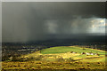
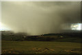
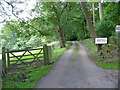
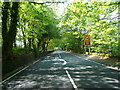
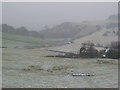
Nearby Images from Geograph Britain and Ireland:
©2020(licence)
©2020(licence)
©2006(licence)
©2011(licence)
©2011(licence)
The above images may not be of the site on this page, they are loaded from Geograph.
Please Submit an Image of this site or go out and take one for us!
Click here to see more info for this site
Nearby sites
Key: Red: member's photo, Blue: 3rd party photo, Yellow: other image, Green: no photo - please go there and take one, Grey: site destroyed
Download sites to:
KML (Google Earth)
GPX (GPS waypoints)
CSV (Garmin/Navman)
CSV (Excel)
To unlock full downloads you need to sign up as a Contributory Member. Otherwise downloads are limited to 50 sites.
Turn off the page maps and other distractions
Nearby sites listing. In the following links * = Image available
141m SW 225° Macclesfield Common I Round Barrow(s) (SJ938732)
780m SE 140° Teggs Nose Farm Round Barrow(s) (SJ944727)
1.8km SSE 151° Langley Conical mound* Round Barrow(s) (SJ948717)
2.0km SE 135° Teggs Nose reservoir* Round Barrow(s) (SJ953719)
2.2km SSE 146° High Low* Round Barrow(s) (SJ951715)
2.2km W 265° St Anne's Well (Macclesfield)* Holy Well or Sacred Spring (SJ917731)
2.3km SE 136° Higher Ridgegate* Standing Stone (Menhir) (SJ9550671636)
2.4km SW 215° Sutton Hall* Round Barrow(s) (SJ925713)
2.9km WNW 299° Beech Hall Round Barrow(s) (SJ914747)
2.9km ESE 104° Charity Lane II Round Barrow(s) (SJ967726)
2.9km ESE 104° Charity Lane III* Round Barrow(s) (SJ967726)
2.9km WNW 286° West Park Boulder* Natural Stone / Erratic / Other Natural Feature (SJ911741)
2.9km WNW 288° West Park Crosses* Ancient Cross (SJ911742)
3.0km WNW 303° Lavenham Close* Round Barrow(s) (SJ914749)
3.2km ESE 106° Charity Lane I* Round Barrow(s) (SJ970724)
3.3km WNW 291° Macclesfield Cemetery* Round Barrow(s) (SJ908745)
3.4km ESE 112° Toot Hill* Ancient Village or Settlement (SJ971720)
3.5km NNE 28° Gin Clough Farm* Standing Stone (Menhir) (SJ9554076365)
3.5km ESE 114° Toot Hill Warilow* Round Barrow(s) (SJ971719)
3.6km ENE 63° Brock Low* Round Barrow(s) (SJ971749)
3.7km NE 43° Yearnslow* Round Barrow(s) (SJ96447597)
3.8km NNE 28° Black Rock Farm* Round Barrow(s) (SJ957766)
3.8km ESE 110° Rains Low* Round Barrow(s) (SJ975720)
3.8km SSW 208° Broad Oak Farm* Round Barrow(s) (SJ921699)
4.1km NNE 26° Great Low Hillfort (SJ957770)
View more nearby sites and additional images


 We would like to know more about this location. Please feel free to add a brief description and any relevant information in your own language.
 Wir möchten mehr über diese Stätte erfahren. Bitte zögern Sie nicht, eine kurze Beschreibung und relevante Informationen in Deutsch hinzuzufügen.
 Nous aimerions en savoir encore un peu sur les lieux. S'il vous plaît n'hesitez pas à ajouter une courte description et tous les renseignements pertinents dans votre propre langue.
 Quisieramos informarnos un poco más de las lugares. No dude en añadir una breve descripción y otros datos relevantes en su propio idioma.