


<< Text Pages >> Scale House (Rylstone) - Cairn in England in Yorkshire (North)
Submitted by Anne T on Saturday, 06 January 2018 Page Views: 1580
Neolithic and Bronze AgeSite Name: Scale House (Rylstone)Country: England
NOTE: This site is 0.745 km away from the location you searched for.
County: Yorkshire (North) Type: Cairn
Nearest Town: Skipton Nearest Village: Rylstone
Map Ref: SD9708856870
Latitude: 54.007842N Longitude: 2.045921W
Condition:
| 5 | Perfect |
| 4 | Almost Perfect |
| 3 | Reasonable but with some damage |
| 2 | Ruined but still recognisable as an ancient site |
| 1 | Pretty much destroyed, possibly visible as crop marks |
| 0 | No data. |
| -1 | Completely destroyed |
| 5 | Superb |
| 4 | Good |
| 3 | Ordinary |
| 2 | Not Good |
| 1 | Awful |
| 0 | No data. |
| 5 | Can be driven to, probably with disabled access |
| 4 | Short walk on a footpath |
| 3 | Requiring a bit more of a walk |
| 2 | A long walk |
| 1 | In the middle of nowhere, a nightmare to find |
| 0 | No data. |
| 5 | co-ordinates taken by GPS or official recorded co-ordinates |
| 4 | co-ordinates scaled from a detailed map |
| 3 | co-ordinates scaled from a bad map |
| 2 | co-ordinates of the nearest village |
| 1 | co-ordinates of the nearest town |
| 0 | no data |
Be the first person to rate this site - see the 'Contribute!' box in the right hand menu.
Internal Links:
External Links:
Round Cairn in Yorkshire (North)
The Northern Antiquarian (TNA) features a page for this tumulus - see their entry for Scale House, Rylstone, North Yorkshire, which gives directions for finding this site, together with a description taken from historical reference material and local folklore.
This round cairn is scheduled as Historic England List ID 1010451, which tells us: "The monument is in a low lying position near Scale House farmyard. It includes a turf covered cairn 1.5m high and 14m in diameter and a slight surrounding ditch 1.3m wide. The monument was excavated by Canon Greenwell in 1864."
The tumulus is also recorded as Pastscape Monument No. 46401, which adds: "Situated at SD 97095687, on a small hill spur, this well-preserved barrow measures 14.5m diameter and 1.2m maximum height. The remains of the ditch are too slight for measurement ... Excavation recovered a tree-trunk coffin."
Note: Have you visited this site? Do you have any photographs or information to add?
You may be viewing yesterday's version of this page. To see the most up to date information please register for a free account.
Do not use the above information on other web sites or publications without permission of the contributor.
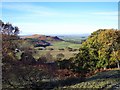
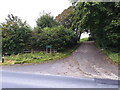
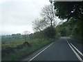
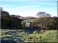
Nearby Images from Geograph Britain and Ireland:
©2010(licence)
©2019(licence)
©2017(licence)
©2010(licence)
©2019(licence)
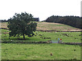
The above images may not be of the site on this page, they are loaded from Geograph.
Please Submit an Image of this site or go out and take one for us!
Click here to see more info for this site
Nearby sites
Key: Red: member's photo, Blue: 3rd party photo, Yellow: other image, Green: no photo - please go there and take one, Grey: site destroyed
Download sites to:
KML (Google Earth)
GPX (GPS waypoints)
CSV (Garmin/Navman)
CSV (Excel)
To unlock full downloads you need to sign up as a Contributory Member. Otherwise downloads are limited to 50 sites.
Turn off the page maps and other distractions
Nearby sites listing. In the following links * = Image available
1.0km ESE 122° Nettlehole Ridge* Stone Circle (SD97945634)
1.3km SW 216° Rough Haw (Flasby) Hillfort (SD963558)
1.8km ESE 115° Fairies Chest (Embsay Moor)* Natural Stone / Erratic / Other Natural Feature (SD9869656105)
1.9km N 3° St Peter's Church (Rylstone) Ancient Cross (SD972588)
2.5km SSW 193° Skyrakes West (Stirton) Rock Art (SD965544)
4.0km W 272° St Helen's Well (Eshton)* Holy Well or Sacred Spring (SD9309656992)
4.6km SW 223° Kirk Sink (Gargrave) Ancient Village or Settlement (SD9396753517)
4.8km SW 235° Roman Ford (Gargrave)* Ancient Trackway (SD9316354086)
4.9km SW 233° St Andrew (Gargrave)* Ancient Cross (SD93205391)
5.1km SW 232° The Garris* Ancient Village or Settlement (SD9306153776)
5.5km SSE 159° Craven Museum* Museum (SD9902451734)
5.9km SSW 202° Broughton Circle Stone Circle (SD9490551404)
6.0km NE 38° Ebolton Cave* Cave or Rock Shelter (SE008616)
6.2km ESE 118° Eastby 01 (Low Lane) Rock Art (SE026540)
6.3km ESE 115° Eastby 02 (Bark Lane) Rock Art (SE02835421)
6.6km W 274° Lower Colgarth Hill Tumulus* Round Barrow(s) (SD9048157360)
6.7km ESE 123° St Helen's Well (Draughton) Holy Well or Sacred Spring (SE02705324)
6.8km SSE 158° Great Wood Laithe (19) Rock Art (SD9962050551)
6.9km SSE 158° Horse Close Hill (Skipton) Ancient Village or Settlement (SD9965350468)
7.1km NNE 28° The Linton Stones* Natural Stone / Erratic / Other Natural Feature (SE0042763177)
7.2km NNE 28° Linton Churchyard Cross* Ancient Cross (SE0053963220)
7.4km SSE 161° High Laithe Stone (17) Rock Art (SD9951649914)
7.5km SSE 162° Low Snaygill Stone (Skipton) Rock Art (SD9939949729)
7.5km N 9° Little Wood* Ancient Village or Settlement (SD98266429)
7.7km NE 53° Burnsall Crosses* Ancient Cross (SE032615)
View more nearby sites and additional images


 We would like to know more about this location. Please feel free to add a brief description and any relevant information in your own language.
 Wir möchten mehr über diese Stätte erfahren. Bitte zögern Sie nicht, eine kurze Beschreibung und relevante Informationen in Deutsch hinzuzufügen.
 Nous aimerions en savoir encore un peu sur les lieux. S'il vous plaît n'hesitez pas à ajouter une courte description et tous les renseignements pertinents dans votre propre langue.
 Quisieramos informarnos un poco más de las lugares. No dude en añadir una breve descripción y otros datos relevantes en su propio idioma.