


<< Text Pages >> Werneth Low Enclosure - Ancient Village or Settlement in England in Greater Manchester
Submitted by vicky on Thursday, 25 March 2004 Page Views: 6221
Multi-periodSite Name: Werneth Low EnclosureCountry: England
NOTE: This site is 1.548 km away from the location you searched for.
County: Greater Manchester Type: Ancient Village or Settlement
Nearest Town: Hyde Nearest Village: Godley Green
Map Ref: SJ97099315 Landranger Map Number: 109
Latitude: 53.435122N Longitude: 2.045268W
Condition:
| 5 | Perfect |
| 4 | Almost Perfect |
| 3 | Reasonable but with some damage |
| 2 | Ruined but still recognisable as an ancient site |
| 1 | Pretty much destroyed, possibly visible as crop marks |
| 0 | No data. |
| -1 | Completely destroyed |
| 5 | Superb |
| 4 | Good |
| 3 | Ordinary |
| 2 | Not Good |
| 1 | Awful |
| 0 | No data. |
| 5 | Can be driven to, probably with disabled access |
| 4 | Short walk on a footpath |
| 3 | Requiring a bit more of a walk |
| 2 | A long walk |
| 1 | In the middle of nowhere, a nightmare to find |
| 0 | No data. |
| 5 | co-ordinates taken by GPS or official recorded co-ordinates |
| 4 | co-ordinates scaled from a detailed map |
| 3 | co-ordinates scaled from a bad map |
| 2 | co-ordinates of the nearest village |
| 1 | co-ordinates of the nearest town |
| 0 | no data |
Internal Links:
External Links:
Ditched Enclosure in Greater Manchester
This double ditched enclosure is recorded as Pastscape Monument No. 1085517, which tells us this site was first discovered from air photos. It is thought to be late Iron Age or Roman. "Excavations in 1992 across the north-east corner provided a 3rd century AD date for one ditch fill".
The Journal of Antiquities also features a page for this site - see their entry for Werneth Low and Hangingbank, Greater Manchester, which features a description and a photograph. The Journal entry also includes information about another settlement or farmstead called Hanginbank at SJ 9647 9352 - see the Portal's page for Hangingbank, Werneth Low.
You may be viewing yesterday's version of this page. To see the most up to date information please register for a free account.
Do not use the above information on other web sites or publications without permission of the contributor.
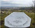
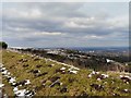
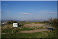
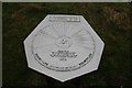
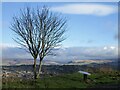
Nearby Images from Geograph Britain and Ireland:
©2010(licence)
©2010(licence)
©2010(licence)
©2013(licence)
©2023(licence)
The above images may not be of the site on this page, they are loaded from Geograph.
Please Submit an Image of this site or go out and take one for us!
Click here to see more info for this site
Nearby sites
Key: Red: member's photo, Blue: 3rd party photo, Yellow: other image, Green: no photo - please go there and take one, Grey: site destroyed
Download sites to:
KML (Google Earth)
GPX (GPS waypoints)
CSV (Garmin/Navman)
CSV (Excel)
To unlock full downloads you need to sign up as a Contributory Member. Otherwise downloads are limited to 50 sites.
Turn off the page maps and other distractions
Nearby sites listing. In the following links * = Image available
314m SW 217° Werneth Low Cairn Cairn (SJ969929)
720m WNW 301° Hangingbank, Werneth Low* Ancient Village or Settlement (SJ96479352)
1.0km WNW 289° Lower Higham Farm Cairn (SJ961935)
1.2km WSW 254° Werneth Low (Hyde) Ancient Village or Settlement (SJ959928)
2.6km SE 134° Ludworth Intake* Round Barrow(s) (SJ98989131)
2.8km SE 143° Brown Low* Round Barrow(s) (SJ988909)
4.1km E 90° Hargate Hill* Standing Stone (Menhir) (SK01239315)
4.1km ESE 122° Robin Hood's Picking Rods* Ancient Cross (SK0060990941)
4.2km SW 227° St Chad's Well (Chadkirk)* Holy Well or Sacred Spring (SJ93979027)
4.2km ESE 122° Chisworth Cupmarked stone* Rock Art (SK007909)
4.4km SSE 165° Mellor Hillfort* Hillfort (SJ982889)
4.4km NNE 24° Buckton Edge Cairn (SJ989972)
4.5km NNE 26° Hobson Moor Cairn II Cairn (SJ991972)
4.7km SE 126° Ringstones (new circle at Near Slack Farm)* Modern Stone Circle etc (SK0087290394)
5.0km SE 135° Ringstones (Derbyshire)* Stone Circle (SK006896)
5.1km ESE 104° Coombes Edge* Ring Cairn (SK0204591892)
5.2km NNE 20° Stalybridge Cairn* Cairn (SJ989980)
5.2km NNE 21° Hobson Moor Cairn I Cairn (SJ990980)
6.0km ENE 68° Mouselow Castle Hillfort (SK027954)
6.1km SSE 165° Mellor Moor* Cairn (SJ9867187246)
7.0km E 87° Carr House Lane standing stone Standing Stone (Menhir) (SK041935)
7.1km NNE 19° Harridge Pike Cairn (SJ994999)
8.7km NNE 12° Buckton Castle Hillfort (SD9890501634)
8.7km S 178° St Mary (Disley)* Ancient Cross (SJ97388444)
9.4km SE 133° Watery Hey Well* Holy Well or Sacred Spring (SK0399986733)
View more nearby sites and additional images


 We would like to know more about this location. Please feel free to add a brief description and any relevant information in your own language.
 Wir möchten mehr über diese Stätte erfahren. Bitte zögern Sie nicht, eine kurze Beschreibung und relevante Informationen in Deutsch hinzuzufügen.
 Nous aimerions en savoir encore un peu sur les lieux. S'il vous plaît n'hesitez pas à ajouter une courte description et tous les renseignements pertinents dans votre propre langue.
 Quisieramos informarnos un poco más de las lugares. No dude en añadir una breve descripción y otros datos relevantes en su propio idioma.