


<< Text Pages >> Zulueta Fondo Cabaña - Ancient Village or Settlement in Spain in Navarra
Submitted by holger_rix on Saturday, 28 November 2015 Page Views: 561
Multi-periodSite Name: Zulueta Fondo Cabaña Alternative Name: Zulueta Etxola HondoaCountry: Spain
NOTE: This site is 0.876 km away from the location you searched for.
Region: Navarra Type: Ancient Village or Settlement
Latitude: 42.992637N Longitude: 2.022381W
Condition:
| 5 | Perfect |
| 4 | Almost Perfect |
| 3 | Reasonable but with some damage |
| 2 | Ruined but still recognisable as an ancient site |
| 1 | Pretty much destroyed, possibly visible as crop marks |
| 0 | No data. |
| -1 | Completely destroyed |
| 5 | Superb |
| 4 | Good |
| 3 | Ordinary |
| 2 | Not Good |
| 1 | Awful |
| 0 | No data. |
| 5 | Can be driven to, probably with disabled access |
| 4 | Short walk on a footpath |
| 3 | Requiring a bit more of a walk |
| 2 | A long walk |
| 1 | In the middle of nowhere, a nightmare to find |
| 0 | No data. |
| 5 | co-ordinates taken by GPS or official recorded co-ordinates |
| 4 | co-ordinates scaled from a detailed map |
| 3 | co-ordinates scaled from a bad map |
| 2 | co-ordinates of the nearest village |
| 1 | co-ordinates of the nearest town |
| 0 | no data |
Be the first person to rate this site - see the 'Contribute!' box in the right hand menu.
Internal Links:
External Links:
Ancient Village or Settlement in Navarra
You may be viewing yesterday's version of this page. To see the most up to date information please register for a free account.
Do not use the above information on other web sites or publications without permission of the contributor.
Nearby Images from Flickr
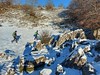
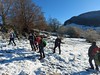
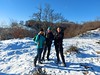
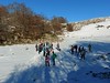
The above images may not be of the site on this page, but were taken nearby. They are loaded from Flickr so please click on them for image credits.
Click here to see more info for this site
Nearby sites
Click here to view sites on an interactive map of the areaKey: Red: member's photo, Blue: 3rd party photo, Yellow: other image, Green: no photo - please go there and take one, Grey: site destroyed
Download sites to:
KML (Google Earth)
GPX (GPS waypoints)
CSV (Garmin/Navman)
CSV (Excel)
To unlock full downloads you need to sign up as a Contributory Member. Otherwise downloads are limited to 50 sites.
Turn off the page maps and other distractions
Nearby sites listing. In the following links * = Image available
102m SW 214° Zulueta Túmulo 2 Round Barrow(s)
109m SSW 212° Zulueta Túmulo 1 Round Barrow(s)
176m SW 231° Zulueta Túmulo 3 Ring Cairn
421m SE 133° Antzesao Fondo Cabaña Ancient Village or Settlement
556m S 188° Obioneta Iparralde Dolmen* Burial Chamber or Dolmen
575m S 187° Obioneta Menhir Standing Stone (Menhir)
576m SSE 147° Maantsa Dolmen* Burial Chamber or Dolmen
578m SE 125° Antzesao Túmulo Round Barrow(s)
608m SSW 191° Obioneta Hegoalde Dolmen* Burial Chamber or Dolmen
833m SSE 160° Zeontza Dolmen* Burial Chamber or Dolmen
926m SE 134° Garraztita Dolmen* Burial Chamber or Dolmen
931m SW 236° Trikuharri Dolmen* Burial Chamber or Dolmen
1.3km ESE 114° Atallorbe Túmulo Round Barrow(s)
1.3km ESE 117° Atallorbe Fondo Cabaña Ancient Village or Settlement
1.4km WSW 256° Igaratza 3 Zutarria* Standing Stone (Menhir)
1.5km SE 131° Arakil Fondo Cabaña Ancient Village or Settlement
1.6km SE 130° Arakil Menhir* Standing Stone (Menhir)
1.7km W 262° Igaratza Hego Trikuharria* Burial Chamber or Dolmen
1.7km W 261° Igaratza 4 Zutarria Standing Stone (Menhir)
1.7km WSW 256° Igaratza 2 Harrespila* Stone Circle
1.7km W 266° Igaratza Ipar Trikuharria Burial Chamber or Dolmen
1.7km SSE 168° Aralar 6 Etxola Hondoa Ancient Village or Settlement
1.8km S 189° Otromingo Soroaundi Fondo Cabaña Ancient Village or Settlement
1.8km W 266° Igaratza Tumulua* Round Barrow(s)
1.8km ESE 107° Illobi Fondo Cabaña Ancient Village or Settlement
View more nearby sites and additional images


 We would like to know more about this location. Please feel free to add a brief description and any relevant information in your own language.
 Wir möchten mehr über diese Stätte erfahren. Bitte zögern Sie nicht, eine kurze Beschreibung und relevante Informationen in Deutsch hinzuzufügen.
 Nous aimerions en savoir encore un peu sur les lieux. S'il vous plaît n'hesitez pas à ajouter une courte description et tous les renseignements pertinents dans votre propre langue.
 Quisieramos informarnos un poco más de las lugares. No dude en añadir una breve descripción y otros datos relevantes en su propio idioma.