


<< Our Photo Pages >> Swinkley Knoll - Round Barrow(s) in England in County Durham
Submitted by durhamnature on Sunday, 24 February 2013 Page Views: 2228
Neolithic and Bronze AgeSite Name: Swinkley KnollCountry: England
NOTE: This site is 0.316 km away from the location you searched for.
County: County Durham Type: Round Barrow(s)
Nearest Town: Barnard Castle Nearest Village: Eggleston
Map Ref: NY98352425
Latitude: 54.613404N Longitude: 2.027064W
Condition:
| 5 | Perfect |
| 4 | Almost Perfect |
| 3 | Reasonable but with some damage |
| 2 | Ruined but still recognisable as an ancient site |
| 1 | Pretty much destroyed, possibly visible as crop marks |
| 0 | No data. |
| -1 | Completely destroyed |
| 5 | Superb |
| 4 | Good |
| 3 | Ordinary |
| 2 | Not Good |
| 1 | Awful |
| 0 | No data. |
| 5 | Can be driven to, probably with disabled access |
| 4 | Short walk on a footpath |
| 3 | Requiring a bit more of a walk |
| 2 | A long walk |
| 1 | In the middle of nowhere, a nightmare to find |
| 0 | No data. |
| 5 | co-ordinates taken by GPS or official recorded co-ordinates |
| 4 | co-ordinates scaled from a detailed map |
| 3 | co-ordinates scaled from a bad map |
| 2 | co-ordinates of the nearest village |
| 1 | co-ordinates of the nearest town |
| 0 | no data |
Internal Links:
External Links:
")
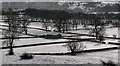
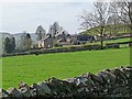
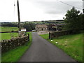
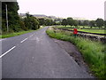
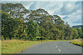
Round barrow in Teesdale overlooking the River Tees. There is no public access, the barrow can be seen in the distance from the roadside.
You may be viewing yesterday's version of this page. To see the most up to date information please register for a free account.
Do not use the above information on other web sites or publications without permission of the contributor.
Nearby Images from Geograph Britain and Ireland:
©2009(licence)
©2011(licence)
©2016(licence)
©2009(licence)
©2020(licence)
The above images may not be of the site on this page, they are loaded from Geograph.
Please Submit an Image of this site or go out and take one for us!
Click here to see more info for this site
Nearby sites
Key: Red: member's photo, Blue: 3rd party photo, Yellow: other image, Green: no photo - please go there and take one, Grey: site destroyed
Download sites to:
KML (Google Earth)
GPX (GPS waypoints)
CSV (Garmin/Navman)
CSV (Excel)
To unlock full downloads you need to sign up as a Contributory Member. Otherwise downloads are limited to 50 sites.
Turn off the page maps and other distractions
Nearby sites listing. In the following links * = Image available
961m N 351° Eggleston Stone Circle (NY982252)
2.4km E 97° Stobgreen Plantation 1* Rock Art (NZ0071423974)
2.4km E 96° Stobgreen Plantation 2* Rock Art (NZ0072824000)
2.8km ESE 111° Stobgreen Plantation 3 Rock Art (NZ0093623252)
2.8km ESE 104° Stobgreen Plantation N01 Rock Art (NZ0107323567)
3.0km ESE 105° Stobgreen Plantation - The Grayson Stone* Rock Art (NZ0128723489)
3.1km ESE 108° Brackenheads 7* Rock Art (NZ0134023255)
3.2km ESE 108° Brackenheads 8* Rock Art (NZ0136123281)
3.2km ESE 108° Brackenheads N01* Rock Art (NZ0142323244)
3.2km SSW 196° Bracken Rigg 2* Rock Art (NY9745321132)
3.3km ESE 108° Brackenheads N02 Rock Art (NZ0144923234)
3.3km ESE 108° Brackenheads N03* Rock Art (NZ0145423225)
3.3km ESE 106° Brackenheads 4 Rock Art (NZ0150423321)
3.3km ESE 107° Brackenheads 6* Rock Art (NZ0150123299)
3.3km ESE 107° Brackenheads 5 Rock Art (NZ0150023290)
3.3km ESE 107° Brackenheads 2* Rock Art (NZ0150523298)
3.3km ESE 107° Brackenheads 1* Rock Art (NZ0150823298)
3.3km ESE 107° Brackenheads 3* Rock Art (NZ0153523286)
3.5km SSW 196° Bracken Rigg 1* Rock Art (NY9740920922)
3.7km SSW 212° Romaldkirk Moor 2 Rock Art (NY9640021100)
3.7km SSE 149° Guestwick Hills 1* Rock Art (NZ0025521039)
3.8km SSW 212° Romaldkirk Moor 1 Rock Art (NY9632621055)
3.8km SSE 149° Guestwick Hills 2 Rock Art (NZ0028020980)
4.0km SSW 213° Romaldkirk Moor 3 Rock Art (NY9614820923)
4.0km E 96° Barnard Castle Allotment 1 & Langleydale Common 10 Rock Art (NZ0237923805)
View more nearby sites and additional images


 We would like to know more about this location. Please feel free to add a brief description and any relevant information in your own language.
 Wir möchten mehr über diese Stätte erfahren. Bitte zögern Sie nicht, eine kurze Beschreibung und relevante Informationen in Deutsch hinzuzufügen.
 Nous aimerions en savoir encore un peu sur les lieux. S'il vous plaît n'hesitez pas à ajouter une courte description et tous les renseignements pertinents dans votre propre langue.
 Quisieramos informarnos un poco más de las lugares. No dude en añadir una breve descripción y otros datos relevantes en su propio idioma.