

<< Our Photo Pages >> Lud's Church - Natural Stone / Erratic / Other Natural Feature in England in Staffordshire
Submitted by Postman on Monday, 17 December 2012 Page Views: 6641
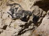
Natural PlacesSite Name: Lud's ChurchCountry: England County: Staffordshire Type: Natural Stone / Erratic / Other Natural Feature
Nearest Town: Leek Nearest Village: Allgreave
Map Ref: SJ987656
Latitude: 53.187490N Longitude: 2.020911W
Condition:
| 5 | Perfect |
| 4 | Almost Perfect |
| 3 | Reasonable but with some damage |
| 2 | Ruined but still recognisable as an ancient site |
| 1 | Pretty much destroyed, possibly visible as crop marks |
| 0 | No data. |
| -1 | Completely destroyed |
| 5 | Superb |
| 4 | Good |
| 3 | Ordinary |
| 2 | Not Good |
| 1 | Awful |
| 0 | No data. |
| 5 | Can be driven to, probably with disabled access |
| 4 | Short walk on a footpath |
| 3 | Requiring a bit more of a walk |
| 2 | A long walk |
| 1 | In the middle of nowhere, a nightmare to find |
| 0 | No data. |
| 5 | co-ordinates taken by GPS or official recorded co-ordinates |
| 4 | co-ordinates scaled from a detailed map |
| 3 | co-ordinates scaled from a bad map |
| 2 | co-ordinates of the nearest village |
| 1 | co-ordinates of the nearest town |
| 0 | no data |
Internal Links:
External Links:
I have visited· I would like to visit
BrownEdger would like to visit
Couplands visited on 9th Oct 2021 - their rating: Amb: 5 Access: 3
NDM visited on 21st May 2021 - their rating: Cond: 4 Amb: 5 Access: 2
Marko visited on 1st Jun 2020 - their rating: Cond: 4 Amb: 4 Access: 2
Ballhc visited on 19th Oct 2014 - their rating: Cond: 4 Amb: 5 Access: 2
lichen visited on 4th Jan 2014 - their rating: Cond: 5 Amb: 5 Access: 4
Justmoist visited on 10th Nov 2012 - their rating: Cond: 4 Amb: 5 Access: 3 Great place to explore. Easy to climb down to if you use the signed entrance! Otherwise some knowledge of rock climbing required. Lovely colours and rocks similar to the roaches. Spiritual feel to it. Jx
Average ratings for this site from all visit loggers: Condition: 4.2 Ambience: 4.83 Access: 2.67
")
You may be viewing yesterday's version of this page. To see the most up to date information please register for a free account.
")
")
")
")
")
")
")
")
")
")
")
")
")
")
")
")
")
")
")
")
")
")
Do not use the above information on other web sites or publications without permission of the contributor.
Click here to see more info for this site
Nearby sites
Key: Red: member's photo, Blue: 3rd party photo, Yellow: other image, Green: no photo - please go there and take one, Grey: site destroyed
Download sites to:
KML (Google Earth)
GPX (GPS waypoints)
CSV (Garmin/Navman)
CSV (Excel)
To unlock full downloads you need to sign up as a Contributory Member. Otherwise downloads are limited to 50 sites.
Turn off the page maps and other distractions
Nearby sites listing. In the following links * = Image available
1.6km ENE 61° Roaches Stone carving* Carving (SK00076637)
2.0km WNW 297° Allgreave* Standing Stone (Menhir) (SJ969665)
2.2km SE 141° The Roaches Barrow Round Barrow(s) (SK001639)
2.3km W 270° Bartomley Farm* Long Barrow (SJ964656)
2.5km SE 145° Sainter's Dolmen* Rock Outcrop (SK00106357)
3.4km ESE 116° The Bald Stone* Natural Stone / Erratic / Other Natural Feature (SK018641)
3.6km ENE 67° Flash Chambered Tomb (SK0267)
3.7km WNW 299° Longgutter* Round Barrow(s) (SJ955674)
3.7km WNW 303° Bullstones* Stone Circle (SJ9556867627)
3.8km NW 311° Cessbank Common* Round Barrow(s) (SJ958681)
3.9km WNW 297° Clulow Cross* Round Barrow(s) (SJ952674)
4.2km SW 230° Heaton Low* Round Barrow(s) (SJ955629)
4.2km SSE 150° Bawd Stone* Natural Stone / Erratic / Other Natural Feature (SK0079561976)
4.2km SSE 153° The Roaches* Natural Stone / Erratic / Other Natural Feature (SK006618)
4.3km SSE 150° Sainter's Circle* Stone Circle (SK008619)
4.6km SE 134° The Winking Man* Natural Stone / Erratic / Other Natural Feature (SK0202162362)
4.7km W 275° Bosley Minn 2 & 3* Standing Stones (SJ940660)
4.7km W 277° Bosley Minn 4 & 5* Standing Stones (SJ940662)
4.8km SSW 202° Gun Hill Standing Stone* Standing Stone (Menhir) (SJ969612)
4.8km NW 320° The Plague Stone* Ancient Cross (SJ9561269221)
4.8km W 273° Bosley Minn 1* Standing Stone (Menhir) (SJ93886585)
5.4km SSE 166° Leekfrith Stone* Standing Stone (Menhir) (SK000604)
5.4km SSE 163° Leekfrith Tumulus* Round Barrow(s) (SK003604)
5.7km SW 234° St Helen's Well (Rushton Spencer)* Holy Well or Sacred Spring (SJ94076222)
5.8km N 351° Macclesfield Forest Ancient Cross (SJ97767136)
View more nearby sites and additional images


 We would like to know more about this location. Please feel free to add a brief description and any relevant information in your own language.
 Wir möchten mehr über diese Stätte erfahren. Bitte zögern Sie nicht, eine kurze Beschreibung und relevante Informationen in Deutsch hinzuzufügen.
 Nous aimerions en savoir encore un peu sur les lieux. S'il vous plaît n'hesitez pas à ajouter une courte description et tous les renseignements pertinents dans votre propre langue.
 Quisieramos informarnos un poco más de las lugares. No dude en añadir una breve descripción y otros datos relevantes en su propio idioma.