


<< Our Photo Pages >> Craven Museum - Museum in England in Yorkshire (North)
Submitted by Sunny100 on Sunday, 18 May 2014 Page Views: 4935
MuseumsSite Name: Craven Museum Alternative Name: Craven Museum and GalleryCountry: England
NOTE: This site is 0.333 km away from the location you searched for.
County: Yorkshire (North) Type: Museum
Nearest Town: Skipton
Map Ref: SD9902451734
Latitude: 53.961689N Longitude: 2.016363W
Condition:
| 5 | Perfect |
| 4 | Almost Perfect |
| 3 | Reasonable but with some damage |
| 2 | Ruined but still recognisable as an ancient site |
| 1 | Pretty much destroyed, possibly visible as crop marks |
| 0 | No data. |
| -1 | Completely destroyed |
| 5 | Superb |
| 4 | Good |
| 3 | Ordinary |
| 2 | Not Good |
| 1 | Awful |
| 0 | No data. |
| 5 | Can be driven to, probably with disabled access |
| 4 | Short walk on a footpath |
| 3 | Requiring a bit more of a walk |
| 2 | A long walk |
| 1 | In the middle of nowhere, a nightmare to find |
| 0 | No data. |
| 5 | co-ordinates taken by GPS or official recorded co-ordinates |
| 4 | co-ordinates scaled from a detailed map |
| 3 | co-ordinates scaled from a bad map |
| 2 | co-ordinates of the nearest village |
| 1 | co-ordinates of the nearest town |
| 0 | no data |
Internal Links:
External Links:
I have visited· I would like to visit
DrewParsons AmyBlahBlahBlah would like to visit
")
From the prehistoric period over 20,000 years ago to post medieval times, visitors can see the changing local landscape through fascinating objects.
The interactive displays include objects found in local caves, an iron age sword, 'Celtic' stone heads, mosaics and painted wall plaster from Kirk Sink Roman villa, and an Elizabethan silver coin hoard.
Opening Hours: Monday, Wednesday, Thursday, Friday and Saturday. 10.00am – 4.00pm
Address: Town Hall, High Street, Skipton, North Yorkshire, BD23 1AH
Telephone: 01756 706407
Admission: Free
Website: Craven Museum
Note: Celtic stone heads!
You may be viewing yesterday's version of this page. To see the most up to date information please register for a free account.
")
")
")
Do not use the above information on other web sites or publications without permission of the contributor.
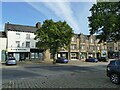
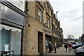
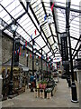
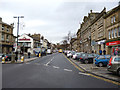
Nearby Images from Geograph Britain and Ireland:
©2021(licence)
![SD9951 : Skipton buildings [20] by Michael Dibb](https://s1.geograph.org.uk/geophotos/07/01/25/7012597_90eebfca_120x120.jpg)
©2021(licence)
©2015(licence)
©2022(licence)
©2012(licence)
The above images may not be of the site on this page, they are loaded from Geograph.
Please Submit an Image of this site or go out and take one for us!
Click here to see more info for this site
Nearby sites
Key: Red: member's photo, Blue: 3rd party photo, Yellow: other image, Green: no photo - please go there and take one, Grey: site destroyed
Download sites to:
KML (Google Earth)
GPX (GPS waypoints)
CSV (Garmin/Navman)
CSV (Excel)
To unlock full downloads you need to sign up as a Contributory Member. Otherwise downloads are limited to 50 sites.
Turn off the page maps and other distractions
Nearby sites listing. In the following links * = Image available
1.3km SSE 153° Great Wood Laithe (19) Rock Art (SD9962050551)
1.4km SSE 154° Horse Close Hill (Skipton) Ancient Village or Settlement (SD9965350468)
1.9km SSE 165° High Laithe Stone (17) Rock Art (SD9951649914)
2.0km S 169° Low Snaygill Stone (Skipton) Rock Art (SD9939949729)
3.7km NW 317° Skyrakes West (Stirton) Rock Art (SD965544)
4.0km ENE 68° St Helen's Well (Draughton) Holy Well or Sacred Spring (SE02705324)
4.1km W 265° Broughton Circle Stone Circle (SD9490551404)
4.2km ENE 58° Eastby 01 (Low Lane) Rock Art (SE026540)
4.3km SSE 163° Hamblethorpe (Low Bradley)* Standing Stones (SE0030347622)
4.4km N 356° Fairies Chest (Embsay Moor)* Natural Stone / Erratic / Other Natural Feature (SD9869656105)
4.5km ENE 57° Eastby 02 (Bark Lane) Rock Art (SE02835421)
4.5km SSE 157° Black Hill Ring Cairn* Ring Cairn (SE00814756)
4.6km SSE 156° Bradley Long Cairn* Chambered Cairn (SE0091047573)
4.6km SSE 156° Black Hill Round Cairn* Round Cairn (SE0087347529)
4.7km NNW 347° Nettlehole Ridge* Stone Circle (SD97945634)
4.9km NW 326° Rough Haw (Flasby) Hillfort (SD963558)
4.9km SSE 161° Farnhill Moor (Kildwick)* Rock Art (SE00644710)
5.3km WNW 289° Kirk Sink (Gargrave) Ancient Village or Settlement (SD9396753517)
5.5km NNW 339° Scale House (Rylstone) Cairn (SD9708856870)
5.8km SSW 199° Babyhouse Lane (Cononley) Ancient Village or Settlement (SD97194627)
5.8km SW 236° Standrise Earth Circle (Carleton in Craven) Misc. Earthwork (SD94194847)
5.9km ESE 108° Counter Hill (31) Rock Art (SE0463049950)
6.2km WNW 291° St Andrew (Gargrave)* Ancient Cross (SD93205391)
6.2km SSE 160° St Andrew, Kildwick, West Yorkshire* Ancient Cross (SE0114445893)
6.3km ESE 105° Counter Hill (Addingham) Misc. Earthwork (SE051501)
View more nearby sites and additional images


 We would like to know more about this location. Please feel free to add a brief description and any relevant information in your own language.
 Wir möchten mehr über diese Stätte erfahren. Bitte zögern Sie nicht, eine kurze Beschreibung und relevante Informationen in Deutsch hinzuzufügen.
 Nous aimerions en savoir encore un peu sur les lieux. S'il vous plaît n'hesitez pas à ajouter une courte description et tous les renseignements pertinents dans votre propre langue.
 Quisieramos informarnos un poco más de las lugares. No dude en añadir una breve descripción y otros datos relevantes en su propio idioma.