

<< Our Photo Pages >> The Bearstone - Standing Stone (Menhir) in England in Dorset
Submitted by BigBear on Friday, 22 August 2008 Page Views: 8127
Neolithic and Bronze AgeSite Name: The Bearstone Alternative Name: The Bear Stone, Monolith at Bear MeadCountry: England
NOTE: This site is 1.202 km away from the location you searched for.
County: Dorset Type: Standing Stone (Menhir)
Nearest Town: Wimborne Nearest Village: Stour
Map Ref: SY986993
Latitude: 50.793264N Longitude: 2.02123W
Condition:
| 5 | Perfect |
| 4 | Almost Perfect |
| 3 | Reasonable but with some damage |
| 2 | Ruined but still recognisable as an ancient site |
| 1 | Pretty much destroyed, possibly visible as crop marks |
| 0 | No data. |
| -1 | Completely destroyed |
| 5 | Superb |
| 4 | Good |
| 3 | Ordinary |
| 2 | Not Good |
| 1 | Awful |
| 0 | No data. |
| 5 | Can be driven to, probably with disabled access |
| 4 | Short walk on a footpath |
| 3 | Requiring a bit more of a walk |
| 2 | A long walk |
| 1 | In the middle of nowhere, a nightmare to find |
| 0 | No data. |
| 5 | co-ordinates taken by GPS or official recorded co-ordinates |
| 4 | co-ordinates scaled from a detailed map |
| 3 | co-ordinates scaled from a bad map |
| 2 | co-ordinates of the nearest village |
| 1 | co-ordinates of the nearest town |
| 0 | no data |
Internal Links:
External Links:
")
We dug a descent pit, talked to a friendly local farmer, and it was pulled vertical with strap + digger, no problem. Underneath was trapped quarter-inch single-strand wire, seen a lot of it locally, believe it was used for Inclosure Act around 1815, so it probably fell 190 years ago.
I searched old maps in the County Records office, several "stones" mentioned, but not this monolith. Possible stone circle 570 metres NE, now vanished. Several other large stones (limestone or ironstone) within 2 miles, all smaller. Christened monolith "Bear Stone" because the area is Bear Mead (from old maps). It sits on a floodplain, 10 metres from Dorset's largest river, floods perhaps once per winter.
The nearest source of fine limestone is Purbeck, could have been brought by raft along coast and up the River Stour. There are unusual "smooth holes" in the surface, two on the flat bottom. We placed a small time capsule in one of these holes. I found a nice flint thumbnail scraper while digging descent pit. I have made a notice board with full details and pictures. The land is private, email me to come and see the Bearstone. Anyone with info about this monolith, please please contact me.
More details, photos and my email address are on my web site.
John Palmer
Read about the discovery of this stone on this page.
Note: Unrecorded fallen monolith excavated and raised, near Stour at Wimborne
You may be viewing yesterday's version of this page. To see the most up to date information please register for a free account.
Do not use the above information on other web sites or publications without permission of the contributor.
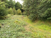
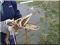
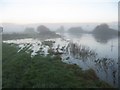
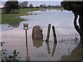
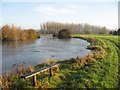
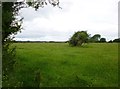
Nearby Images from Geograph Britain and Ireland:
©2009(licence)
©2009(licence)
©2009(licence)
©2009(licence)
©2013(licence)
The above images may not be of the site on this page, they are loaded from Geograph.
Please Submit an Image of this site or go out and take one for us!
Click here to see more info for this site
Nearby sites
Key: Red: member's photo, Blue: 3rd party photo, Yellow: other image, Green: no photo - please go there and take one, Grey: site destroyed
Download sites to:
KML (Google Earth)
GPX (GPS waypoints)
CSV (Garmin/Navman)
CSV (Excel)
To unlock full downloads you need to sign up as a Contributory Member. Otherwise downloads are limited to 50 sites.
Turn off the page maps and other distractions
Nearby sites listing. In the following links * = Image available
1.3km NE 42° Pamphill* Natural Stone / Erratic / Other Natural Feature (ST995003)
3.8km NE 35° Bakers Dozen* Modern Stone Circle etc (SU008024)
4.3km NNW 329° Badbury Rings* Hillfort (ST96400299)
4.6km NW 322° Badbury Barrow Barrow Cemetery (ST958029)
5.5km NW 314° Straw Barrow Round Barrow(s) (ST94660312)
5.7km WNW 294° Shapwick Round Barrow(s) (ST9336301635)
6.3km E 80° Bowl round barrow just outside Stapehill community centre Dorset Barrow Cemetery (SU0482700373)
6.9km N 11° High Lea Farm* Barrow Cemetery (ST999061)
7.7km WNW 291° Spettisbury Rings* Hillfort (ST914020)
7.9km NE 36° Colebarrow* Hillfort (SU033057)
8.1km E 90° Ferndown Town Common* Round Barrow(s) (SZ067993)
8.6km SE 125° Poole Timber Circle Timber Circle (SZ057944)
8.6km E 95° Dudsbury Hill Tumuli* Round Barrow(s) (SZ072985)
8.7km ESE 113° Two Barrow Heath Barrow Cemetery (SZ0663495924)
8.9km NE 51° Holt Heath* Round Barrow(s) (SU055049)
9.2km E 99° Dudsbury Camp* Hillfort (SZ077979)
9.3km E 94° Parley Barrow* Round Barrow(s) (SZ07909865)
9.5km NW 315° Buzbury Rings* Ancient Village or Settlement (ST919060)
9.5km SE 138° Parkstone Standing Stone (Menhir) (SZ050922)
10.0km E 93° Ralph's Barrow* Round Barrow(s) (SZ086988)
10.2km NW 316° Tarrant Rawston Long Barrow* Long Barrow (ST91550667)
10.3km NE 39° Roman Barrow, Knob's Crook* Round Barrow(s) (SU051073)
10.4km SSW 192° Conygar Hill Timber Circle Timber Circle (SY964891)
10.6km SE 129° Fern Barrow* Round Barrow(s) (SZ069926)
11.0km E 83° Trickett's Cross Barrow* Round Barrow(s) (SU095007)
View more nearby sites and additional images


 We would like to know more about this location. Please feel free to add a brief description and any relevant information in your own language.
 Wir möchten mehr über diese Stätte erfahren. Bitte zögern Sie nicht, eine kurze Beschreibung und relevante Informationen in Deutsch hinzuzufügen.
 Nous aimerions en savoir encore un peu sur les lieux. S'il vous plaît n'hesitez pas à ajouter une courte description et tous les renseignements pertinents dans votre propre langue.
 Quisieramos informarnos un poco más de las lugares. No dude en añadir una breve descripción y otros datos relevantes en su propio idioma.