Featured: How and why the ancients enchanted Great Britain and Brittany

How and why the ancients enchanted Great Britain and Brittany

The Quest for the Shaman: Shape-shifters, Sorcerers and Spirit-healers of Ancient Europe

The Quest for the Shaman: Shape-shifters, Sorcerers and Spirit-healers of Ancient Europe

Who's Online

There are currently, 233 guests and 2 members online.

You are a guest. To join in, please register for free by clicking here

Sponsors

<< Our Photo Pages >> Mellor Moor - Cairn in England in Greater Manchester

Submitted by astronomer on Wednesday, 18 July 2012  Page Views: 16516

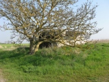
Neolithic and Bronze AgeSite Name: Mellor Moor Alternative Name: Shaw Cairn
Country: England County: Greater Manchester Type: Cairn
Nearest Town: Marple  Nearest Village: Mellor
Map Ref: SJ9867187246  Landranger Map Number: 109
Latitude: 53.382060N  Longitude: 2.021444W
Condition:
5Perfect
4Almost Perfect
3Reasonable but with some damage
2Ruined but still recognisable as an ancient site
1Pretty much destroyed, possibly visible as crop marks
0No data.
-1Completely destroyed
2 Ambience:
5Superb
4Good
3Ordinary
2Not Good
1Awful
0No data.
3 Access:
5Can be driven to, probably with disabled access
4Short walk on a footpath
3Requiring a bit more of a walk
2A long walk
1In the middle of nowhere, a nightmare to find
0No data.
4 Accuracy:
5co-ordinates taken by GPS or official recorded co-ordinates
4co-ordinates scaled from a detailed map
3co-ordinates scaled from a bad map
2co-ordinates of the nearest village
1co-ordinates of the nearest town
0no data
5

Internal Links:
External Links:

Mellor Moor
Mellor Moor submitted by astronomer : In this view, Frank Parker and Doug Pickford are examining one of several radial lines of stones that connect the inner and outer stone rings. It has been suggested that this indicates that the cairn was enlarged. Between these rings, cremation burials have been discovered. (Vote or comment on this photo)
Kerb Cairn in Stockport, Greater Manchester. Excavation of an inhumation cist uncovered about 100 amber beads, which would have formed a precious necklace from an elite group. Another find was a stone platform next to the cairn. Excavation of the cairn and its surroundings is continuing.

In 1975, John Bu'Lock identified what he thought was a possible cairn on Mellor Moor above Cobden Edge, which is the highest point in Stockport, the trig point on Mellor Moor being at 328 meters (1076 feet). This area was once a plantation, but is now a wildlife preserve above the pastures of a working dairy farm. For the next several years, Ruth Collier, Kath Lowe and John Clarke excavated the site with help from students of Marple Hall School.

They uncovered parts of a funerary cairn built around 4000 years ago, with more than a dozen cremation burials, some within stone cists, which were given names like Willie, Pericles, Cecil and Hector. Those associated with burials were consistent with the building of the cairn in the Late Neolithic or Early Bronze Age but the finds included around 500 flints, many dating from the Early Mesolithic Period indicating that the Cairn was built on the site of much earlier activity. Unfortunately recording of the excavation was not to modern archaeological standards and the finds were never sent for analysis by experts in the appropriate fields. Afine example of a plano convex knife was amongst the finds along with an almost complete ceramic food vessel which has now been conserved and reconstructed.

Later Investigation - 2000

The archive came to the Greater Manchester Archaeology Unit where a Bradford University student on placement, Victoria Mellor, produced a report. As part of the Mellor Heritage Project, the Trust set itself the task of recording the nature of the cairn more thoroughly and establishing the extent of the earlier excavations, examining the cairn's immediate unexcavated and attempting to understand the setting and nature of the prehistoric activity. Read the Report on the Shaw Cairn investigations 1976-1988 (PDF file) and other previous work here.

2007

It was decided to send up a team to clear the heather in the spring and assess the area. Timing any investigation is difficult on the moor as it must be carried out when the weather is not too harsh on the exposed hilltop, the birds are not nesting or the undergrowth of heather at its height. It soon became clear however that the old excavations had not been back-filled and the team were able to clear the ground sufficiently to carry out further Geophysical Investigation.

2008 and 2009

An evaluation excavation was then carried out in June 2008 which proved tremendously exciting. It confirmed the presence of a flat Ring Barrow covered in stone, with a kerb of large stones, surrounding piles of smaller stones and a stone lined grave known as a cist. Unfortunately most of the cist was found to have been damaged by previous digging so only a fraction remained of the original deposit with no trace of the burial itself.

However, a tremendous amount of new information could still be gained from the site along with some remarkable finds. Spectacular photographs were taken from an arial camera give a wonderful birds eye view of the Cairn from above.

The Cairn was found to consist of both an inner and outer kerb with radials, which possibly suggest phasing. The size of the cist indicates that the burial was an inhumation and and within this disturbed fill was found a further fine plano-convex knife along with the more remarkable discovery of a number of rare and beautiful amber beads from a necklace. In the base of the cleaned out cist can even be seen the marks of staining from the body.

Read more at Mellor Archaeological Trust and Pastscape Monument No. 890910.

Note: Visit Shaw Cairn on Mellor Moor, Sat 21-Sun 22 July
You may be viewing yesterday's version of this page. To see the most up to date information please register for a free account.


Mellor Moor
Mellor Moor submitted by astronomer : Another view of the pot boiler found by Frank Parker at Shaw cairn. (Vote or comment on this photo)

Mellor Moor
Mellor Moor submitted by astronomer : Among several unusual stones found during our visit to Shaw cairn, today, Easter Sunday 2009, was this fragment of what may have been a pot boiler stone (a cooking stone). The stone is reddened by fire heating and cracked, by thermal shock as it was plunged into a pot of cooler liquid. (Vote or comment on this photo)

Mellor Moor
Mellor Moor submitted by astronomer : Stone cist, Shaw cairn, Mellor Moor. (Vote or comment on this photo)

Mellor Moor
Mellor Moor submitted by astronomer : Since Vicky's contribution, Shaw cairn on Mellor Moor has been excavated by the Mellor Archaeological Trust in 2008. Details can be found on their website. This is now considered one of the most important late Neolithic/early Bronze age burial sites in Greater Manchester. (1 comment - Vote or comment on this photo)

Mellor Moor
Mellor Moor submitted by astronomer : Another view showing the parallel curbs at Shaw cairn, Mellor Moor. (Vote or comment on this photo)

Mellor Moor
Mellor Moor submitted by vicky : Somewhere in this area on Mellor Moor End there is supposed to be a cairn but as can be seen from the photo it is now badly overgrown and quarried, making it almost impossible to ascertain exactly where the cairn is/was located and whether any of it still remains.

Do not use the above information on other web sites or publications without permission of the contributor.
Click here to see more info for this site

Nearby sites

Click here to view sites on an interactive OS map

Key: Red: member's photo, Blue: 3rd party photo, Yellow: other image, Green: no photo - please go there and take one, Grey: site destroyed

Download sites to:
KML (Google Earth)
GPX (GPS waypoints)
CSV (Garmin/Navman)
CSV (Excel)

To unlock full downloads you need to sign up as a Contributory Member. Otherwise downloads are limited to 50 sites.


Turn off the page maps and other distractions

Nearby sites listing. In the following links * = Image available
 1.7km NNW 344° Mellor Hillfort* Hillfort (SJ982889)
 3.0km NE 39° Ringstones (Derbyshire)* Stone Circle (SK006896)
 3.1km SSW 205° St Mary (Disley)* Ancient Cross (SJ97388444)
 3.7km N 2° Brown Low* Round Barrow(s) (SJ988909)
 3.8km NE 35° Ringstones (new circle at Near Slack Farm)* Modern Stone Circle etc (SK0087290394)
 4.1km N 4° Ludworth Intake* Round Barrow(s) (SJ98989131)
 4.2km NNE 28° Robin Hood's Picking Rods* Ancient Cross (SK0060990941)
 4.2km NNE 29° Chisworth Cupmarked stone* Rock Art (SK007909)
 5.3km E 95° Watery Hey Well* Holy Well or Sacred Spring (SK0399986733)
 5.4km SSW 204° Lyme Park* Ancient Cross (SJ96458235)
 5.4km SSE 166° Ringstone (Whaley Bridge) Stone Circle (SK000820)
 5.6km WNW 303° St Chad's Well (Chadkirk)* Holy Well or Sacred Spring (SJ93979027)
 5.6km S 171° The Dipping Stone* Ancient Cross (SJ99558171)
 5.7km E 96° Whitworth Well* Holy Well or Sacred Spring (SK0437786691)
 5.7km NE 36° Coombes Edge* Ring Cairn (SK0204591892)
 5.9km SSE 169° Hawkhurst Head* Standing Stone (Menhir) (SJ99838149)
 5.9km NNW 343° Werneth Low Cairn Cairn (SJ969929)
 6.0km SSW 201° Knightslow Wood E Round Barrow(s) (SJ965817)
 6.0km SSW 201° Knightslow Wood W* Round Barrow(s) (SJ965817)
 6.0km SSW 204° Knights Low NW Round Barrow(s) (SJ962818)
 6.0km SSW 202° Knightslow Wood* Round Barrow(s) (SJ964817)
 6.0km SE 127° Chinley Churn Barrow Round Barrow(s) (SK035836)
 6.0km SSW 201° Knights Low W Round Barrow(s) (SJ965816)
 6.1km SSW 192° Bowstones* Ancient Cross (SJ9739181309)
 6.1km SSW 202° Knights Low E* Round Barrow(s) (SJ964816)
View more nearby sites and additional images

<< Sedgeford Iron Age Settlement

Ingleborough Camp >>

Please add your thoughts on this site

Prehistoric Dorset

Prehistoric Dorset

Sponsors

Auto-Translation (Google)

Translate from English into:

"Mellor Moor" | Login/Create an Account | 3 News and Comments
  
Go back to top of page    Comments are owned by the poster. We aren't responsible for their content.
Visit Shaw Cairn on Mellor Moor, Sat 21-Sun 22 July by Andy B on Saturday, 14 July 2012
(User Info | Send a Message)
County: Derbyshire

Sat 21-Sun 22 July; 11.00-16.00

Mellor is geographically strategic, bounded on the NW and SW by the two big rivers, Etherow and Goyt, which join to form the Mersey, and on the east by a ridge looking over a valley to Kinder Scout. Three spurs project towards the Cheshire Plain. To the north, Ludworth Moor has two Bronze Age barrows. The central spur has an Iron-Age/Romano-British settlement and finds from Mesolithic to Medieval. To the south, the Early Bronze Age burial, Shaw Cairn, is on the top of Mellor Moor at 328m, with magnificent views in all directions. Amateurs, who dug the site in 1976-86, found cremated bones, pottery, including one food vessel that could be reconstructed, Mesolithic flints and later flint knives.

The pottery has recently been examined by Dr Alison Sheridan, who found remains of 8 pots, one of the finest collections of Broze Age pottery in NW England. Experts at Edinburgh University were able to provide much information on the cremated human and animal bones. The flints have been examined by Dr Andrew Myers and rated as an important collection.

In 2008-9, Mellor Archaeological Trust revisited the site as part of the HLF-funded Mellor Heritage Project. Excavation of an inhumation cist uncovered about 100 amber beads, which would have formed a precious necklace from an elite group. Another find was a stone platform next to the cairn. Excavation of the cairn and its surroundings is continuing each summer with local volunteers and a group from Sheffield University led by Dr Bob Johnston. Finds and other information will be on display at Shaw Farm. NO cost but voluntary contributions requested.

Location: Shaw Farm, New Mills, High Peak, Derbyshire SK22 4QE. Leave New Mills by Mellor Road, left on Apple Tree Road, past New Mills Golf Club to Shaw Farm. The site is a walk from the farm to the top of the hill. Also walking access from a gate on Black Lane, near the junction with Bogguard Road.

Org: Mellor Archaeological Trust
Name: John and Ann Hearle
Tel: 01614 271149
Email: johnhearle@hearle.eclipse.co.uk
Web: http://www.mellorheritage.org.uk

Part of the Festival of British Archaeology 2012
[ Reply to This ]

Mellor Moor by coldrum on Sunday, 30 October 2011
(User Info | Send a Message)
From Pastscape:

"An Early Bronze Age cairn, 12m in diameter and surviving up to 0.4m high, sited on a prominent natural knoll on Mellor Moor and therefore highly visible from afar in all directions. The cairn sits slightly off the summit, suggesting that it was designed to be visible primarily from the low-lying plain, in an arc through south-west to north-west. What appears to be a sparse scatter of clearance cairns on the gently sloping top of the knoll to the west of the cairn may represent the clearance of the land to allow unrestricted views of the monument, since agriculture on this constricted piece of ground seems improbable. K Lowe's excavations in 1976, currently unpublished, showed the monument to have been built in at least two phases, with the addition of a new outer kerb in craesing the original diameter by c. 3m and enclosing a series of satellite chambers and cremations in cists. At the time of the 2008 field examination, the excavation trenches remained open, though the stone rubble remains essentially undisturbed. Further excavations in 2007 revealed what may be one of the primary graves, heavily disturbed (possibly by robbing for surrounding post-medieval field walls or for the construction of an OS trig pillar on its top), but nevertheless containing an amber necklace.

In June 2008, English Heritage examined the monument in response to a request from the Mellor History Project. The Early Bronze Age cairn, 12m in diameter and surviving up to 0.4m high, is sited on a prominent natural knoll on Mellor Moor and therefore highly visible from afar in all directions. The cairn sits slightly off the summit, suggesting that it was designed to be visible primarily from the low-lying plain, in an arc through south-west to north-west. What appears to be a sparse scatter of clearance cairns on the gently sloping top of the knoll to the west of the cairn may represent the clearance of the land to allow unrestricted views of the monument, since agriculture on this constricted piece of ground seems improbable. K Lowe's excavations in 1976, currently unpublished, showed the monument to have been built in at least two phases, with the addition of a new outer kerb in craesing the original diameter by c. 3m and enclosing a series of satellite chambers and cremations in cists. At the time of the 2008 field examination, the excavation trenches remained open, though the stone rubble remains essentially undisturbed. Further excavations in 2007 revealed what may be one of the primary graves, heavily disturbed (possibly by robbing for surrounding post-medieval field walls or for the construction of an OS trig pillar on its top), but nevertheless containing an amber necklace. "

http://www.pastscape.org.uk/hob.aspx?hob_id=890910
[ Reply to This ]

Rare Bronze Age necklace is found by Andy B on Monday, 08 December 2008
(User Info | Send a Message)
A rare amber necklace believed to be about 4,000 years old has been uncovered in Greater Manchester.

Archaeologists made the find while excavating a cist - a type of stone-lined grave - in Mellor, Stockport.

It is the first time a necklace of this kind from the early Bronze Age has been found in north-west England.

Experts from the University of Manchester Archaeological Unit said an amber necklace was one of the ultimate status symbols of the period.

The necklace consists of dozens of pierced amber beads of various sizes, linked together on a length of fibre.

It was discovered in the cist by experts from the university and local Mellor Archaeological Trust, who said the mystery was now how the material got to the north west.

"Amber is very significant," said Vicky Nash, of the Mellor Archaeological Trust, who found the ancient item.

"It's associated with burials in the prehistoric period but it's not readily available, the nearest source is in the Baltic [region].

"So to find that [necklace] in conjunction with a cist, it shows it was a burial of somebody particularly important at that time."

Photo at the BBC:
http://news.bbc.co.uk/1/hi/england/manchester/7758075.stm
[ Reply to This ]

Your Name: Anonymous [ Register Now ]
Subject:


Add your comment or contribution to this page. Spam or offensive posts are deleted immediately, don't even bother

<<< What is five plus one as a number? (Please type the answer to this question in the little box on the left)
You can also embed videos and other things. For Youtube please copy and paste the 'embed code'.
For Google Street View please include Street View in the text.
Create a web link like this: <a href="https://www.megalithic.co.uk">This is a link</a>  

Allowed HTML is:
<p> <b> <i> <a> <img> <em> <br> <strong> <blockquote> <tt> <li> <ol> <ul> <object> <param> <embed> <iframe>

We would like to know more about this location. Please feel free to add a brief description and any relevant information in your own language.
Wir möchten mehr über diese Stätte erfahren. Bitte zögern Sie nicht, eine kurze Beschreibung und relevante Informationen in Deutsch hinzuzufügen.
Nous aimerions en savoir encore un peu sur les lieux. S'il vous plaît n'hesitez pas à ajouter une courte description et tous les renseignements pertinents dans votre propre langue.
Quisieramos informarnos un poco más de las lugares. No dude en añadir una breve descripción y otros datos relevantes en su propio idioma.