


<< Text Pages >> Llano de los Congrejos - Ancient Village or Settlement in Spain in Canary Isles
Submitted by Klingon on Saturday, 26 May 2007 Page Views: 3052
Multi-periodSite Name: Llano de los CongrejosCountry: Spain
NOTE: This site is 0.856 km away from the location you searched for.
Region: Canary Isles Type: Ancient Village or Settlement
Nearest Town: Tamaduste
Latitude: 27.818000N Longitude: 17.895W
Condition:
| 5 | Perfect |
| 4 | Almost Perfect |
| 3 | Reasonable but with some damage |
| 2 | Ruined but still recognisable as an ancient site |
| 1 | Pretty much destroyed, possibly visible as crop marks |
| 0 | No data. |
| -1 | Completely destroyed |
| 5 | Superb |
| 4 | Good |
| 3 | Ordinary |
| 2 | Not Good |
| 1 | Awful |
| 0 | No data. |
| 5 | Can be driven to, probably with disabled access |
| 4 | Short walk on a footpath |
| 3 | Requiring a bit more of a walk |
| 2 | A long walk |
| 1 | In the middle of nowhere, a nightmare to find |
| 0 | No data. |
| 5 | co-ordinates taken by GPS or official recorded co-ordinates |
| 4 | co-ordinates scaled from a detailed map |
| 3 | co-ordinates scaled from a bad map |
| 2 | co-ordinates of the nearest village |
| 1 | co-ordinates of the nearest town |
| 0 | no data |
Be the first person to rate this site - see the 'Contribute!' box in the right hand menu.
Internal Links:
External Links:
Ancient Village or Settlement in Canary Isles
Island: La Hierro
Coordinates taken from a map.
You may be viewing yesterday's version of this page. To see the most up to date information please register for a free account.
Do not use the above information on other web sites or publications without permission of the contributor.
Nearby Images from Flickr
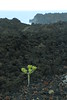

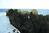
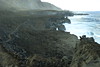
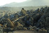
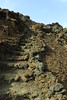
The above images may not be of the site on this page, but were taken nearby. They are loaded from Flickr so please click on them for image credits.
Click here to see more info for this site
Nearby sites
Click here to view sites on an interactive map of the areaKey: Red: member's photo, Blue: 3rd party photo, Yellow: other image, Green: no photo - please go there and take one, Grey: site destroyed
Download sites to:
KML (Google Earth)
GPX (GPS waypoints)
CSV (Garmin/Navman)
CSV (Excel)
To unlock full downloads you need to sign up as a Contributory Member. Otherwise downloads are limited to 50 sites.
Turn off the page maps and other distractions
Nearby sites listing. In the following links * = Image available
1.8km S 186° Barranco del Tejeteica Rock Art
2.1km S 191° Barranco del Cuevo Rock Art
20.7km SW 230° Tagoror Rock Art
20.9km SW 231° Los Letreros Rock Art
68.3km ENE 63° La Fortaleza (Gomera) Natural Stone / Erratic / Other Natural Feature
73.8km N 3° Roques de Teneguia* Rock Art
81.9km N 7° Barranco de La Calderera* Cave or Rock Shelter
82.3km N 7° La Calderera* Cave or Rock Shelter
85.3km N 8° Cueva de Belmaco* Rock Art
85.3km N 4° Pico Nambroque Rock Art
88.7km N 3° Lomo de Las Casas and Los Corrales Settlements* Ancient Village or Settlement
92.5km N 1° El Paso Pyramid* Pyramid / Mastaba
93.2km N 1° El Cementerio* Rock Art
93.3km N 359° Museo Arqueológico Benahoarita* Museum
93.4km N 1° La Fajana* Rock Art
93.4km N 8° Los Cancajos Pyramid* Pyramid / Mastaba
95.3km N 358° La Passada* Rock Art
96.1km N 2° Tamarahoya* Rock Art
96.7km N 2° Tamarahoya 2* Rock Art
96.8km N 2° Tamarahoya 2c* Rock Art
97.5km N 8° Museo Insular Museum
99.5km N 1° Rogue de Idafe* Rock Art
100.7km N 3° Era de los Guanches* Rock Art
101.1km N 1° Taburiente Petroglyphs (1)* Rock Art
101.1km N 1° Taburiente Petroglyphs (2)* Rock Art
View more nearby sites and additional images


 We would like to know more about this location. Please feel free to add a brief description and any relevant information in your own language.
 Wir möchten mehr über diese Stätte erfahren. Bitte zögern Sie nicht, eine kurze Beschreibung und relevante Informationen in Deutsch hinzuzufügen.
 Nous aimerions en savoir encore un peu sur les lieux. S'il vous plaît n'hesitez pas à ajouter une courte description et tous les renseignements pertinents dans votre propre langue.
 Quisieramos informarnos un poco más de las lugares. No dude en añadir una breve descripción y otros datos relevantes en su propio idioma.