


<< Our Photo Pages >> Casa del Baile - Rock Art in Spain in Canary Isles
Submitted by Klingon on Wednesday, 05 September 2012 Page Views: 2117
Rock ArtSite Name: Casa del BaileCountry: Spain
NOTE: This site is 445.157 km away from the location you searched for.
Region: Canary Isles Type: Rock Art
Latitude: 28.817494N Longitude: 17.918687W
Condition:
| 5 | Perfect |
| 4 | Almost Perfect |
| 3 | Reasonable but with some damage |
| 2 | Ruined but still recognisable as an ancient site |
| 1 | Pretty much destroyed, possibly visible as crop marks |
| 0 | No data. |
| -1 | Completely destroyed |
| 5 | Superb |
| 4 | Good |
| 3 | Ordinary |
| 2 | Not Good |
| 1 | Awful |
| 0 | No data. |
| 5 | Can be driven to, probably with disabled access |
| 4 | Short walk on a footpath |
| 3 | Requiring a bit more of a walk |
| 2 | A long walk |
| 1 | In the middle of nowhere, a nightmare to find |
| 0 | No data. |
| 5 | co-ordinates taken by GPS or official recorded co-ordinates |
| 4 | co-ordinates scaled from a detailed map |
| 3 | co-ordinates scaled from a bad map |
| 2 | co-ordinates of the nearest village |
| 1 | co-ordinates of the nearest town |
| 0 | no data |
Internal Links:
External Links:
I have visited· I would like to visit
Klingon visited on 28th Aug 2012 - their rating: Cond: 3 Amb: 4 Access: 5
HChavez visited - their rating: Cond: 2 Amb: 2 Access: 5
Average ratings for this site from all visit loggers: Condition: 2.5 Ambience: 3 Access: 5
")
Casa del Baile = house of the dance
You may be viewing yesterday's version of this page. To see the most up to date information please register for a free account.
Do not use the above information on other web sites or publications without permission of the contributor.
Nearby Images from Flickr
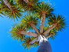
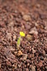
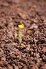
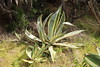
The above images may not be of the site on this page, but were taken nearby. They are loaded from Flickr so please click on them for image credits.
Click here to see more info for this site
Nearby sites
Click here to view sites on an interactive map of the areaKey: Red: member's photo, Blue: 3rd party photo, Yellow: other image, Green: no photo - please go there and take one, Grey: site destroyed
Download sites to:
KML (Google Earth)
GPX (GPS waypoints)
CSV (Garmin/Navman)
CSV (Excel)
To unlock full downloads you need to sign up as a Contributory Member. Otherwise downloads are limited to 50 sites.
Turn off the page maps and other distractions
Nearby sites listing. In the following links * = Image available
1.7km SE 141° Parque Cultural La Zarza* Museum
2.0km SE 145° La Zarza* Rock Art
2.0km SSE 151° La Zarzita* Rock Art
3.8km W 278° El Calvario 1* Rock Art
3.9km WNW 283° El Calvario 2* Rock Art
6.0km SSE 161° Los Mojones* Ancient Village or Settlement
6.0km WSW 247° Cuevas de Buracas Petroglyphs* Rock Art
7.0km SSE 155° Cueva del Flaire* Cave or Rock Shelter
7.8km SSE 155° Roque de Los Muchachos* Natural Stone / Erratic / Other Natural Feature
8.0km SE 143° Pared de Roberto* Rock Art
10.1km SE 136° La Ciudad* Ancient Village or Settlement
10.6km SSE 161° Taburiente Petroglyphs (2)* Rock Art
10.6km SSE 161° Taburiente Petroglyphs (1)* Rock Art
12.2km SSE 162° Rogue de Idafe* Rock Art
13.2km SE 143° Era de los Guanches* Rock Art
15.4km SSE 159° Tamarahoya 2c* Rock Art
15.6km SSE 159° Tamarahoya 2* Rock Art
15.9km SSE 162° Tamarahoya* Rock Art
16.0km S 186° La Passada* Rock Art
17.9km S 177° Museo Arqueológico Benahoarita* Museum
18.1km S 169° La Fajana* Rock Art
18.3km SSE 169° El Cementerio* Rock Art
19.1km SSE 168° El Paso Pyramid* Pyramid / Mastaba
21.1km SE 133° Museo Insular Museum
23.8km SSE 162° Lomo de Las Casas and Los Corrales Settlements* Ancient Village or Settlement
View more nearby sites and additional images


 We would like to know more about this location. Please feel free to add a brief description and any relevant information in your own language.
 Wir möchten mehr über diese Stätte erfahren. Bitte zögern Sie nicht, eine kurze Beschreibung und relevante Informationen in Deutsch hinzuzufügen.
 Nous aimerions en savoir encore un peu sur les lieux. S'il vous plaît n'hesitez pas à ajouter une courte description et tous les renseignements pertinents dans votre propre langue.
 Quisieramos informarnos un poco más de las lugares. No dude en añadir una breve descripción y otros datos relevantes en su propio idioma.