 with our Megalithic Portal iPhone app")


<< Our Photo Pages >> Santa Barbara Pyramid (1) - Pyramid / Mastaba in Spain in Canary Isles
Submitted by Klingon on Tuesday, 21 August 2007 Page Views: 7163
Multi-periodSite Name: Santa Barbara Pyramid (1)Country: Spain Region: Canary Isles Type: Pyramid / Mastaba
Nearest Town: Icod des Los Vinos Nearest Village: Santa Barbara
Latitude: 28.371523N Longitude: 16.695738W
Condition:
| 5 | Perfect |
| 4 | Almost Perfect |
| 3 | Reasonable but with some damage |
| 2 | Ruined but still recognisable as an ancient site |
| 1 | Pretty much destroyed, possibly visible as crop marks |
| 0 | No data. |
| -1 | Completely destroyed |
| 5 | Superb |
| 4 | Good |
| 3 | Ordinary |
| 2 | Not Good |
| 1 | Awful |
| 0 | No data. |
| 5 | Can be driven to, probably with disabled access |
| 4 | Short walk on a footpath |
| 3 | Requiring a bit more of a walk |
| 2 | A long walk |
| 1 | In the middle of nowhere, a nightmare to find |
| 0 | No data. |
| 5 | co-ordinates taken by GPS or official recorded co-ordinates |
| 4 | co-ordinates scaled from a detailed map |
| 3 | co-ordinates scaled from a bad map |
| 2 | co-ordinates of the nearest village |
| 1 | co-ordinates of the nearest town |
| 0 | no data |
Internal Links:
External Links:
I have visited· I would like to visit
DrewParsons would like to visit
Klingon has visited here
 (PID:34691)")
You may be viewing yesterday's version of this page. To see the most up to date information please register for a free account.
Do not use the above information on other web sites or publications without permission of the contributor.
Nearby Images from Flickr
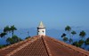
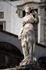
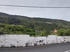
The above images may not be of the site on this page, but were taken nearby. They are loaded from Flickr so please click on them for image credits.
Click here to see more info for this site
Nearby sites
Click here to view sites on an interactive map of the areaKey: Red: member's photo, Blue: 3rd party photo, Yellow: other image, Green: no photo - please go there and take one, Grey: site destroyed
Download sites to:
KML (Google Earth)
GPX (GPS waypoints)
CSV (Garmin/Navman)
CSV (Excel)
To unlock full downloads you need to sign up as a Contributory Member. Otherwise downloads are limited to 50 sites.
Turn off the page maps and other distractions
Nearby sites listing. In the following links * = Image available
94m ENE 68° Santa Barbara Pyramid (2)* Pyramid / Mastaba
14.9km ENE 70° Museo Arqueológico del Puerto de la Cruz Museum
28.2km E 101° Güímar Pyramids* Pyramid / Mastaba
64.5km WSW 242° La Fortaleza (Gomera) Natural Stone / Erratic / Other Natural Feature
95.4km ESE 115° Centro de Interpretación Los Caserones Museum
95.4km ESE 115° Lomo Caserones* Barrow Cemetery
95.7km ESE 115° Poblado de Caserones* Ancient Village or Settlement
102.7km ESE 103° Mugaretes del Clavo* Ancient Village or Settlement
103.0km ESE 107° Necrópolis del Maipés de Agaete* Barrow Cemetery
103.8km ESE 103° Bocabarranco* Ancient Village or Settlement
103.9km ESE 103° Poblado del Agujero* Ancient Village or Settlement
104.2km ESE 103° La Guancha* Ancient Village or Settlement
105.0km ESE 104° Museo y Parque Arqueológico (Gáldar)* Museum
105.0km ESE 104° Cueva Pintada* Ancient Village or Settlement
107.5km ESE 112° Mesa de Acusa* Cave or Rock Shelter
107.7km ESE 110° Risco Caído Cave or Rock Shelter
108.2km WNW 283° Cueva de Belmaco* Rock Art
108.7km WNW 287° Los Cancajos Pyramid* Pyramid / Mastaba
108.8km W 281° Barranco de La Calderera* Cave or Rock Shelter
108.9km W 281° La Calderera* Cave or Rock Shelter
109.9km ESE 111° Centro de Interpretación del Paisaje Cultural de Risco Caído y Montañas Sagradas* Museum
109.9km WNW 289° Museo Insular Museum
110.0km ESE 103° Cenobio de Valeron* Cave or Rock Shelter
110.4km ESE 112° Cuevas del Rey* Cave or Rock Shelter
111.9km ESE 112° Roque Bentaiga* Cave or Rock Shelter
View more nearby sites and additional images


 We would like to know more about this location. Please feel free to add a brief description and any relevant information in your own language.
 Wir möchten mehr über diese Stätte erfahren. Bitte zögern Sie nicht, eine kurze Beschreibung und relevante Informationen in Deutsch hinzuzufügen.
 Nous aimerions en savoir encore un peu sur les lieux. S'il vous plaît n'hesitez pas à ajouter une courte description et tous les renseignements pertinents dans votre propre langue.
 Quisieramos informarnos un poco más de las lugares. No dude en añadir una breve descripción y otros datos relevantes en su propio idioma.