


<< Other Photo Pages >> Wind Wolves Preserve - Rock Art in United States in The West
Submitted by bat400 on Thursday, 05 December 2019 Page Views: 5439
Rock ArtSite Name: Wind Wolves Preserve Alternative Name: Pleito Cave, Peito Creek, Cache Cave, CA-KER-77Country: United States
NOTE: This site is 25.046 km away from the location you searched for.
Region: The West Type: Rock Art
Nearest Town: Bakersfield
Latitude: 34.994000N Longitude: 119.185W
Condition:
| 5 | Perfect |
| 4 | Almost Perfect |
| 3 | Reasonable but with some damage |
| 2 | Ruined but still recognisable as an ancient site |
| 1 | Pretty much destroyed, possibly visible as crop marks |
| 0 | No data. |
| -1 | Completely destroyed |
| 5 | Superb |
| 4 | Good |
| 3 | Ordinary |
| 2 | Not Good |
| 1 | Awful |
| 0 | No data. |
| 5 | Can be driven to, probably with disabled access |
| 4 | Short walk on a footpath |
| 3 | Requiring a bit more of a walk |
| 2 | A long walk |
| 1 | In the middle of nowhere, a nightmare to find |
| 0 | No data. |
| 5 | co-ordinates taken by GPS or official recorded co-ordinates |
| 4 | co-ordinates scaled from a detailed map |
| 3 | co-ordinates scaled from a bad map |
| 2 | co-ordinates of the nearest village |
| 1 | co-ordinates of the nearest town |
| 0 | no data |
Internal Links:
External Links:
I have visited· I would like to visit
hoya105 would like to visit
")
Unfortunately, the rock art was made on fragile sandstone surfaces, and has been fading and detaching from rock for at least as long as the paintings have been known to modern Californians. It does not appear that regular visits to the rock art are still possible. However, a unique project involving the University of Central Lancashire, California State University - Channel Islands, University of Strathclyde, and the Rock Art Documentation Group has resulted in recording the art with portable instruments to capture the micro-topography enhanced and visible images, and Spectroscopy to document and study the Pleito images, including a virtual reality tour of the sites.
It appears that the virtual reality tour can be enjoyed at the Wind Wolves Preserve ranger station. The location provided in the header is for the ranger station, and does not reflect the actual location of the Pleito Cave site.
Additionally, many of the images can be seen in the web links at the bottom of this listing.
In addition to the Ranger Station, the Wind Wolves Preserve offers hiking and horse trails. From the Wind Wolves website: "The preserve is an ecologically unique region where the Transverse Ranges, Coast Ranges, Sierra Nevada, western Mojave Desert and San Joaquin Valley converge. Due to elevation ranging from 640 to 6,005 feet, the preserve has an impressive array of landforms and habitats" including "... a 30-square-mile veritable sea of grasslands ... home to the endangered San Joaquin kit fox and blunt-nosed leopard lizard, and one of the largest stands of the endangered Bakersfield cactus. ... grasslands rise from the valley floor and transition into classic California blue oak and valley oak savanna with extensive riparian wetlands. The oak savanna rises into juniper and pinyon forests that ascend into stands of ponderosa pine and big cone spruce." "At 93,000 acres, Wind Wolves is the west coast's largest non-profit preserve."
Other archaeological sites can be found within the preserve, including Cache Cave, a Chumash culture "cache" or "bundle" collection cave.
Web links:
Explore the Extraordinary Paintings of Pleito Cave. Background for the imaging project and many images and historical information. This website also includes a section for "virtual reality" that doesn't seem to hold any actual content.
Enculturating environments: the archaeology of interior South-Central California.
News and Events - Cache Cave California, USA, Date: Prehistoric.
You may be viewing yesterday's version of this page. To see the most up to date information please register for a free account.
Do not use the above information on other web sites or publications without permission of the contributor.
Nearby Images from Flickr


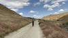
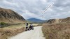
The above images may not be of the site on this page, but were taken nearby. They are loaded from Flickr so please click on them for image credits.
Click here to see more info for this site
Nearby sites
Click here to view sites on an interactive map of the areaKey: Red: member's photo, Blue: 3rd party photo, Yellow: other image, Green: no photo - please go there and take one, Grey: site destroyed
Download sites to:
KML (Google Earth)
GPX (GPS waypoints)
CSV (Garmin/Navman)
CSV (Excel)
To unlock full downloads you need to sign up as a Contributory Member. Otherwise downloads are limited to 50 sites.
Turn off the page maps and other distractions
Nearby sites listing. In the following links * = Image available
63.7km WNW 286° Painted Rock, Carrizo Plain* Rock Art
77.5km SW 225° Chumash Painted Cave* Cave or Rock Shelter
79.2km ENE 77° Tomo Kahni* Rock Art
79.7km SW 216° Burton Mound* Artificial Mound
97.8km SE 126° Tataviam Pictograph Site* Rock Art
123.0km NNE 20° Painted Rock at Tule River Rock Art
128.0km SE 144° Levitated Mass* Modern Stone Circle etc
153.1km WNW 284° Los Osos Back Bay* Ancient Village or Settlement
154.3km SW 227° California Channel Islands* Ancient Village or Settlement
157.7km WNW 286° Morro Creek* Ancient Village or Settlement
177.1km SE 144° Bolsa Chica Mesa* Ancient Village or Settlement
180.8km NE 52° Coso Petroglyphs* Rock Art
182.6km E 82° Inscription Canyon* Rock Art
212.9km NNE 33° Swansea petroglyph site* Rock Art
237.3km SE 124° Hemet Maze Stone* Rock Art
272.3km NNE 15° Bishop Eastern Sierra Petroglyphs* Rock Art
280.7km SE 124° Anza Fertility Site* Natural Stone / Erratic / Other Natural Feature
293.4km SE 136° San Diego Archaeological Centre* Museum
297.8km ESE 110° Brunette Lady* Rock Art
298.3km ESE 110° Barker Dam Trail* Rock Art
298.9km ESE 110° Red lady* Rock Art
300.3km ESE 106° Archaeology and Paleontology Curation Center Museum
302.3km E 85° 17 Mile Point* Rock Art
303.3km NW 307° Monterey Indian Stone* Rock Art
309.0km NW 312° Moss Landing Shellmound* Artificial Mound
View more nearby sites and additional images


 We would like to know more about this location. Please feel free to add a brief description and any relevant information in your own language.
 Wir möchten mehr über diese Stätte erfahren. Bitte zögern Sie nicht, eine kurze Beschreibung und relevante Informationen in Deutsch hinzuzufügen.
 Nous aimerions en savoir encore un peu sur les lieux. S'il vous plaît n'hesitez pas à ajouter une courte description et tous les renseignements pertinents dans votre propre langue.
 Quisieramos informarnos un poco más de las lugares. No dude en añadir una breve descripción y otros datos relevantes en su propio idioma.